Bay-facing waterfront
The northern edge of town runs along San Juan Bay. The shoreline is the strongest line on the poster, with the outline of Old San Juan across the water.
Fakatino mape mukamuka · Puerto Rico
18.4413° N / 66.1182° W
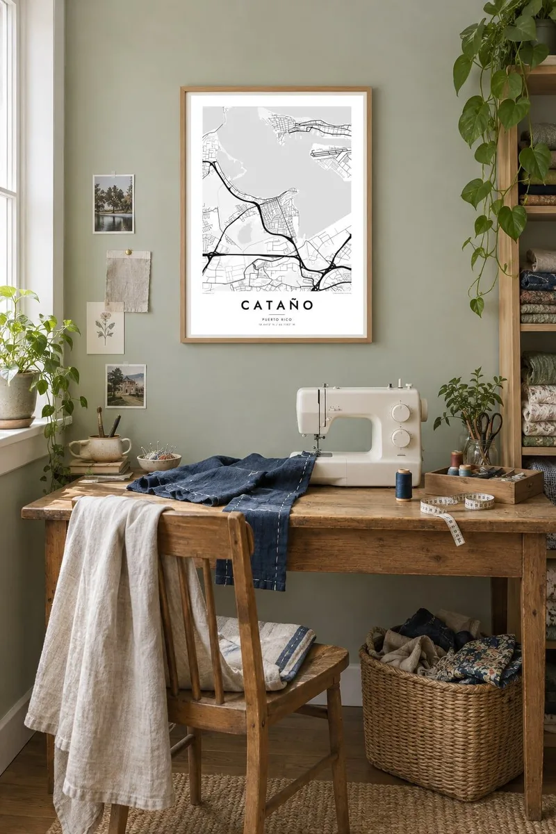
A low shoreline on the south side of San Juan Bay, looking across the water at the old walled city.


Taha e taone, lima e onoonoaga
Tapaki e taha puhala ke kitia ai ki luga he puipui. Kua tatai e totogi he tau puhala oti — pete he lolomi, poloka, po ke faila HD.
 Tau pikselo mooli · faila lolomi 24 × 36″
Maama mitaki ke lolomi
Ko e 100% e fahi mooli mai he faila lolomi. Ko e tau poster oti — pete kua lolomi, poloka, po ke utu hifo — kua taute ke he ha mautolu a tau tokoluga (server) ke he 300 DPI, hokotia ke he 7,200 × 10,800 piksela, ke maeke ai e tau ala ikiiki tote ke maaliali fakamitaki he lolomi 24 × 36″.
He Pā


Ko e mape
Cataño sits on the southern edge of San Juan Bay, directly across the water from Old San Juan. From above, the town is a compact wedge of streets pressed between the bay and the flat coastal lands of northern Puerto Rico. Its waterfront faces north toward the historic walled city, and the channel between them shows on the map as a short, calm stretch of open water.
Much of the municipality is low and close to sea level, and the map shows this clearly. There is a tight grid near the shore, larger industrial and port blocks along the bay, and highways running west toward Toa Baja and east toward Guaynabo and the rest of the metropolitan area. Wetland and mangrove soften the edges where land meets water.
Cataño is widely known for two things: the passenger ferry that has long linked it to Old San Juan, and the Bacardí rum distillery on the bay shore. A Cataño map poster keeps both in view without labels. The shoreline, the ferry crossing and the dense streets tell the story in simple black lines.
The northern edge of town runs along San Juan Bay. The shoreline is the strongest line on the poster, with the outline of Old San Juan across the water.
A short passenger ferry route connects Cataño with Old San Juan. On the map, the narrow stretch of water between the two landings shows how close the towns really are.
Inland, streets spread across flat land near sea level. Compact neighbourhoods give way to wetlands, highways and the wider street network of metropolitan San Juan.
Taute ke ha hau
Lafi e aho, taha higoa po ke taha kupu haau, hiki e fakatino, lahi po ke tuaga.
Ko e kitiaaga nakai totogi kua tote e maaliali mo e fakamailoga vai. Ko e tau lolomi mo e tau faila HD kua taute ke he 300 DPI, hokotia ke he 7,200 × 10,800 px, nakai fai fakamailoga vai.
Ko e ha Cataño
If you grew up in Cataño or took the ferry every day, this map holds a very specific geography: home on one shore, the old city on the other. It's a quiet reminder of that crossing, whether it's framed in a living room or pinned above a desk.
You can set the title, add a subtitle such as a family name or a date, and edit the coordinates line. Then choose Classic black & white, Noir, Paper, Blueprint or Sand. The digital files cost $9, or you can order a printed poster from a partner near you.
Talaage e poster Cataño| Lahi he lolomi | Maama | Tau faila |
|---|---|---|
| 30 × 40 cm11.8 × 15.7″ | 3,543 × 4,724 px | PNG · PDF |
| 29.7 × 42 cm (A3)11.7 × 16.5″ | 3,508 × 4,961 px | PNG · PDF |
| 42 × 59.4 cm (A2)16.5 × 23.4″ | 4,961 × 7,016 px | PNG · PDF |
| 45.7 × 61 cm18 × 24″ | 5,400 × 7,200 px | PNG · PDF |
| 50 × 70 cm19.7 × 27.6″ | 5,906 × 8,268 px | PNG · PDF |
| 61 × 91.4 cm24 × 36″ | 7,200 × 10,800 px | PNG · PDF |
Ke fakatatai, ko e fakatino noa kua 900 px e laulahi, fai fakamailoga mo e mo e tau mata komipiuta ni. Ko e tau faila HD kua ato hoko ke he 8× e maama ke he tau faahi takitaha mo e lolomi mitaki he lahi katoa he fakatino.
Fifili e taha puhala i luga he kupega, ti fifili e Poster Lolomi — e lahi mo e, kaeke ke manako ai koe, taha poloka — po ke Tau Faila HD Fakaeletonika. Ko e fakaotiaga totogi ko e taha gahua ni, ti ko e kupega he hau a talaaga ka fakafou fakahaga i mua he fakaotiaga e totogi.
Kua lolomi ai ke he pepa mitaki 200 gsm matte he taha he tau lahi ono, mai he 30 × 40 cm ke hoko ke he 24 × 36″. Kamata e tau poster lolomi mai he $39, kua putoia ai e utaaga.
E. Fifili e poloka akau malolō ke he lanu uli, tea, akau oki mooli, po ke akau pouli. Kua fakalataha mo e sioga malolō nakai malepe ti kua mautali ke tautau. Kamata e tau poster poloka mai he $99, kua putoia ai e utaaga.
Nakai totogi e fakafano ke he motu 60+. Ko e fakatino taha kua lolomi he fenoga lolomi ha mautolu kua tata mo e tau motu 30+, kua hoko mai he tau aho gahua 3–7. Maeke ia koe ke kikite e tuaga mo e fakamuitua he lalo he Haku Tau Fakatonu. Ke he falu motu kua 2–5 e tau tapu, ti ka nakai fakafano a mautolu ki ai, to fakaha he api tupe ia ki mua he totogi.
Fakafano mai e taha ata ki a mautolu he loto he 14 e tau aho tali mai he hokoaga, ti to lolomi foki e mautolu nakai totogi po ke liu atu e totogi ki a koe.
E. He editor i luga he kupega nei, hikihiki e matakupu, e matakupu lalo mo e laini coordinates ke he taha mena kua manako a koe ki ai, ti fifili e puhala mo e lahi. Ko e tau talaaga lolomi, poloka mo e fakaeletonika oti kua fakaaoga tonu e hau a fakatino.
Ma e $9 ka moua e koe e tau faila PNG 300 DPI mo e PDF kua mautali ke lolomi he tau lahi ono oti, nakai fai fakamailoga vai, ke lolomi i fe mena. Nakai maopoopo agaia? Utu hifo fakamua e kitiaaga nakai totogi ne fai fakamailoga vai.
