Arabian Sea coastline
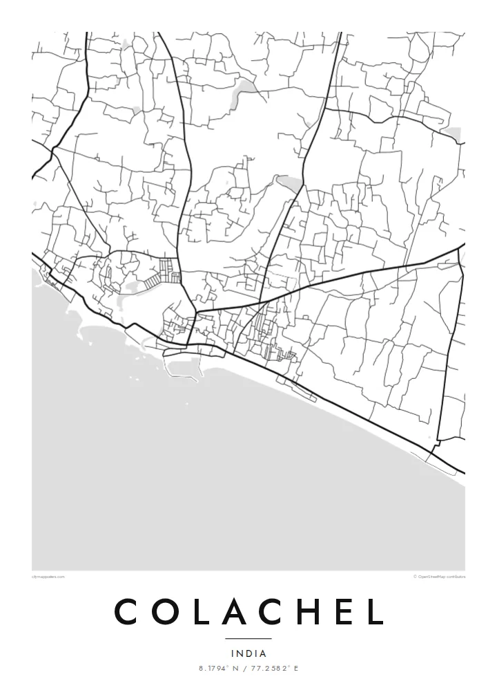
The shore is the poster's defining edge. The town's streets end abruptly against this long curve of coast, which gives the composition a strong sense of place.
Fakatino mape mukamuka · India
8.1794° N / 77.2582° E
A fishing town on the Kanyakumari coast, where lanes run down to the Arabian Sea and boats line the shore.


Taha e taone, lima e onoonoaga
Tapaki e taha puhala ke kitia ai ki luga he puipui. Kua tatai e totogi he tau puhala oti — pete he lolomi, poloka, po ke faila HD.
 Tau pikselo mooli · faila lolomi 24 × 36″
Maama mitaki ke lolomi
Ko e 100% e fahi mooli mai he faila lolomi. Ko e tau poster oti — pete kua lolomi, poloka, po ke utu hifo — kua taute ke he ha mautolu a tau tokoluga (server) ke he 300 DPI, hokotia ke he 7,200 × 10,800 piksela, ke maeke ai e tau ala ikiiki tote ke maaliali fakamitaki he lolomi 24 × 36″.
He Pā


Ko e mape
Colachel is a coastal town in the Kanyakumari district of Tamil Nadu, close to the southern tip of India. The most striking thing on its map is the shoreline, a long, gently curving edge where the land meets the Arabian Sea. The town's streets press close behind it, and lanes run down toward the beach and the harbour.
Fishing shapes the town, and this coast has long supported fishing communities whose settlements follow the shore. Inland the pattern loosens into roads lined with houses, coconut groves and fields, typical of this green corner of the state. The contrast between the dense seafront and the softer interior gives the drawing depth.
Colachel has a notable place in history. In the Battle of Colachel in 1741, the forces of the Travancore kingdom defeated the Dutch East India Company, and a memorial pillar marks the event. A Colachel map poster links that story to the actual coastline where it happened, drawn in clean, simple lines.
The shore is the poster's defining edge. The town's streets end abruptly against this long curve of coast, which gives the composition a strong sense of place.
Narrow lanes run at right angles to the beach and connect homes and the harbour to the water. They form a fine, comb-like pattern along the coast.
A victory pillar commemorates the 1741 battle in which Travancore defeated the Dutch. It is a small but meaningful point on the map, close to the coast.
Taute ke ha hau
Lafi e aho, taha higoa po ke taha kupu haau, hiki e fakatino, lahi po ke tuaga.
Ko e kitiaaga nakai totogi kua tote e maaliali mo e fakamailoga vai. Ko e tau lolomi mo e tau faila HD kua taute ke he 300 DPI, hokotia ke he 7,200 × 10,800 px, nakai fai fakamailoga vai.
Ko e ha Colachel
For families from Colachel and the wider Kanyakumari coast, many of whom now work in Kerala, the Gulf or further away, this map is a direct link to home. The meeting of streets and sea makes it a naturally balanced image for a calm living space.
You can personalise the title and subtitle, perhaps in honour of a parent or for a wedding, and adjust the coordinates line. There are five styles: Classic black & white, Noir, Paper, Blueprint and Sand. The $9 package includes a 300 DPI PNG and a print-ready PDF in each of six sizes.
Talaage e poster Colachel| Lahi he lolomi | Maama | Tau faila |
|---|---|---|
| 30 × 40 cm11.8 × 15.7″ | 3,543 × 4,724 px | PNG · PDF |
| 29.7 × 42 cm (A3)11.7 × 16.5″ | 3,508 × 4,961 px | PNG · PDF |
| 42 × 59.4 cm (A2)16.5 × 23.4″ | 4,961 × 7,016 px | PNG · PDF |
| 45.7 × 61 cm18 × 24″ | 5,400 × 7,200 px | PNG · PDF |
| 50 × 70 cm19.7 × 27.6″ | 5,906 × 8,268 px | PNG · PDF |
| 61 × 91.4 cm24 × 36″ | 7,200 × 10,800 px | PNG · PDF |
Ke fakatatai, ko e fakatino noa kua 900 px e laulahi, fai fakamailoga mo e mo e tau mata komipiuta ni. Ko e tau faila HD kua ato hoko ke he 8× e maama ke he tau faahi takitaha mo e lolomi mitaki he lahi katoa he fakatino.
Fifili e taha puhala i luga he kupega, ti fifili e Poster Lolomi — e lahi mo e, kaeke ke manako ai koe, taha poloka — po ke Tau Faila HD Fakaeletonika. Ko e fakaotiaga totogi ko e taha gahua ni, ti ko e kupega he hau a talaaga ka fakafou fakahaga i mua he fakaotiaga e totogi.
Kua lolomi ai ke he pepa mitaki 200 gsm matte he taha he tau lahi ono, mai he 30 × 40 cm ke hoko ke he 24 × 36″. Kamata e tau poster lolomi mai he $39, kua putoia ai e utaaga.
E. Fifili e poloka akau malolō ke he lanu uli, tea, akau oki mooli, po ke akau pouli. Kua fakalataha mo e sioga malolō nakai malepe ti kua mautali ke tautau. Kamata e tau poster poloka mai he $99, kua putoia ai e utaaga.
Nakai totogi e fakafano ke he motu 60+. Ko e fakatino taha kua lolomi he fenoga lolomi ha mautolu kua tata mo e tau motu 30+, kua hoko mai he tau aho gahua 3–7. Maeke ia koe ke kikite e tuaga mo e fakamuitua he lalo he Haku Tau Fakatonu. Ke he falu motu kua 2–5 e tau tapu, ti ka nakai fakafano a mautolu ki ai, to fakaha he api tupe ia ki mua he totogi.
Fakafano mai e taha ata ki a mautolu he loto he 14 e tau aho tali mai he hokoaga, ti to lolomi foki e mautolu nakai totogi po ke liu atu e totogi ki a koe.
E. He editor i luga he kupega nei, hikihiki e matakupu, e matakupu lalo mo e laini coordinates ke he taha mena kua manako a koe ki ai, ti fifili e puhala mo e lahi. Ko e tau talaaga lolomi, poloka mo e fakaeletonika oti kua fakaaoga tonu e hau a fakatino.
Ma e $9 ka moua e koe e tau faila PNG 300 DPI mo e PDF kua mautali ke lolomi he tau lahi ono oti, nakai fai fakamailoga vai, ke lolomi i fe mena. Nakai maopoopo agaia? Utu hifo fakamua e kitiaaga nakai totogi ne fai fakamailoga vai.
