Planned street grid
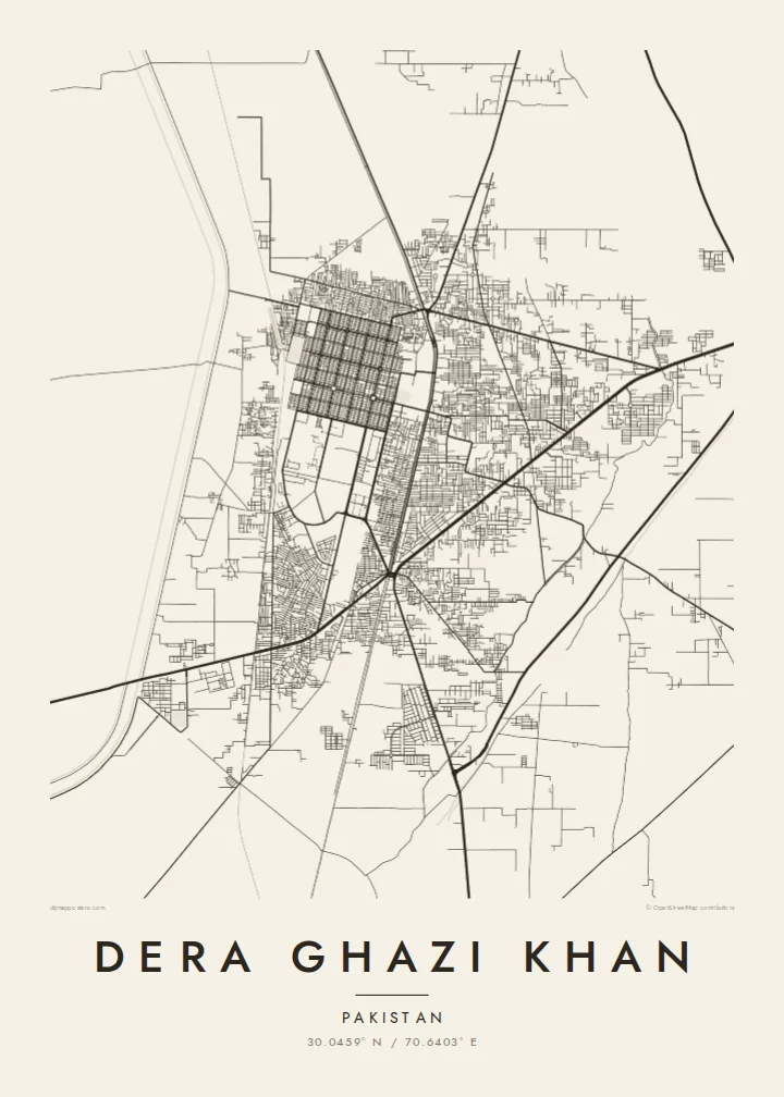
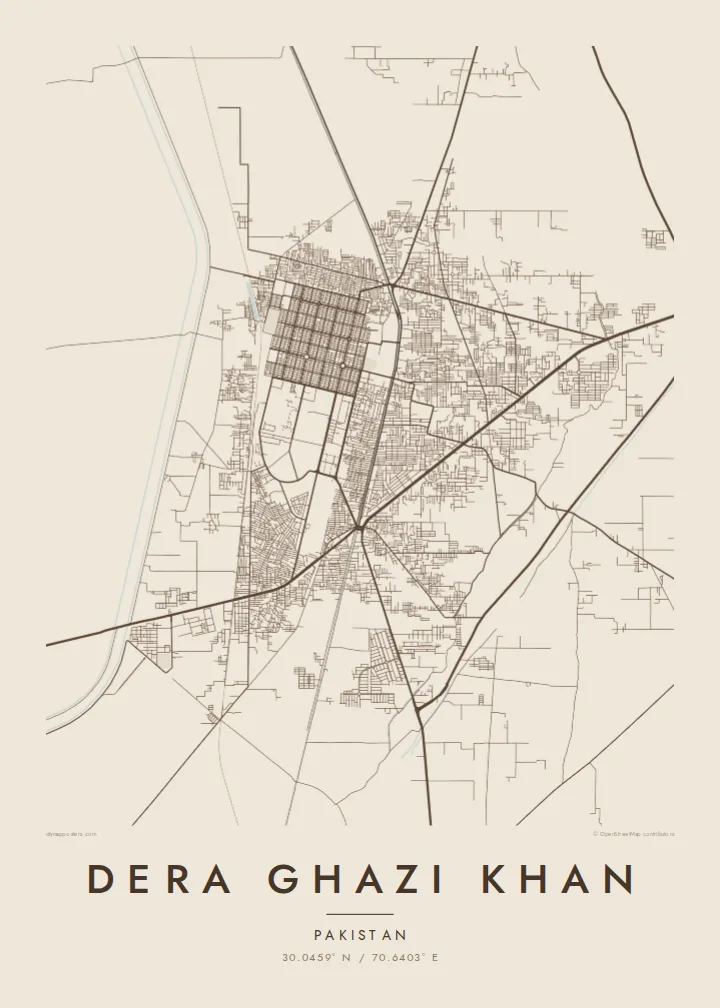
The rebuilt city is laid out on a clear rectilinear plan, making its streets unusually orderly for the region and giving the poster a strong, readable pattern.
Fakatino mape mukamuka · Pakistan
30.0459° N / 70.6403° E
A planned grid on the plains west of the Indus, with the Sulaiman Mountains rising beyond the farmland to the west



Taha e taone, lima e onoonoaga
Tapaki e taha puhala ke kitia ai ki luga he puipui. Kua tatai e totogi he tau puhala oti — pete he lolomi, poloka, po ke faila HD.
 Tau pikselo mooli · faila lolomi 24 × 36″
Maama mitaki ke lolomi
Ko e 100% e fahi mooli mai he faila lolomi. Ko e tau poster oti — pete kua lolomi, poloka, po ke utu hifo — kua taute ke he ha mautolu a tau tokoluga (server) ke he 300 DPI, hokotia ke he 7,200 × 10,800 piksela, ke maeke ai e tau ala ikiiki tote ke maaliali fakamitaki he lolomi 24 × 36″.
He Pā


Ko e mape
Dera Ghazi Khan lies on the flat alluvial plain between the Indus River and the foothills of the Sulaiman Mountains in southwestern Punjab. On a map the city appears compact and regular, with straight streets meeting at right angles and blocks arranged in an ordered pattern, surrounded by farmland, canals and scattered villages.
That regularity has a reason. The original town stood closer to the Indus and was lost to the river's floods in the early twentieth century, after which the city was rebuilt on a new, planned site further west. Roads now cross the plain eastward toward the river and the bridge that links the district with Muzaffargarh and the rest of Punjab.
The city takes its name from Ghazi Khan, son of a Baloch chief who settled the area in the late fifteenth century, and Baloch and Saraiki cultures remain central to its identity. A Dera Ghazi Khan map poster shows the geometry of a rebuilt city set within a wide landscape shaped by water and mountains.
The rebuilt city is laid out on a clear rectilinear plan, making its streets unusually orderly for the region and giving the poster a strong, readable pattern.
Canals and field boundaries run across the surrounding plain in long lines, drawing a fine texture of agricultural land around the edges of the urban area.
Main routes lead east across the floodplain toward the Indus crossing, a reminder of how closely the city's story is tied to the river.
Taute ke ha hau
Lafi e aho, taha higoa po ke taha kupu haau, hiki e fakatino, lahi po ke tuaga.
Ko e kitiaaga nakai totogi kua tote e maaliali mo e fakamailoga vai. Ko e tau lolomi mo e tau faila HD kua taute ke he 300 DPI, hokotia ke he 7,200 × 10,800 px, nakai fai fakamailoga vai.
Ko e ha Dera Ghazi Khan
For families from Dera Ghazi Khan now living in Lahore, Karachi, the Gulf or Europe, this map is a quiet reminder of home and its familiar streets. It also suits anyone interested in cities that were rebuilt from scratch on a new plan.
You can personalise the title, the subtitle with a name or date, and the coordinates line, then choose Classic black & white, Noir, Paper, Blueprint or Sand. Start with a free 900 px preview before buying the $9 HD files.
Talaage e poster Dera Ghazi Khan| Lahi he lolomi | Maama | Tau faila |
|---|---|---|
| 30 × 40 cm11.8 × 15.7″ | 3,543 × 4,724 px | PNG · PDF |
| 29.7 × 42 cm (A3)11.7 × 16.5″ | 3,508 × 4,961 px | PNG · PDF |
| 42 × 59.4 cm (A2)16.5 × 23.4″ | 4,961 × 7,016 px | PNG · PDF |
| 45.7 × 61 cm18 × 24″ | 5,400 × 7,200 px | PNG · PDF |
| 50 × 70 cm19.7 × 27.6″ | 5,906 × 8,268 px | PNG · PDF |
| 61 × 91.4 cm24 × 36″ | 7,200 × 10,800 px | PNG · PDF |
Ke fakatatai, ko e fakatino noa kua 900 px e laulahi, fai fakamailoga mo e mo e tau mata komipiuta ni. Ko e tau faila HD kua ato hoko ke he 8× e maama ke he tau faahi takitaha mo e lolomi mitaki he lahi katoa he fakatino.
Fifili e taha puhala i luga he kupega, ti fifili e Poster Lolomi — e lahi mo e, kaeke ke manako ai koe, taha poloka — po ke Tau Faila HD Fakaeletonika. Ko e fakaotiaga totogi ko e taha gahua ni, ti ko e kupega he hau a talaaga ka fakafou fakahaga i mua he fakaotiaga e totogi.
Kua lolomi ai ke he pepa mitaki 200 gsm matte he taha he tau lahi ono, mai he 30 × 40 cm ke hoko ke he 24 × 36″. Kamata e tau poster lolomi mai he $39, kua putoia ai e utaaga.
E. Fifili e poloka akau malolō ke he lanu uli, tea, akau oki mooli, po ke akau pouli. Kua fakalataha mo e sioga malolō nakai malepe ti kua mautali ke tautau. Kamata e tau poster poloka mai he $99, kua putoia ai e utaaga.
Nakai totogi e fakafano ke he motu 60+. Ko e fakatino taha kua lolomi he fenoga lolomi ha mautolu kua tata mo e tau motu 30+, kua hoko mai he tau aho gahua 3–7. Maeke ia koe ke kikite e tuaga mo e fakamuitua he lalo he Haku Tau Fakatonu. Ke he falu motu kua 2–5 e tau tapu, ti ka nakai fakafano a mautolu ki ai, to fakaha he api tupe ia ki mua he totogi.
Fakafano mai e taha ata ki a mautolu he loto he 14 e tau aho tali mai he hokoaga, ti to lolomi foki e mautolu nakai totogi po ke liu atu e totogi ki a koe.
E. He editor i luga he kupega nei, hikihiki e matakupu, e matakupu lalo mo e laini coordinates ke he taha mena kua manako a koe ki ai, ti fifili e puhala mo e lahi. Ko e tau talaaga lolomi, poloka mo e fakaeletonika oti kua fakaaoga tonu e hau a fakatino.
Ma e $9 ka moua e koe e tau faila PNG 300 DPI mo e PDF kua mautali ke lolomi he tau lahi ono oti, nakai fai fakamailoga vai, ke lolomi i fe mena. Nakai maopoopo agaia? Utu hifo fakamua e kitiaaga nakai totogi ne fai fakamailoga vai.
Tata mai
