Indus floodplain
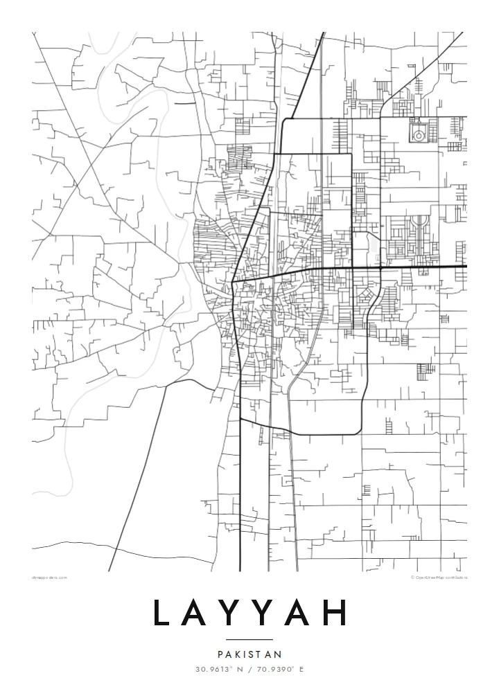
West of the town the river spreads into a wide braided bed of channels and sandbars, a restless landscape that gives the map its most organic shapes.
Fakatino mape mukamuka · Pakistan
30.9613° N / 70.9390° E
A Punjab town on level ground between the braided Indus floodplain and the sandy expanse of the Thal.


Taha e taone, lima e onoonoaga
Tapaki e taha puhala ke kitia ai ki luga he puipui. Kua tatai e totogi he tau puhala oti — pete he lolomi, poloka, po ke faila HD.
 Tau pikselo mooli · faila lolomi 24 × 36″
Maama mitaki ke lolomi
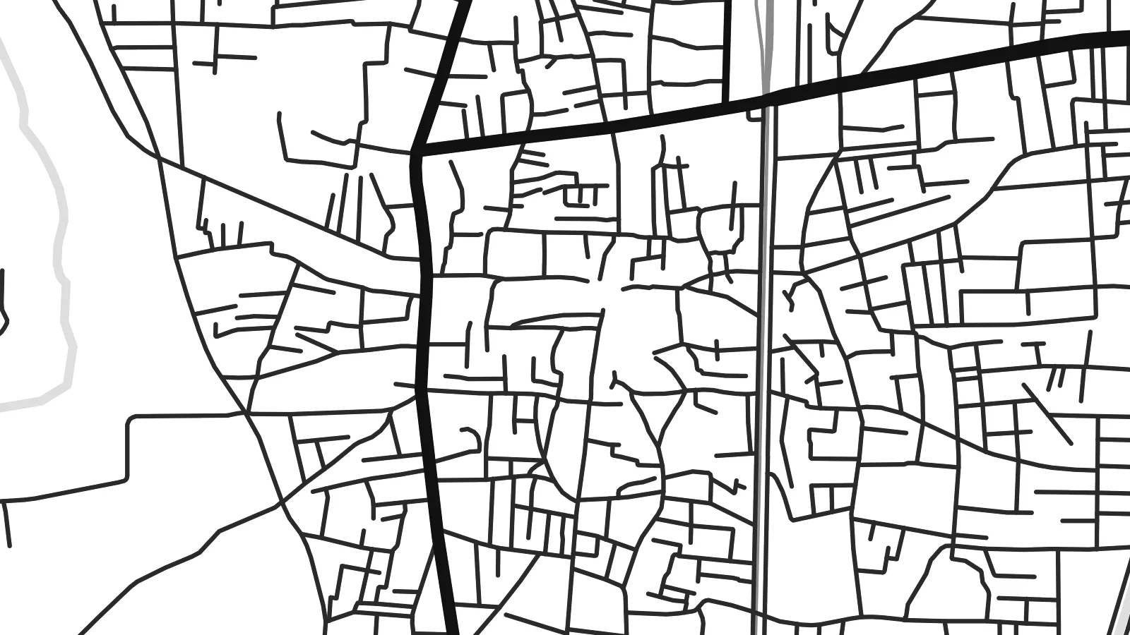
Ko e 100% e fahi mooli mai he faila lolomi. Ko e tau poster oti — pete kua lolomi, poloka, po ke utu hifo — kua taute ke he ha mautolu a tau tokoluga (server) ke he 300 DPI, hokotia ke he 7,200 × 10,800 piksela, ke maeke ai e tau ala ikiiki tote ke maaliali fakamitaki he lolomi 24 × 36″.
He Pā


Ko e mape
Layyah lies in southwestern Punjab, on the eastern side of the Indus, where the wide river plain meets the drier lands of the Thal. On a map the surroundings are flat and open, crossed by canals, field tracks and scattered villages. The town itself forms a compact centre with roads fanning outward to neighbouring districts, and there are no hills or coastlines to interrupt its plan.
The river's presence is felt more than seen from the streets. To the west, the Indus spreads into a broad bed of channels, sandbars and seasonal floodland that shifts from year to year. To the east, the land becomes sandier and more sparsely settled. The town sits between these two landscapes, and its roads and canals mark the line where irrigation has made steady farming possible.
Layyah is the administrative centre of its district and a market town for the surrounding agricultural area. Its map is quiet and even in texture, a web of local streets rather than grand avenues. A Layyah map poster suits that modesty: a clear network of roads on level ground, with the river country on one side and the Thal on the other, rendered in simple lines.
West of the town the river spreads into a wide braided bed of channels and sandbars, a restless landscape that gives the map its most organic shapes.
Irrigation canals run across the level land around Layyah in long straight lines, dividing fields and guiding roads, and they are among the clearest features on the map.
To the east the ground turns sandier and settlement thins out, so the dense town streets stand out against a lighter, emptier background.
Taute ke ha hau
Lafi e aho, taha higoa po ke taha kupu haau, hiki e fakatino, lahi po ke tuaga.
Ko e kitiaaga nakai totogi kua tote e maaliali mo e fakamailoga vai. Ko e tau lolomi mo e tau faila HD kua taute ke he 300 DPI, hokotia ke he 7,200 × 10,800 px, nakai fai fakamailoga vai.
Ko e ha Layyah
For people from Layyah who now live in Lahore, the Gulf or further away, a map of home is a simple thing to keep on the wall. It shows the streets they know without needing any explanation.
You can personalise the title and subtitle, and set the coordinates line or a meaningful date. Five styles are available: Classic black & white, Noir, Paper, Blueprint and Sand, with Sand a natural fit for the Thal landscape nearby.
Talaage e poster Layyah| Lahi he lolomi | Maama | Tau faila |
|---|---|---|
| 30 × 40 cm11.8 × 15.7″ | 3,543 × 4,724 px | PNG · PDF |
| 29.7 × 42 cm (A3)11.7 × 16.5″ | 3,508 × 4,961 px | PNG · PDF |
| 42 × 59.4 cm (A2)16.5 × 23.4″ | 4,961 × 7,016 px | PNG · PDF |
| 45.7 × 61 cm18 × 24″ | 5,400 × 7,200 px | PNG · PDF |
| 50 × 70 cm19.7 × 27.6″ | 5,906 × 8,268 px | PNG · PDF |
| 61 × 91.4 cm24 × 36″ | 7,200 × 10,800 px | PNG · PDF |
Ke fakatatai, ko e fakatino noa kua 900 px e laulahi, fai fakamailoga mo e mo e tau mata komipiuta ni. Ko e tau faila HD kua ato hoko ke he 8× e maama ke he tau faahi takitaha mo e lolomi mitaki he lahi katoa he fakatino.
Fifili e taha puhala i luga he kupega, ti fifili e Poster Lolomi — e lahi mo e, kaeke ke manako ai koe, taha poloka — po ke Tau Faila HD Fakaeletonika. Ko e fakaotiaga totogi ko e taha gahua ni, ti ko e kupega he hau a talaaga ka fakafou fakahaga i mua he fakaotiaga e totogi.
Kua lolomi ai ke he pepa mitaki 200 gsm matte he taha he tau lahi ono, mai he 30 × 40 cm ke hoko ke he 24 × 36″. Kamata e tau poster lolomi mai he $39, kua putoia ai e utaaga.
E. Fifili e poloka akau malolō ke he lanu uli, tea, akau oki mooli, po ke akau pouli. Kua fakalataha mo e sioga malolō nakai malepe ti kua mautali ke tautau. Kamata e tau poster poloka mai he $99, kua putoia ai e utaaga.
Nakai totogi e fakafano ke he motu 60+. Ko e fakatino taha kua lolomi he fenoga lolomi ha mautolu kua tata mo e tau motu 30+, kua hoko mai he tau aho gahua 3–7. Maeke ia koe ke kikite e tuaga mo e fakamuitua he lalo he Haku Tau Fakatonu. Ke he falu motu kua 2–5 e tau tapu, ti ka nakai fakafano a mautolu ki ai, to fakaha he api tupe ia ki mua he totogi.
Fakafano mai e taha ata ki a mautolu he loto he 14 e tau aho tali mai he hokoaga, ti to lolomi foki e mautolu nakai totogi po ke liu atu e totogi ki a koe.
E. He editor i luga he kupega nei, hikihiki e matakupu, e matakupu lalo mo e laini coordinates ke he taha mena kua manako a koe ki ai, ti fifili e puhala mo e lahi. Ko e tau talaaga lolomi, poloka mo e fakaeletonika oti kua fakaaoga tonu e hau a fakatino.
Ma e $9 ka moua e koe e tau faila PNG 300 DPI mo e PDF kua mautali ke lolomi he tau lahi ono oti, nakai fai fakamailoga vai, ke lolomi i fe mena. Nakai maopoopo agaia? Utu hifo fakamua e kitiaaga nakai totogi ne fai fakamailoga vai.
