Deep-water port
The harbour basin was excavated inland from the shore, and its straight, engineered edges stand out on the map. It contrasts sharply with the natural curve of the coastline nearby.
Fakatino mape mukamuka · Sri Lanka
6.1241° N / 81.1185° E
A coastal town on Sri Lanka's southern shore, set between a curved bay, a large dug-out harbour and inland salt lagoons


Taha e taone, lima e onoonoaga
Tapaki e taha puhala ke kitia ai ki luga he puipui. Kua tatai e totogi he tau puhala oti — pete he lolomi, poloka, po ke faila HD.
 Tau pikselo mooli · faila lolomi 24 × 36″
Maama mitaki ke lolomi
Ko e 100% e fahi mooli mai he faila lolomi. Ko e tau poster oti — pete kua lolomi, poloka, po ke utu hifo — kua taute ke he ha mautolu a tau tokoluga (server) ke he 300 DPI, hokotia ke he 7,200 × 10,800 piksela, ke maeke ai e tau ala ikiiki tote ke maaliali fakamitaki he lolomi 24 × 36″.
He Pā


Ko e mape
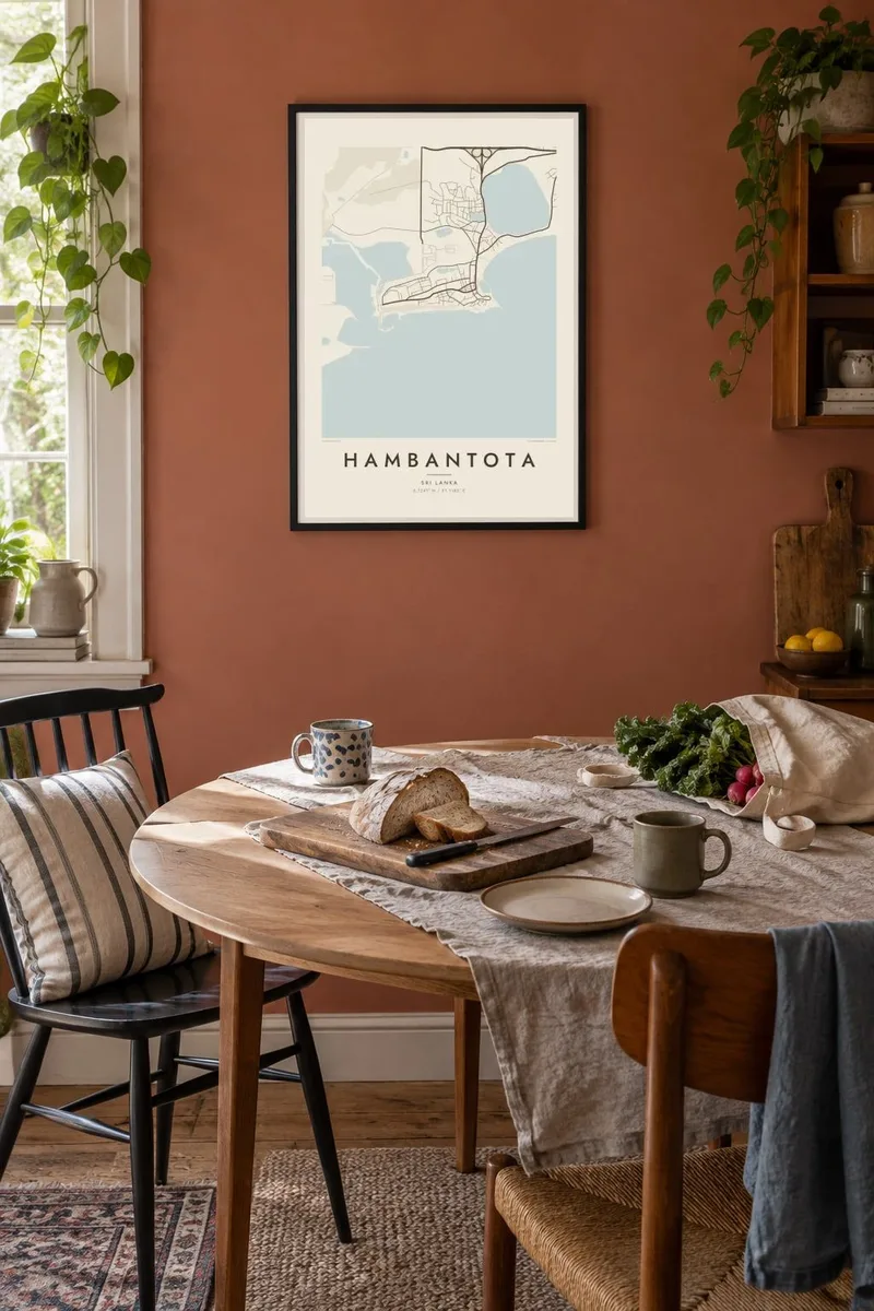
Hambantota is on the southern coast of Sri Lanka, where the land flattens into a dry zone of scrub, lagoons and long beaches. The map is defined by water. There is the sweep of the bay in front of the old town, a set of shallow lagoons and salt pans inland, and to the west a large port basin cut deep into the land.
That port, built in the 2000s and 2010s, is the town's best-known feature. In 2017 it was leased to a Chinese state-owned company on a 99-year agreement, which drew international attention. The town itself was badly damaged in the 2004 Indian Ocean tsunami and has been largely rebuilt, with new administrative areas and wide roads added since.
A Hambantota map poster puts the old seafront town, the planned newer districts and the geometric edges of the harbour on one sheet. The coastline is the strongest line, and lagoons break up the land behind it. The result is a striking coastal composition with lots of open space around the shapes.
The harbour basin was excavated inland from the shore, and its straight, engineered edges stand out on the map. It contrasts sharply with the natural curve of the coastline nearby.
Shallow lagoons and salt pans lie behind the coast. They have long supported salt production and appear on the map as irregular pale shapes set among the roads.
The older town faces a gently curving bay where fishing boats have traditionally landed. That arc of shoreline anchors the southern edge of the composition.
Taute ke ha hau
Lafi e aho, taha higoa po ke taha kupu haau, hiki e fakatino, lahi po ke tuaga.
Ko e kitiaaga nakai totogi kua tote e maaliali mo e fakamailoga vai. Ko e tau lolomi mo e tau faila HD kua taute ke he 300 DPI, hokotia ke he 7,200 × 10,800 px, nakai fai fakamailoga vai.
Ko e ha Hambantota
For people from the Southern Province, visitors to the nearby national parks or anyone who has worked on the port and new town, the map captures a coast that has changed a great deal. The water shapes alone make it a strong print.
Personalise the title and subtitle, perhaps with a family name or the year of a visit, and keep or edit the coordinates. Choose from Classic black & white, Noir, Paper, Blueprint and Sand.
Talaage e poster Hambantota| Lahi he lolomi | Maama | Tau faila |
|---|---|---|
| 30 × 40 cm11.8 × 15.7″ | 3,543 × 4,724 px | PNG · PDF |
| 29.7 × 42 cm (A3)11.7 × 16.5″ | 3,508 × 4,961 px | PNG · PDF |
| 42 × 59.4 cm (A2)16.5 × 23.4″ | 4,961 × 7,016 px | PNG · PDF |
| 45.7 × 61 cm18 × 24″ | 5,400 × 7,200 px | PNG · PDF |
| 50 × 70 cm19.7 × 27.6″ | 5,906 × 8,268 px | PNG · PDF |
| 61 × 91.4 cm24 × 36″ | 7,200 × 10,800 px | PNG · PDF |
Ke fakatatai, ko e fakatino noa kua 900 px e laulahi, fai fakamailoga mo e mo e tau mata komipiuta ni. Ko e tau faila HD kua ato hoko ke he 8× e maama ke he tau faahi takitaha mo e lolomi mitaki he lahi katoa he fakatino.
Fifili e taha puhala i luga he kupega, ti fifili e Poster Lolomi — e lahi mo e, kaeke ke manako ai koe, taha poloka — po ke Tau Faila HD Fakaeletonika. Ko e fakaotiaga totogi ko e taha gahua ni, ti ko e kupega he hau a talaaga ka fakafou fakahaga i mua he fakaotiaga e totogi.
Kua lolomi ai ke he pepa mitaki 200 gsm matte he taha he tau lahi ono, mai he 30 × 40 cm ke hoko ke he 24 × 36″. Kamata e tau poster lolomi mai he $39, kua putoia ai e utaaga.
E. Fifili e poloka akau malolō ke he lanu uli, tea, akau oki mooli, po ke akau pouli. Kua fakalataha mo e sioga malolō nakai malepe ti kua mautali ke tautau. Kamata e tau poster poloka mai he $99, kua putoia ai e utaaga.
Nakai totogi e fakafano ke he motu 60+. Ko e fakatino taha kua lolomi he fenoga lolomi ha mautolu kua tata mo e tau motu 30+, kua hoko mai he tau aho gahua 3–7. Maeke ia koe ke kikite e tuaga mo e fakamuitua he lalo he Haku Tau Fakatonu. Ke he falu motu kua 2–5 e tau tapu, ti ka nakai fakafano a mautolu ki ai, to fakaha he api tupe ia ki mua he totogi.
Fakafano mai e taha ata ki a mautolu he loto he 14 e tau aho tali mai he hokoaga, ti to lolomi foki e mautolu nakai totogi po ke liu atu e totogi ki a koe.
E. He editor i luga he kupega nei, hikihiki e matakupu, e matakupu lalo mo e laini coordinates ke he taha mena kua manako a koe ki ai, ti fifili e puhala mo e lahi. Ko e tau talaaga lolomi, poloka mo e fakaeletonika oti kua fakaaoga tonu e hau a fakatino.
Ma e $9 ka moua e koe e tau faila PNG 300 DPI mo e PDF kua mautali ke lolomi he tau lahi ono oti, nakai fai fakamailoga vai, ke lolomi i fe mena. Nakai maopoopo agaia? Utu hifo fakamua e kitiaaga nakai totogi ne fai fakamailoga vai.
Tata mai
