Songak Mountain
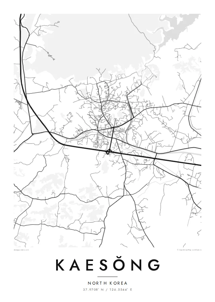
The mountain rises directly north of the city, and on the map its slopes appear as an open, street-free area that frames the historic centre.
Fakatino mape mukamuka · North Korea
37.9708° N / 126.5544° E
A former royal capital in a hill-ringed basin near the Korean border, its old town gathered below Songak Mountain.


Taha e taone, lima e onoonoaga
Tapaki e taha puhala ke kitia ai ki luga he puipui. Kua tatai e totogi he tau puhala oti — pete he lolomi, poloka, po ke faila HD.
 Tau pikselo mooli · faila lolomi 24 × 36″
Maama mitaki ke lolomi
Ko e 100% e fahi mooli mai he faila lolomi. Ko e tau poster oti — pete kua lolomi, poloka, po ke utu hifo — kua taute ke he ha mautolu a tau tokoluga (server) ke he 300 DPI, hokotia ke he 7,200 × 10,800 piksela, ke maeke ai e tau ala ikiiki tote ke maaliali fakamitaki he lolomi 24 × 36″.
He Pā


Ko e mape
Kaesŏng lies in the far south of North Korea, close to the demarcation line with South Korea. On a map it sits in a basin surrounded by hills, with Songak Mountain rising to the north. The older part of the city occupies the lower ground in a compact layout, while newer districts and roads extend toward the south.
For nearly five centuries Kaesŏng was the capital of the Goryeo dynasty, from which the name Korea derives. In 2013 a group of its historic monuments and sites, including the remains of the Manwoldae palace, royal tombs and sections of the old walls, was inscribed on the UNESCO World Heritage List. The nearby Kaesŏng Industrial Region operated as an inter-Korean project until 2016.
A Kaesŏng map poster presents a city rarely seen up close by outsiders, drawn with the same clarity as any other place. The compact old town, the ring of hills and the roads leading south make a restrained, balanced composition. It suits collectors of historic capitals and anyone with family roots or a scholarly interest in the Korean peninsula.
The mountain rises directly north of the city, and on the map its slopes appear as an open, street-free area that frames the historic centre.
The remains of Manwoldae, the former royal palace, lie at the foot of Songak Mountain and mark the heart of the old Goryeo capital.
Hills enclose the city on several sides, so the built-up area forms a compact shape on the valley floor, with roads leaving through gaps in the terrain.
Taute ke ha hau
Lafi e aho, taha higoa po ke taha kupu haau, hiki e fakatino, lahi po ke tuaga.
Ko e kitiaaga nakai totogi kua tote e maaliali mo e fakamailoga vai. Ko e tau lolomi mo e tau faila HD kua taute ke he 300 DPI, hokotia ke he 7,200 × 10,800 px, nakai fai fakamailoga vai.
Ko e ha Kaesŏng
Kaesŏng speaks to history on a large scale: a medieval capital, a divided peninsula and families separated by a border. For many, a map is one of the few ways to hold the city in view, quietly and without comment.
Personalise the title, subtitle and coordinates line, using Kaesŏng, Kaesong or another spelling. Five styles are available: Classic black and white, Noir, Paper, Blueprint and Sand. Choose $9 HD files in six sizes or a printed poster on matte paper.
Talaage e poster Kaesŏng| Lahi he lolomi | Maama | Tau faila |
|---|---|---|
| 30 × 40 cm11.8 × 15.7″ | 3,543 × 4,724 px | PNG · PDF |
| 29.7 × 42 cm (A3)11.7 × 16.5″ | 3,508 × 4,961 px | PNG · PDF |
| 42 × 59.4 cm (A2)16.5 × 23.4″ | 4,961 × 7,016 px | PNG · PDF |
| 45.7 × 61 cm18 × 24″ | 5,400 × 7,200 px | PNG · PDF |
| 50 × 70 cm19.7 × 27.6″ | 5,906 × 8,268 px | PNG · PDF |
| 61 × 91.4 cm24 × 36″ | 7,200 × 10,800 px | PNG · PDF |
Ke fakatatai, ko e fakatino noa kua 900 px e laulahi, fai fakamailoga mo e mo e tau mata komipiuta ni. Ko e tau faila HD kua ato hoko ke he 8× e maama ke he tau faahi takitaha mo e lolomi mitaki he lahi katoa he fakatino.
Fifili e taha puhala i luga he kupega, ti fifili e Poster Lolomi — e lahi mo e, kaeke ke manako ai koe, taha poloka — po ke Tau Faila HD Fakaeletonika. Ko e fakaotiaga totogi ko e taha gahua ni, ti ko e kupega he hau a talaaga ka fakafou fakahaga i mua he fakaotiaga e totogi.
Kua lolomi ai ke he pepa mitaki 200 gsm matte he taha he tau lahi ono, mai he 30 × 40 cm ke hoko ke he 24 × 36″. Kamata e tau poster lolomi mai he $39, kua putoia ai e utaaga.
E. Fifili e poloka akau malolō ke he lanu uli, tea, akau oki mooli, po ke akau pouli. Kua fakalataha mo e sioga malolō nakai malepe ti kua mautali ke tautau. Kamata e tau poster poloka mai he $99, kua putoia ai e utaaga.
Nakai totogi e fakafano ke he motu 60+. Ko e fakatino taha kua lolomi he fenoga lolomi ha mautolu kua tata mo e tau motu 30+, kua hoko mai he tau aho gahua 3–7. Maeke ia koe ke kikite e tuaga mo e fakamuitua he lalo he Haku Tau Fakatonu. Ke he falu motu kua 2–5 e tau tapu, ti ka nakai fakafano a mautolu ki ai, to fakaha he api tupe ia ki mua he totogi.
Fakafano mai e taha ata ki a mautolu he loto he 14 e tau aho tali mai he hokoaga, ti to lolomi foki e mautolu nakai totogi po ke liu atu e totogi ki a koe.
E. He editor i luga he kupega nei, hikihiki e matakupu, e matakupu lalo mo e laini coordinates ke he taha mena kua manako a koe ki ai, ti fifili e puhala mo e lahi. Ko e tau talaaga lolomi, poloka mo e fakaeletonika oti kua fakaaoga tonu e hau a fakatino.
Ma e $9 ka moua e koe e tau faila PNG 300 DPI mo e PDF kua mautali ke lolomi he tau lahi ono oti, nakai fai fakamailoga vai, ke lolomi i fe mena. Nakai maopoopo agaia? Utu hifo fakamua e kitiaaga nakai totogi ne fai fakamailoga vai.
