The Han River
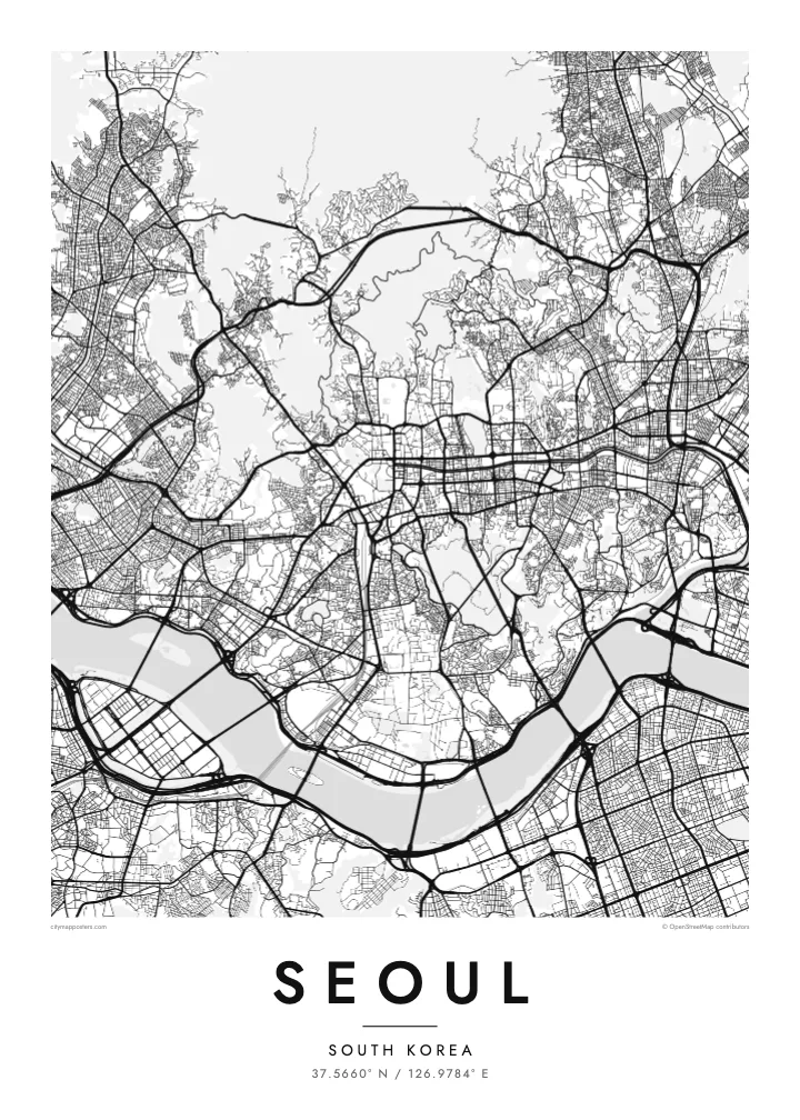
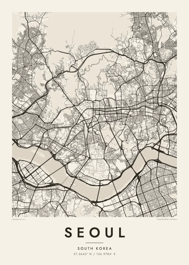
A wide river running across the full width of the city, crossed by a long sequence of bridges. It divides the map into two clear halves and gives the poster its main horizontal line.
Fakatino mape mukamuka · South Korea
37.5660° N / 126.9784° E
A mountain-ringed capital divided by the broad Han River, crossed by dozens of bridges from north to south



Taha e taone, lima e onoonoaga
Tapaki e taha puhala ke kitia ai ki luga he puipui. Kua tatai e totogi he tau puhala oti — pete he lolomi, poloka, po ke faila HD.
 Tau pikselo mooli · faila lolomi 24 × 36″
Maama mitaki ke lolomi
Ko e 100% e fahi mooli mai he faila lolomi. Ko e tau poster oti — pete kua lolomi, poloka, po ke utu hifo — kua taute ke he ha mautolu a tau tokoluga (server) ke he 300 DPI, hokotia ke he 7,200 × 10,800 piksela, ke maeke ai e tau ala ikiiki tote ke maaliali fakamitaki he lolomi 24 × 36″.
He Pā


Ko e mape
Seoul is organised by mountains and a river. The Han River crosses the city from east to west in a wide, gentle curve, dividing it into a northern and a southern half connected by more than two dozen bridges. Around the edges, ridges such as Bukhansan in the north and Gwanaksan in the south enclose the basin, and Namsan rises in the middle of the city.
North of the river, the old walled capital lies between Bugaksan and Namsan, with the palaces of Gyeongbokgung and Changdeokgung and the restored Cheonggyecheon stream running east through the centre. South of the river, Gangnam and its neighbours were developed from the 1970s on a far more regular grid of wide avenues and large blocks. Yeouido, an island in the Han, holds the National Assembly and a cluster of towers.
Sections of the Joseon-era city wall still run along the ridges around the old centre, and Changdeokgung Palace is a UNESCO World Heritage Site. Seoul hosted the Summer Olympics in 1988. A Seoul map poster shows how the city has fitted itself between mountains and river, with palace quarters and newer grids on either side of the Han.
A wide river running across the full width of the city, crossed by a long sequence of bridges. It divides the map into two clear halves and gives the poster its main horizontal line.
A flat island in the Han, home to the National Assembly, financial towers and riverside parks. Its compact, elongated shape stands out clearly in the middle of the river.
Namsan, topped by N Seoul Tower, rises as an open wooded mass south of the palace district, while the old walled city fills the valley between it and the northern ridges.
Taute ke ha hau
Lafi e aho, taha higoa po ke taha kupu haau, hiki e fakatino, lahi po ke tuaga.
Ko e kitiaaga nakai totogi kua tote e maaliali mo e fakamailoga vai. Ko e tau lolomi mo e tau faila HD kua taute ke he 300 DPI, hokotia ke he 7,200 × 10,800 px, nakai fai fakamailoga vai.
Ko e ha Seoul
Seoul suits people who have lived on one side of the Han and crossed it every day, as well as travellers who remember the view from Namsan. The river and mountains give the map a balanced, spacious composition that sits comfortably in almost any room.
Personalise the title and subtitle with a district, a name or a date, and edit the coordinates line to mark a precise place. The poster is available in Classic black & white, Noir, Paper, Blueprint and Sand, as digital files or printed and framed.
Talaage e poster Seoul| Lahi he lolomi | Maama | Tau faila |
|---|---|---|
| 30 × 40 cm11.8 × 15.7″ | 3,543 × 4,724 px | PNG · PDF |
| 29.7 × 42 cm (A3)11.7 × 16.5″ | 3,508 × 4,961 px | PNG · PDF |
| 42 × 59.4 cm (A2)16.5 × 23.4″ | 4,961 × 7,016 px | PNG · PDF |
| 45.7 × 61 cm18 × 24″ | 5,400 × 7,200 px | PNG · PDF |
| 50 × 70 cm19.7 × 27.6″ | 5,906 × 8,268 px | PNG · PDF |
| 61 × 91.4 cm24 × 36″ | 7,200 × 10,800 px | PNG · PDF |
Ke fakatatai, ko e fakatino noa kua 900 px e laulahi, fai fakamailoga mo e mo e tau mata komipiuta ni. Ko e tau faila HD kua ato hoko ke he 8× e maama ke he tau faahi takitaha mo e lolomi mitaki he lahi katoa he fakatino.
Fifili e taha puhala i luga he kupega, ti fifili e Poster Lolomi — e lahi mo e, kaeke ke manako ai koe, taha poloka — po ke Tau Faila HD Fakaeletonika. Ko e fakaotiaga totogi ko e taha gahua ni, ti ko e kupega he hau a talaaga ka fakafou fakahaga i mua he fakaotiaga e totogi.
Kua lolomi ai ke he pepa mitaki 200 gsm matte he taha he tau lahi ono, mai he 30 × 40 cm ke hoko ke he 24 × 36″. Kamata e tau poster lolomi mai he $39, kua putoia ai e utaaga.
E. Fifili e poloka akau malolō ke he lanu uli, tea, akau oki mooli, po ke akau pouli. Kua fakalataha mo e sioga malolō nakai malepe ti kua mautali ke tautau. Kamata e tau poster poloka mai he $99, kua putoia ai e utaaga.
Nakai totogi e fakafano ke he motu 60+. Ko e fakatino taha kua lolomi he fenoga lolomi ha mautolu kua tata mo e tau motu 30+, kua hoko mai he tau aho gahua 3–7. Maeke ia koe ke kikite e tuaga mo e fakamuitua he lalo he Haku Tau Fakatonu. Ke he falu motu kua 2–5 e tau tapu, ti ka nakai fakafano a mautolu ki ai, to fakaha he api tupe ia ki mua he totogi.
Fakafano mai e taha ata ki a mautolu he loto he 14 e tau aho tali mai he hokoaga, ti to lolomi foki e mautolu nakai totogi po ke liu atu e totogi ki a koe.
E. He editor i luga he kupega nei, hikihiki e matakupu, e matakupu lalo mo e laini coordinates ke he taha mena kua manako a koe ki ai, ti fifili e puhala mo e lahi. Ko e tau talaaga lolomi, poloka mo e fakaeletonika oti kua fakaaoga tonu e hau a fakatino.
Ma e $9 ka moua e koe e tau faila PNG 300 DPI mo e PDF kua mautali ke lolomi he tau lahi ono oti, nakai fai fakamailoga vai, ke lolomi i fe mena. Nakai maopoopo agaia? Utu hifo fakamua e kitiaaga nakai totogi ne fai fakamailoga vai.
Tata mai
