Penarth Pier
The Victorian pier extends straight into the Bristol Channel from the seafront. It is a slim, distinctive line against the open water on the poster.
Fakatino mape mukamuka · United Kingdom
51.4386° N / 3.1734° W
A Victorian seaside town on a headland south of Cardiff, with a pier, terraces and a marina on Cardiff Bay.


Taha e taone, lima e onoonoaga
Tapaki e taha puhala ke kitia ai ki luga he puipui. Kua tatai e totogi he tau puhala oti — pete he lolomi, poloka, po ke faila HD.
 Tau pikselo mooli · faila lolomi 24 × 36″
Maama mitaki ke lolomi
Ko e 100% e fahi mooli mai he faila lolomi. Ko e tau poster oti — pete kua lolomi, poloka, po ke utu hifo — kua taute ke he ha mautolu a tau tokoluga (server) ke he 300 DPI, hokotia ke he 7,200 × 10,800 piksela, ke maeke ai e tau ala ikiiki tote ke maaliali fakamitaki he lolomi 24 × 36″.
He Pā


Ko e mape
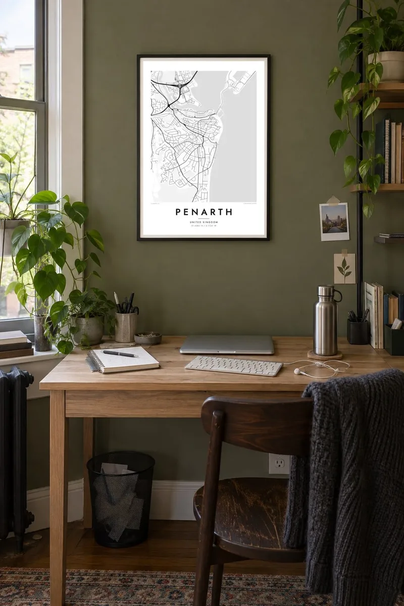
Penarth sits on a headland just south of Cardiff, looking out over the Bristol Channel. On a map, the town is bounded by water on two sides: the open channel to the east and Cardiff Bay to the north. Its streets form a dense, regular pattern of Victorian terraces across the headland, which relaxes into larger villas and gardens along the cliff top and seafront.
Penarth grew in the nineteenth century as a dock town and a genteel resort for Cardiff's wealthy families. Its pier, opened in 1898, still extends into the channel and has a restored Art Deco pavilion. The old docks to the north have been turned into a marina, sheltered by the Cardiff Bay barrage, which links the town across the water to Cardiff's waterfront.
A Penarth map poster brings together very different edges: the straight line of the pier reaching into the sea, the curve of the cliffs, the marina basins to the north and the tidy grid of terraces at the centre. It is a compact composition, full of detail, and a clear picture of a Welsh seaside town that grew up beside a capital city.
The Victorian pier extends straight into the Bristol Channel from the seafront. It is a slim, distinctive line against the open water on the poster.
The former docks, now a marina, and the Cardiff Bay barrage form the northern edge of the town. Their basins and long embankment have clean, geometric shapes.
Rows of Victorian streets cover the headland in a tidy pattern. They thin into villas and gardens toward the clifftop.
Taute ke ha hau
Lafi e aho, taha higoa po ke taha kupu haau, hiki e fakatino, lahi po ke tuaga.
Ko e kitiaaga nakai totogi kua tote e maaliali mo e fakamailoga vai. Ko e tau lolomi mo e tau faila HD kua taute ke he 300 DPI, hokotia ke he 7,200 × 10,800 px, nakai fai fakamailoga vai.
Ko e ha Penarth
Penarth is loved by people who walk its esplanade and pier, and by Cardiff families who moved just across the bay. A map of it suits a seaside home, a wedding gift or a reminder of south Wales from far away.
Personalise the title, subtitle and coordinates, in Welsh or English, and choose Classic black & white, Noir, Paper, Blueprint or Sand. Files come in six print sizes, each as a 300 DPI PNG and a print-ready PDF.
Talaage e poster Penarth| Lahi he lolomi | Maama | Tau faila |
|---|---|---|
| 30 × 40 cm11.8 × 15.7″ | 3,543 × 4,724 px | PNG · PDF |
| 29.7 × 42 cm (A3)11.7 × 16.5″ | 3,508 × 4,961 px | PNG · PDF |
| 42 × 59.4 cm (A2)16.5 × 23.4″ | 4,961 × 7,016 px | PNG · PDF |
| 45.7 × 61 cm18 × 24″ | 5,400 × 7,200 px | PNG · PDF |
| 50 × 70 cm19.7 × 27.6″ | 5,906 × 8,268 px | PNG · PDF |
| 61 × 91.4 cm24 × 36″ | 7,200 × 10,800 px | PNG · PDF |
Ke fakatatai, ko e fakatino noa kua 900 px e laulahi, fai fakamailoga mo e mo e tau mata komipiuta ni. Ko e tau faila HD kua ato hoko ke he 8× e maama ke he tau faahi takitaha mo e lolomi mitaki he lahi katoa he fakatino.
Fifili e taha puhala i luga he kupega, ti fifili e Poster Lolomi — e lahi mo e, kaeke ke manako ai koe, taha poloka — po ke Tau Faila HD Fakaeletonika. Ko e fakaotiaga totogi ko e taha gahua ni, ti ko e kupega he hau a talaaga ka fakafou fakahaga i mua he fakaotiaga e totogi.
Kua lolomi ai ke he pepa mitaki 200 gsm matte he taha he tau lahi ono, mai he 30 × 40 cm ke hoko ke he 24 × 36″. Kamata e tau poster lolomi mai he $39, kua putoia ai e utaaga.
E. Fifili e poloka akau malolō ke he lanu uli, tea, akau oki mooli, po ke akau pouli. Kua fakalataha mo e sioga malolō nakai malepe ti kua mautali ke tautau. Kamata e tau poster poloka mai he $99, kua putoia ai e utaaga.
Nakai totogi e fakafano ke he motu 60+. Ko e fakatino taha kua lolomi he fenoga lolomi ha mautolu kua tata mo e tau motu 30+, kua hoko mai he tau aho gahua 3–7. Maeke ia koe ke kikite e tuaga mo e fakamuitua he lalo he Haku Tau Fakatonu. Ke he falu motu kua 2–5 e tau tapu, ti ka nakai fakafano a mautolu ki ai, to fakaha he api tupe ia ki mua he totogi.
Fakafano mai e taha ata ki a mautolu he loto he 14 e tau aho tali mai he hokoaga, ti to lolomi foki e mautolu nakai totogi po ke liu atu e totogi ki a koe.
E. He editor i luga he kupega nei, hikihiki e matakupu, e matakupu lalo mo e laini coordinates ke he taha mena kua manako a koe ki ai, ti fifili e puhala mo e lahi. Ko e tau talaaga lolomi, poloka mo e fakaeletonika oti kua fakaaoga tonu e hau a fakatino.
Ma e $9 ka moua e koe e tau faila PNG 300 DPI mo e PDF kua mautali ke lolomi he tau lahi ono oti, nakai fai fakamailoga vai, ke lolomi i fe mena. Nakai maopoopo agaia? Utu hifo fakamua e kitiaaga nakai totogi ne fai fakamailoga vai.
Tata mai
