Lahar-shaped riverbeds
The channels draining from the Pinatubo area run through the municipality as wide, braided corridors, left behind by the volcanic sediment that moved down them after the 1991 eruption.
Fakatino mape mukamuka · Philippines
15.0711° N / 120.5423° E
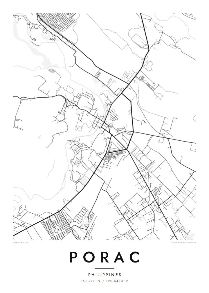
A Pampanga town spreading west from the plain toward the foothills, crossed by wide, pale lahar-scarred riverbeds.


Taha e taone, lima e onoonoaga
Tapaki e taha puhala ke kitia ai ki luga he puipui. Kua tatai e totogi he tau puhala oti — pete he lolomi, poloka, po ke faila HD.
 Tau pikselo mooli · faila lolomi 24 × 36″
Maama mitaki ke lolomi
Ko e 100% e fahi mooli mai he faila lolomi. Ko e tau poster oti — pete kua lolomi, poloka, po ke utu hifo — kua taute ke he ha mautolu a tau tokoluga (server) ke he 300 DPI, hokotia ke he 7,200 × 10,800 piksela, ke maeke ai e tau ala ikiiki tote ke maaliali fakamitaki he lolomi 24 × 36″.
He Pā


Ko e mape
Porac lies on the western edge of the Central Luzon plain, where flat rice land starts to rise toward the Zambales Mountains. From above, the town centre is a compact cluster of streets, while barangays spread outward along roads, the lines between them filled with fields. To the west the land becomes rougher and the street pattern thins out.
The town's recent history is written on its rivers. After Mount Pinatubo erupted in 1991, lahar flows moved down the channels that drain the volcano's slopes and buried large areas of Porac under volcanic sediment. On a map, the Porac River and nearby waterways show up as unusually wide, braided corridors, much broader than the water they usually carry.
A Porac map poster captures a place that rebuilt on new ground. The regular grid of the centre, the scattered villages and the broad riverbeds together describe a town between plain and mountain. In monochrome the sand channels read as pale bands running across the fields. The result is a record of change as much as of streets.
The channels draining from the Pinatubo area run through the municipality as wide, braided corridors, left behind by the volcanic sediment that moved down them after the 1991 eruption.
The poblacion forms a small, orderly block of streets, the densest part of the map and the point from which roads spread out to the surrounding barangays.
West of the centre, settlement thins and the roads start to wind. The map shows the change from flat Pampanga farmland to the uplands below the Zambales range.
Taute ke ha hau
Lafi e aho, taha higoa po ke taha kupu haau, hiki e fakatino, lahi po ke tuaga.
Ko e kitiaaga nakai totogi kua tote e maaliali mo e fakamailoga vai. Ko e tau lolomi mo e tau faila HD kua taute ke he 300 DPI, hokotia ke he 7,200 × 10,800 px, nakai fai fakamailoga vai.
Ko e ha Porac
For families from Porac, and those who have moved away, this map carries the town's story of loss and rebuilding. It works as a quiet reminder of home, and the braided riverbeds make an unusual composition that visitors ask about.
Add a barangay name, a family name or an important date to the title and subtitle, and adjust the coordinates line. Pick one of five styles, from Classic black & white to Sand. Order it as a matte print, framed or unframed, or download the files for $9.
Talaage e poster Porac| Lahi he lolomi | Maama | Tau faila |
|---|---|---|
| 30 × 40 cm11.8 × 15.7″ | 3,543 × 4,724 px | PNG · PDF |
| 29.7 × 42 cm (A3)11.7 × 16.5″ | 3,508 × 4,961 px | PNG · PDF |
| 42 × 59.4 cm (A2)16.5 × 23.4″ | 4,961 × 7,016 px | PNG · PDF |
| 45.7 × 61 cm18 × 24″ | 5,400 × 7,200 px | PNG · PDF |
| 50 × 70 cm19.7 × 27.6″ | 5,906 × 8,268 px | PNG · PDF |
| 61 × 91.4 cm24 × 36″ | 7,200 × 10,800 px | PNG · PDF |
Ke fakatatai, ko e fakatino noa kua 900 px e laulahi, fai fakamailoga mo e mo e tau mata komipiuta ni. Ko e tau faila HD kua ato hoko ke he 8× e maama ke he tau faahi takitaha mo e lolomi mitaki he lahi katoa he fakatino.
Fifili e taha puhala i luga he kupega, ti fifili e Poster Lolomi — e lahi mo e, kaeke ke manako ai koe, taha poloka — po ke Tau Faila HD Fakaeletonika. Ko e fakaotiaga totogi ko e taha gahua ni, ti ko e kupega he hau a talaaga ka fakafou fakahaga i mua he fakaotiaga e totogi.
Kua lolomi ai ke he pepa mitaki 200 gsm matte he taha he tau lahi ono, mai he 30 × 40 cm ke hoko ke he 24 × 36″. Kamata e tau poster lolomi mai he $39, kua putoia ai e utaaga.
E. Fifili e poloka akau malolō ke he lanu uli, tea, akau oki mooli, po ke akau pouli. Kua fakalataha mo e sioga malolō nakai malepe ti kua mautali ke tautau. Kamata e tau poster poloka mai he $99, kua putoia ai e utaaga.
Nakai totogi e fakafano ke he motu 60+. Ko e fakatino taha kua lolomi he fenoga lolomi ha mautolu kua tata mo e tau motu 30+, kua hoko mai he tau aho gahua 3–7. Maeke ia koe ke kikite e tuaga mo e fakamuitua he lalo he Haku Tau Fakatonu. Ke he falu motu kua 2–5 e tau tapu, ti ka nakai fakafano a mautolu ki ai, to fakaha he api tupe ia ki mua he totogi.
Fakafano mai e taha ata ki a mautolu he loto he 14 e tau aho tali mai he hokoaga, ti to lolomi foki e mautolu nakai totogi po ke liu atu e totogi ki a koe.
E. He editor i luga he kupega nei, hikihiki e matakupu, e matakupu lalo mo e laini coordinates ke he taha mena kua manako a koe ki ai, ti fifili e puhala mo e lahi. Ko e tau talaaga lolomi, poloka mo e fakaeletonika oti kua fakaaoga tonu e hau a fakatino.
Ma e $9 ka moua e koe e tau faila PNG 300 DPI mo e PDF kua mautali ke lolomi he tau lahi ono oti, nakai fai fakamailoga vai, ke lolomi i fe mena. Nakai maopoopo agaia? Utu hifo fakamua e kitiaaga nakai totogi ne fai fakamailoga vai.
Tata mai
