The Una River
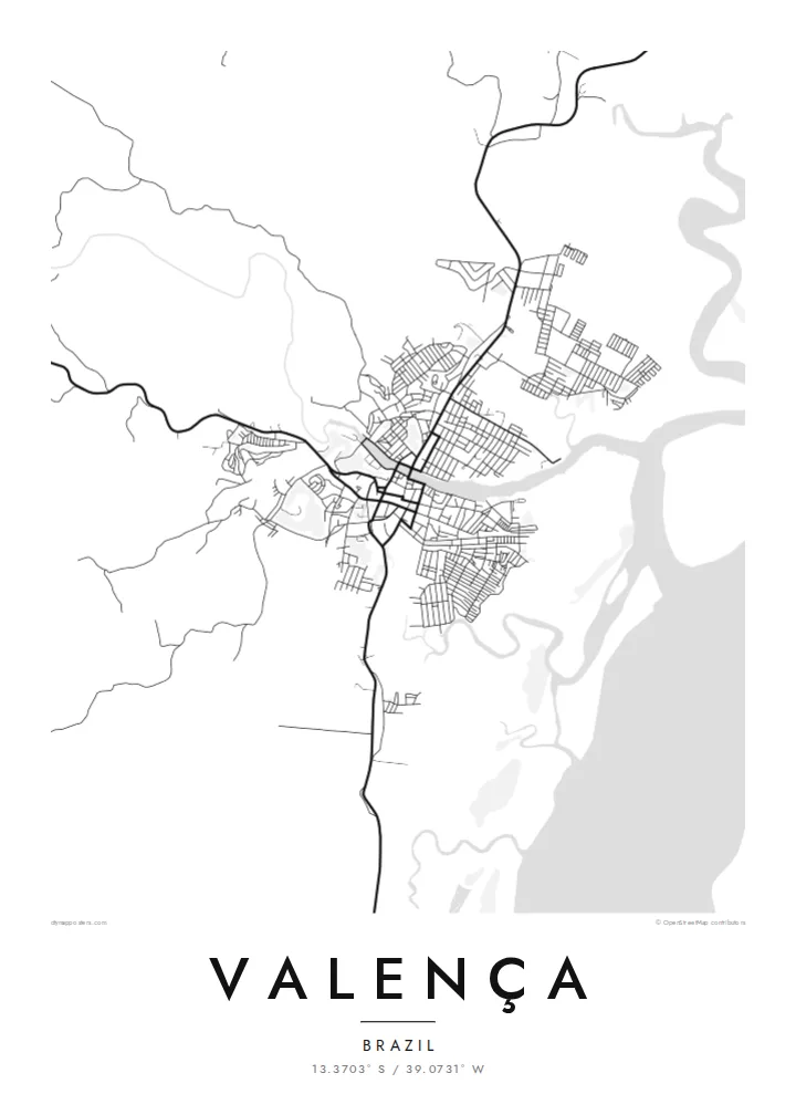
The river runs straight through the town and is its main organising line on the map, with streets and blocks lining both banks and bridges stitching the two halves together.
Fakatino mape mukamuka · Brazil
13.3703° S / 39.0731° W
A river town on the Una estuary, its streets following both banks before mangrove channels open toward the Atlantic coast of Bahia


Taha e taone, lima e onoonoaga
Tapaki e taha puhala ke kitia ai ki luga he puipui. Kua tatai e totogi he tau puhala oti — pete he lolomi, poloka, po ke faila HD.
 Tau pikselo mooli · faila lolomi 24 × 36″
Maama mitaki ke lolomi
Ko e 100% e fahi mooli mai he faila lolomi. Ko e tau poster oti — pete kua lolomi, poloka, po ke utu hifo — kua taute ke he ha mautolu a tau tokoluga (server) ke he 300 DPI, hokotia ke he 7,200 × 10,800 piksela, ke maeke ai e tau ala ikiiki tote ke maaliali fakamitaki he lolomi 24 × 36″.
He Pā


Ko e mape
Valença sits on the Una River a short way inland from the Bahian coast, and from above the river decides everything. The town spreads along both banks, joined by bridges, with the older core close to the water and newer neighbourhoods climbing the low hills behind. Downstream, the channel widens into an estuary edged with mangroves, where solid land gives way to a loose pattern of creeks and islands.
This layout has long made Valença a place of arrival and departure. Boats leave its waterfront for the islands of the Tinharé archipelago, including Morro de São Paulo and Boipeba, and the town has a long tradition of building wooden boats by hand. In the nineteenth century it also became home to one of Brazil's early textile mills, which drew on the river for its power.
A Valença map poster turns this river geography into a clear graphic. The Una draws a strong line through the composition, the street grid gathers tightly around it, and the estuary to the east breaks into fine, irregular shapes. In black and white, the contrast between the dense town and the open water reads especially well, giving the print both structure and a sense of the coast just beyond it.
The river runs straight through the town and is its main organising line on the map, with streets and blocks lining both banks and bridges stitching the two halves together.
East of the centre, the river widens and splits into channels among mangroves, so the plain outline of the land dissolves into delicate, branching water shapes toward the sea.
The waterfront is a departure point for boats to the Tinharé archipelago, including Morro de São Paulo and Boipeba, which ties the town's plan closely to the water.
Taute ke ha hau
Lafi e aho, taha higoa po ke taha kupu haau, hiki e fakatino, lahi po ke tuaga.
Ko e kitiaaga nakai totogi kua tote e maaliali mo e fakamailoga vai. Ko e tau lolomi mo e tau faila HD kua taute ke he 300 DPI, hokotia ke he 7,200 × 10,800 px, nakai fai fakamailoga vai.
Ko e ha Valença
For people who grew up in Valença, or who passed through on the way to the islands, this map holds a particular route: the river, the quay, the streets leading down to the boats. It is a quiet reminder of a place defined by water and travel.
Each poster can be personalised with your own title, subtitle and coordinates line, perhaps a family name or the date of a trip. Choose from five styles, Classic black & white, Noir, Paper, Blueprint or Sand, to suit the room where it will hang.
Talaage e poster Valença| Lahi he lolomi | Maama | Tau faila |
|---|---|---|
| 30 × 40 cm11.8 × 15.7″ | 3,543 × 4,724 px | PNG · PDF |
| 29.7 × 42 cm (A3)11.7 × 16.5″ | 3,508 × 4,961 px | PNG · PDF |
| 42 × 59.4 cm (A2)16.5 × 23.4″ | 4,961 × 7,016 px | PNG · PDF |
| 45.7 × 61 cm18 × 24″ | 5,400 × 7,200 px | PNG · PDF |
| 50 × 70 cm19.7 × 27.6″ | 5,906 × 8,268 px | PNG · PDF |
| 61 × 91.4 cm24 × 36″ | 7,200 × 10,800 px | PNG · PDF |
Ke fakatatai, ko e fakatino noa kua 900 px e laulahi, fai fakamailoga mo e mo e tau mata komipiuta ni. Ko e tau faila HD kua ato hoko ke he 8× e maama ke he tau faahi takitaha mo e lolomi mitaki he lahi katoa he fakatino.
Fifili e taha puhala i luga he kupega, ti fifili e Poster Lolomi — e lahi mo e, kaeke ke manako ai koe, taha poloka — po ke Tau Faila HD Fakaeletonika. Ko e fakaotiaga totogi ko e taha gahua ni, ti ko e kupega he hau a talaaga ka fakafou fakahaga i mua he fakaotiaga e totogi.
Kua lolomi ai ke he pepa mitaki 200 gsm matte he taha he tau lahi ono, mai he 30 × 40 cm ke hoko ke he 24 × 36″. Kamata e tau poster lolomi mai he $39, kua putoia ai e utaaga.
E. Fifili e poloka akau malolō ke he lanu uli, tea, akau oki mooli, po ke akau pouli. Kua fakalataha mo e sioga malolō nakai malepe ti kua mautali ke tautau. Kamata e tau poster poloka mai he $99, kua putoia ai e utaaga.
Nakai totogi e fakafano ke he motu 60+. Ko e fakatino taha kua lolomi he fenoga lolomi ha mautolu kua tata mo e tau motu 30+, kua hoko mai he tau aho gahua 3–7. Maeke ia koe ke kikite e tuaga mo e fakamuitua he lalo he Haku Tau Fakatonu. Ke he falu motu kua 2–5 e tau tapu, ti ka nakai fakafano a mautolu ki ai, to fakaha he api tupe ia ki mua he totogi.
Fakafano mai e taha ata ki a mautolu he loto he 14 e tau aho tali mai he hokoaga, ti to lolomi foki e mautolu nakai totogi po ke liu atu e totogi ki a koe.
E. He editor i luga he kupega nei, hikihiki e matakupu, e matakupu lalo mo e laini coordinates ke he taha mena kua manako a koe ki ai, ti fifili e puhala mo e lahi. Ko e tau talaaga lolomi, poloka mo e fakaeletonika oti kua fakaaoga tonu e hau a fakatino.
Ma e $9 ka moua e koe e tau faila PNG 300 DPI mo e PDF kua mautali ke lolomi he tau lahi ono oti, nakai fai fakamailoga vai, ke lolomi i fe mena. Nakai maopoopo agaia? Utu hifo fakamua e kitiaaga nakai totogi ne fai fakamailoga vai.
Tata mai
