Minato Mirai 21
A modern waterfront district built on reclaimed land, with tall towers, open plazas and a large Ferris wheel forming a clean, planned edge along the bay.
Fakatino mape mukamuka · Japan
35.4333° N / 139.6500° E
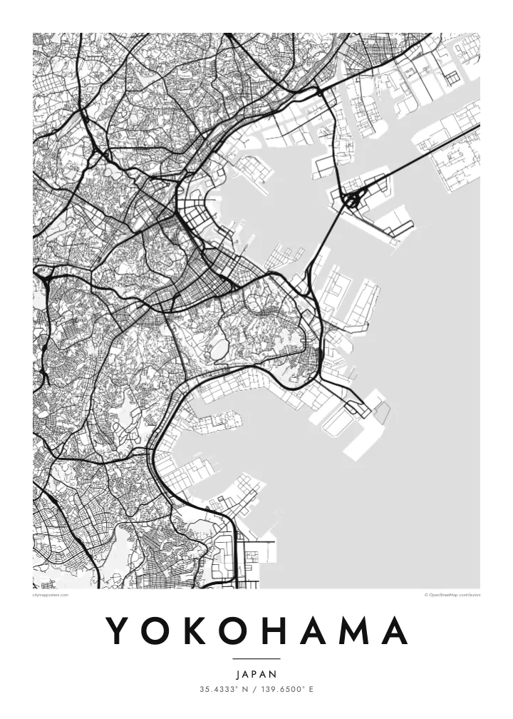
A port city on Tokyo Bay, with a waterfront of piers and reclaimed land and hills rising just behind the harbour.


Taha e taone, lima e onoonoaga
Tapaki e taha puhala ke kitia ai ki luga he puipui. Kua tatai e totogi he tau puhala oti — pete he lolomi, poloka, po ke faila HD.
 Tau pikselo mooli · faila lolomi 24 × 36″
Maama mitaki ke lolomi
Ko e 100% e fahi mooli mai he faila lolomi. Ko e tau poster oti — pete kua lolomi, poloka, po ke utu hifo — kua taute ke he ha mautolu a tau tokoluga (server) ke he 300 DPI, hokotia ke he 7,200 × 10,800 piksela, ke maeke ai e tau ala ikiiki tote ke maaliali fakamitaki he lolomi 24 × 36″.
He Pā


Ko e mape
Yokohama faces Tokyo Bay, and from above its waterfront is a line of piers, reclaimed land and container terminals. The older city centre sits close to the harbour, with Yamashita Park running along the shore, while behind it the land climbs quickly into wooded hills. Further inland, residential districts spread across a rolling landscape of valleys and ridges.
The port opened to foreign trade in 1859, and the city grew from a small fishing village into one of the largest cities in Japan. The hill known as the Bluff, or Yamate, became home to foreign residents, and below it Chinatown, the largest in Japan, still fills a tight grid of streets with gates marking its edges.
Minato Mirai 21 added a new waterfront district of towers, museums and a large Ferris wheel on reclaimed land. A Yokohama map poster shows how the harbour, old town, Chinatown and new waterfront sit together, while the Bay Bridge crosses the entrance to the inner port as one of the most graphic lines on the map.
A modern waterfront district built on reclaimed land, with tall towers, open plazas and a large Ferris wheel forming a clean, planned edge along the bay.
The largest Chinatown in Japan fills a compact grid of streets near the harbour, framed by decorative gates that mark its entrances.
A long cable-stayed bridge crosses the harbour entrance, visible on the map as a thin straight line joining piers and industrial land across the water.
Taute ke ha hau
Lafi e aho, taha higoa po ke taha kupu haau, hiki e fakatino, lahi po ke tuaga.
Ko e kitiaaga nakai totogi kua tote e maaliali mo e fakamailoga vai. Ko e tau lolomi mo e tau faila HD kua taute ke he 300 DPI, hokotia ke he 7,200 × 10,800 px, nakai fai fakamailoga vai.
Ko e ha Yokohama
Yokohama is a city many people know from years of work or study near Tokyo, or from weekends on the harbour. A map poster keeps its waterfront and hills in view long after leaving, and it sits well beside a Tokyo print.
Write your own title and subtitle, add coordinates or a date, and pick a style: Classic black & white, Noir, Paper, Blueprint or Sand. The $9 HD files cover six sizes, including A3 and A2, each without a watermark.
Talaage e poster Yokohama| Lahi he lolomi | Maama | Tau faila |
|---|---|---|
| 30 × 40 cm11.8 × 15.7″ | 3,543 × 4,724 px | PNG · PDF |
| 29.7 × 42 cm (A3)11.7 × 16.5″ | 3,508 × 4,961 px | PNG · PDF |
| 42 × 59.4 cm (A2)16.5 × 23.4″ | 4,961 × 7,016 px | PNG · PDF |
| 45.7 × 61 cm18 × 24″ | 5,400 × 7,200 px | PNG · PDF |
| 50 × 70 cm19.7 × 27.6″ | 5,906 × 8,268 px | PNG · PDF |
| 61 × 91.4 cm24 × 36″ | 7,200 × 10,800 px | PNG · PDF |
Ke fakatatai, ko e fakatino noa kua 900 px e laulahi, fai fakamailoga mo e mo e tau mata komipiuta ni. Ko e tau faila HD kua ato hoko ke he 8× e maama ke he tau faahi takitaha mo e lolomi mitaki he lahi katoa he fakatino.
Fifili e taha puhala i luga he kupega, ti fifili e Poster Lolomi — e lahi mo e, kaeke ke manako ai koe, taha poloka — po ke Tau Faila HD Fakaeletonika. Ko e fakaotiaga totogi ko e taha gahua ni, ti ko e kupega he hau a talaaga ka fakafou fakahaga i mua he fakaotiaga e totogi.
Kua lolomi ai ke he pepa mitaki 200 gsm matte he taha he tau lahi ono, mai he 30 × 40 cm ke hoko ke he 24 × 36″. Kamata e tau poster lolomi mai he $39, kua putoia ai e utaaga.
E. Fifili e poloka akau malolō ke he lanu uli, tea, akau oki mooli, po ke akau pouli. Kua fakalataha mo e sioga malolō nakai malepe ti kua mautali ke tautau. Kamata e tau poster poloka mai he $99, kua putoia ai e utaaga.
Nakai totogi e fakafano ke he motu 60+. Ko e fakatino taha kua lolomi he fenoga lolomi ha mautolu kua tata mo e tau motu 30+, kua hoko mai he tau aho gahua 3–7. Maeke ia koe ke kikite e tuaga mo e fakamuitua he lalo he Haku Tau Fakatonu. Ke he falu motu kua 2–5 e tau tapu, ti ka nakai fakafano a mautolu ki ai, to fakaha he api tupe ia ki mua he totogi.
Fakafano mai e taha ata ki a mautolu he loto he 14 e tau aho tali mai he hokoaga, ti to lolomi foki e mautolu nakai totogi po ke liu atu e totogi ki a koe.
E. He editor i luga he kupega nei, hikihiki e matakupu, e matakupu lalo mo e laini coordinates ke he taha mena kua manako a koe ki ai, ti fifili e puhala mo e lahi. Ko e tau talaaga lolomi, poloka mo e fakaeletonika oti kua fakaaoga tonu e hau a fakatino.
Ma e $9 ka moua e koe e tau faila PNG 300 DPI mo e PDF kua mautali ke lolomi he tau lahi ono oti, nakai fai fakamailoga vai, ke lolomi i fe mena. Nakai maopoopo agaia? Utu hifo fakamua e kitiaaga nakai totogi ne fai fakamailoga vai.
Tata mai
