The Weser
The river curves past the town's eastern edge, a wide smooth line that separates Höxter from the wooded hills of Lower Saxony on the opposite bank.
Positala ya mapu yosavuta · Germany
51.7750° N / 9.3816° E
A half-timbered town on a curve of the Weser, with the Carolingian abbey of Corvey at its edge and wooded hills opposite


Mzinda umodzi, mawonekedwe asanu
Khudzani sitayelo kuti muwone pa khoma. Masitayelo onse amawononga ndalama zofanana — zosindikizidwa, zokutidwa mu chimango kapena ngati mafayilo a HD.
 Ma pixel enieni · fayilo yosindikiza 24 × 36″
Yowala posindikiza
Awa ndi chithunzi 100% chodulidwa cha fayilo yeniyeni yosindikiza. Poster iliyonse — yosindikizidwa, yokutidwa mu chimango kapena yotsitsidwa — imapangidwa pa maseva athu pa 300 DPI, mpaka ma pixel 7,200 × 10,800, choncho ngakhale misewu yaying'ono kwambiri imakhalabe yowoneka bwino pa kope la 24 × 36″.
Pakhoma


Mapu
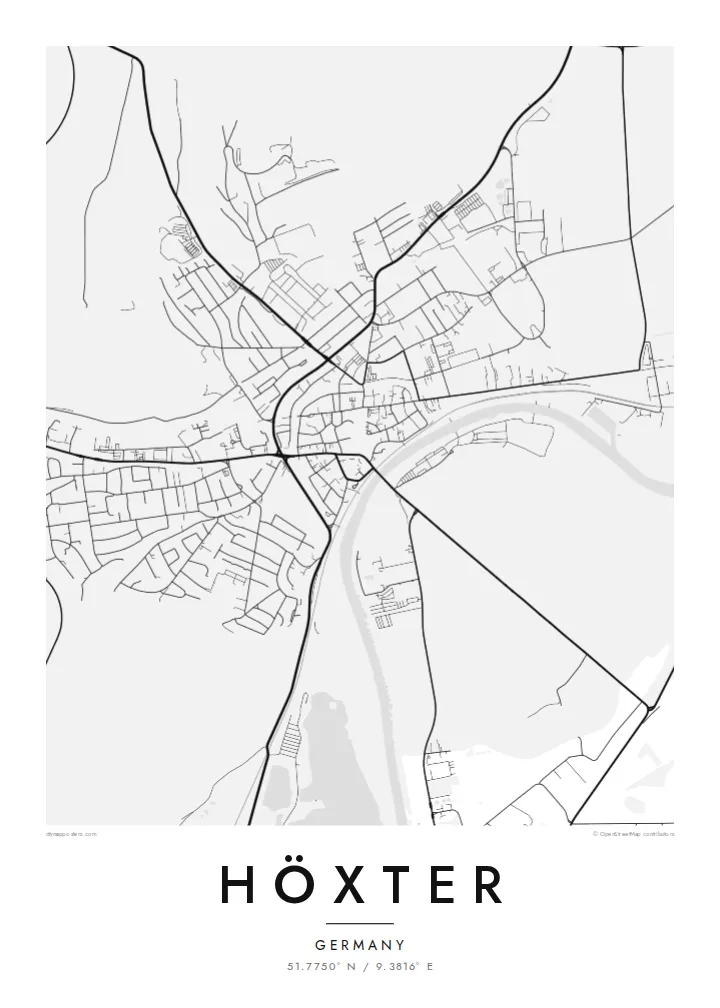
Höxter lies on the Weser in eastern North Rhine-Westphalia, in the wooded hill country of the Weser Uplands. The river runs along the eastern side of the town, and the old centre sits on its western bank, a compact cluster of lanes around the market and churches. Across the water, forested slopes rise toward the Solling hills in neighbouring Lower Saxony.
Just outside the town stands Corvey, a former Benedictine abbey founded in the ninth century. Its Carolingian westwork, one of the few surviving buildings of that era, was inscribed as a UNESCO World Heritage Site in 2014. The poet August Heinrich Hoffmann von Fallersleben, author of the text of the German national anthem, worked as librarian at Corvey and is buried there.
A Höxter map poster brings together the dense medieval centre, the broad curve of the Weser and the open grounds of Corvey with its avenues and parkland. The town is also known for its many half-timbered houses, and although they cannot be seen from above, their narrow plots give the historic streets a fine, closely spaced grain that reads well in black and white.
The river curves past the town's eastern edge, a wide smooth line that separates Höxter from the wooded hills of Lower Saxony on the opposite bank.
The former abbey and its grounds sit a short distance from the centre, a UNESCO-listed site whose axial layout and surrounding greenery form a calm, ordered shape on the map.
Narrow streets and closely packed plots cluster in the old town near the river, creating the densest and most finely detailed part of the poster.
Ipangeni yanu
Onjezani tsiku, dzina kapena mawu anu, sinthani mawonekedwe, kukula kapena momwe yaimira.
Chitsanzo chaulere ndi chotsika mu resolution ndipo chili ndi chizindikiro chothira madzi. Zosindikizidwa ndi mafayilo a HD zimapangidwa pa 300 DPI, mpaka ma px 7,200 × 10,800, popanda chizindikiro chothira madzi.
Chifukwa chiyani Höxter
Höxter maps are chosen by people who grew up in the Weser Uplands, by students of the town's university campus, and by visitors who came for Corvey and stayed for the river. The composition is historic without being ornamental.
Add your own title, a subtitle and a date, such as a graduation or a wedding at Corvey, and adjust the coordinates. Choose from five styles, including Blueprint and Sand, and download a free watermarked preview first. HD files cost $9.
Odara poster ya Höxter| Kukula kosindikiza | Mphamvu ya chithunzi | Mafayilo |
|---|---|---|
| 30 × 40 cm11.8 × 15.7″ | 3,543 × 4,724 px | PNG · PDF |
| 29.7 × 42 cm (A3)11.7 × 16.5″ | 3,508 × 4,961 px | PNG · PDF |
| 42 × 59.4 cm (A2)16.5 × 23.4″ | 4,961 × 7,016 px | PNG · PDF |
| 45.7 × 61 cm18 × 24″ | 5,400 × 7,200 px | PNG · PDF |
| 50 × 70 cm19.7 × 27.6″ | 5,906 × 8,268 px | PNG · PDF |
| 61 × 91.4 cm24 × 36″ | 7,200 × 10,800 px | PNG · PDF |
Poyerekeza, chithunzi chaulere ndi cha 900 px m'lifupi, chili ndi chizindikiro ndipo ndi cha pa sikirini. Mafayilo a HD ali ndi mphamvu yochulukira mpaka 8× mbali iliyonse ndipo amasindikizika bwino pa kukula konse kwa positala.
Sankhani sitayelo kumtunda kwa tsamba, kenako musankhe Poster Yosindikizidwa — kukula ndi, mukafuna, chimango — kapena Mafayilo a Digital HD. Kulipira kumatenga sitepe imodzi, ndipo tsamba la oda yanu limasinthidwa nthawi yomweyo pambuyo pa kulipira.
Imasindikizidwa pa pepala labwino la matte la 200 gsm mu kukula kumodzi mwa zisanu ndi chimodzi, kuyambira 30 × 40 cm mpaka 24 × 36″. Maposita osindikizidwa amayamba pa $39, kutumiza kuphatikizidwa.
Inde. Sankhani chimango cha mtengo wolimba mu utoto wakuda, woyera, oak wachilengedwe kapena mtengo wakuda. Chimabwera ndi galasi losathyoka ndipo chikonzekera kupachikidwa nthawi yomweyo. Maposita a mu chimango amayamba pa $99, kutumiza kuphatikizidwa.
Kutumiza ndi kwaulere kumayiko oposa 60. Positala iliyonse imasindikizidwa ndi mnzathu wosindikiza wapafupi kwambiri mwa anzathu m'mayiko oposa 30, ndipo nthawi zambiri imafika m'masiku 3–7 antchito. Mukhoza kutsatira momwe oda ilili ndi malo ake pa "Maoda Anga". Mayiko ena amatenga masabata 2–5, ndipo kumene sitinayambe kutumiza, tsambali likuuzani musanalipire.
Titumizireni chithunzi masiku 14 kuchokera pa tsiku la kutumiza ndipo tidzaisindikizanso kwaulere kapena kukubwezerani ndalama zanu.
Inde. Mu chida chokonzera pa tsambali, sinthani mutu, mutu wowonjezera ndi mzere wa ma coordinates kukhala chilichonse chomwe mufuna, ndipo sankhani sitayelo ndi kukula. Maoda osindikizidwa, a mu chimango ndi a digital onse amagwiritsa ntchito kapangidwe kanu enieni.
Pa $9 mumalandira mafayilo a PNG a 300 DPI ndi PDF okonzeka kusindikiza mu kukula konse kwa zisanu ndi chimodzi, popanda chizindikiro chothira madzi, kuti musindikize kulikonse. Simunatsimikize? Tsitsani kaye chitsanzo chaulere chokhala ndi chizindikiro chothira madzi.
