Beerenberg
The volcano fills the northern end of the island, and its round, glacier-covered cone gives the map a strong, heavy head. The coastline around it is steep and largely inaccessible.
Positala ya mapu yosavuta · Norway
70.9931° N / 8.5029° W
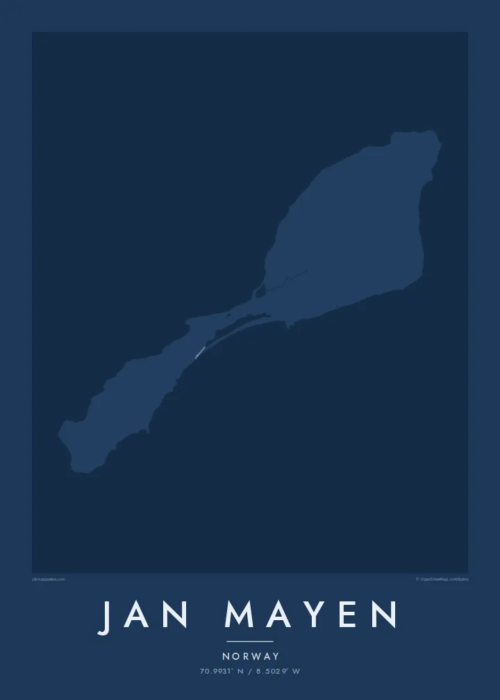
A narrow Arctic island of two volcanic halves joined by a thin neck, crowned by a glaciated volcano in the north.



Mzinda umodzi, mawonekedwe asanu
Khudzani sitayelo kuti muwone pa khoma. Masitayelo onse amawononga ndalama zofanana — zosindikizidwa, zokutidwa mu chimango kapena ngati mafayilo a HD.
 Ma pixel enieni · fayilo yosindikiza 24 × 36″
Yowala posindikiza
Awa ndi chithunzi 100% chodulidwa cha fayilo yeniyeni yosindikiza. Poster iliyonse — yosindikizidwa, yokutidwa mu chimango kapena yotsitsidwa — imapangidwa pa maseva athu pa 300 DPI, mpaka ma pixel 7,200 × 10,800, choncho ngakhale misewu yaying'ono kwambiri imakhalabe yowoneka bwino pa kope la 24 × 36″.
Pakhoma


Mapu
Jan Mayen is a Norwegian volcanic island in the Arctic Ocean, northeast of Iceland. It is long and slender, and its outline falls into two parts: a broad northern section dominated by the volcano Beerenberg, and a lower, narrower southern section, linked by a slim isthmus. Beerenberg is the northernmost active volcano above sea level, and glaciers flow down its flanks toward the sea.
There is no permanent population. A small station staffed by Norwegian personnel handles weather observation and other services, and it accounts for most of the island's few tracks and buildings. A Jan Mayen map poster is therefore almost entirely coastline: capes, lagoons and the round mass of the volcano, with only the faintest trace of anything built by people.
Access is restricted, and the island is rarely visited outside official duty or occasional expeditions. Its isolation is part of its appeal as a subject. The outline, with its heavy northern head and thin southern tail, is one of the more unusual shapes a map poster can hold, and it reads clearly even without streets.
The volcano fills the northern end of the island, and its round, glacier-covered cone gives the map a strong, heavy head. The coastline around it is steep and largely inaccessible.
A narrow neck of land joins the two halves, with small lagoons along its shores. On the poster it is the thinnest point of the outline, easy to trace by eye.
The island's only settlement is a small cluster of buildings and tracks used by station staff. It is the one place where the map shows anything made by people.
Ipangeni yanu
Onjezani tsiku, dzina kapena mawu anu, sinthani mawonekedwe, kukula kapena momwe yaimira.
Chitsanzo chaulere ndi chotsika mu resolution ndipo chili ndi chizindikiro chothira madzi. Zosindikizidwa ndi mafayilo a HD zimapangidwa pa 300 DPI, mpaka ma px 7,200 × 10,800, popanda chizindikiro chothira madzi.
Chifukwa chiyani Jan Mayen
Jan Mayen appeals to people who have served on the station, polar travellers and those who collect remote places. It is a map almost free of roads, which makes the poster feel more like a drawing of land and sea than a guide.
Use the title and subtitle for a posting, an expedition year or simply the island's name, and adjust the coordinates line. Noir and Blueprint suit its Arctic character, though all five styles, including Classic, Paper and Sand, are available. Files include six sizes as PNG and PDF.
Odara poster ya Jan Mayen| Kukula kosindikiza | Mphamvu ya chithunzi | Mafayilo |
|---|---|---|
| 30 × 40 cm11.8 × 15.7″ | 3,543 × 4,724 px | PNG · PDF |
| 29.7 × 42 cm (A3)11.7 × 16.5″ | 3,508 × 4,961 px | PNG · PDF |
| 42 × 59.4 cm (A2)16.5 × 23.4″ | 4,961 × 7,016 px | PNG · PDF |
| 45.7 × 61 cm18 × 24″ | 5,400 × 7,200 px | PNG · PDF |
| 50 × 70 cm19.7 × 27.6″ | 5,906 × 8,268 px | PNG · PDF |
| 61 × 91.4 cm24 × 36″ | 7,200 × 10,800 px | PNG · PDF |
Poyerekeza, chithunzi chaulere ndi cha 900 px m'lifupi, chili ndi chizindikiro ndipo ndi cha pa sikirini. Mafayilo a HD ali ndi mphamvu yochulukira mpaka 8× mbali iliyonse ndipo amasindikizika bwino pa kukula konse kwa positala.
Sankhani sitayelo kumtunda kwa tsamba, kenako musankhe Poster Yosindikizidwa — kukula ndi, mukafuna, chimango — kapena Mafayilo a Digital HD. Kulipira kumatenga sitepe imodzi, ndipo tsamba la oda yanu limasinthidwa nthawi yomweyo pambuyo pa kulipira.
Imasindikizidwa pa pepala labwino la matte la 200 gsm mu kukula kumodzi mwa zisanu ndi chimodzi, kuyambira 30 × 40 cm mpaka 24 × 36″. Maposita osindikizidwa amayamba pa $39, kutumiza kuphatikizidwa.
Inde. Sankhani chimango cha mtengo wolimba mu utoto wakuda, woyera, oak wachilengedwe kapena mtengo wakuda. Chimabwera ndi galasi losathyoka ndipo chikonzekera kupachikidwa nthawi yomweyo. Maposita a mu chimango amayamba pa $99, kutumiza kuphatikizidwa.
Kutumiza ndi kwaulere kumayiko oposa 60. Positala iliyonse imasindikizidwa ndi mnzathu wosindikiza wapafupi kwambiri mwa anzathu m'mayiko oposa 30, ndipo nthawi zambiri imafika m'masiku 3–7 antchito. Mukhoza kutsatira momwe oda ilili ndi malo ake pa "Maoda Anga". Mayiko ena amatenga masabata 2–5, ndipo kumene sitinayambe kutumiza, tsambali likuuzani musanalipire.
Titumizireni chithunzi masiku 14 kuchokera pa tsiku la kutumiza ndipo tidzaisindikizanso kwaulere kapena kukubwezerani ndalama zanu.
Inde. Mu chida chokonzera pa tsambali, sinthani mutu, mutu wowonjezera ndi mzere wa ma coordinates kukhala chilichonse chomwe mufuna, ndipo sankhani sitayelo ndi kukula. Maoda osindikizidwa, a mu chimango ndi a digital onse amagwiritsa ntchito kapangidwe kanu enieni.
Pa $9 mumalandira mafayilo a PNG a 300 DPI ndi PDF okonzeka kusindikiza mu kukula konse kwa zisanu ndi chimodzi, popanda chizindikiro chothira madzi, kuti musindikize kulikonse. Simunatsimikize? Tsitsani kaye chitsanzo chaulere chokhala ndi chizindikiro chothira madzi.
Pafupi
