Mays Island
A narrow island in the Cedar River holding civic buildings, linked to both banks by bridges. On the poster it appears as a small block of streets floating in the middle of the water.
Poster de mapa minimalista · Estados Unidos
42.0083° N / 91.6441° W
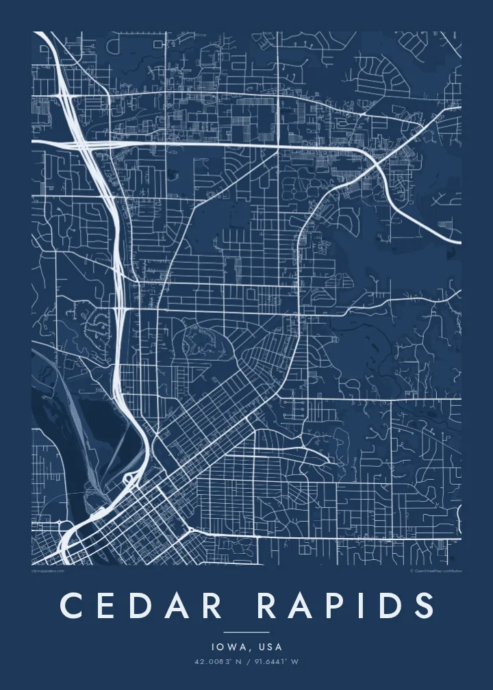
A river city split diagonally by the Cedar, with an island at its centre and four quadrants of numbered streets.



Uma cidade, cinco ambientes
Toque num estilo para o ver na parede. Todos os estilos custam o mesmo — impresso, emoldurado ou em ficheiros HD.
 Pixels reais · ficheiro de impressão 24 × 36″
Nitidez de impressão
Este é um recorte a 100% do ficheiro de impressão real. Todos os pósteres — impressos, emoldurados ou descarregados — são gerados nos nossos servidores a 300 DPI, até 7,200 × 10,800 pixels, para que até as ruas mais pequenas fiquem nítidas numa impressão de 24 × 36″.
Na parede


O mapa
From above, Cedar Rapids is organised around the Cedar River, which cuts through the city from northwest to southeast. Streets and avenues are numbered and labelled by quadrant (NE, NW, SE and SW), so the map reads as four grids meeting at the water. Downtown sits on the east bank, and a series of bridges connects it to the west side and to Mays Island in the middle of the channel.
Mays Island is the detail most people remember. Civic buildings stand on it, which makes Cedar Rapids one of very few American cities with its seat of government on a river island. A short walk upstream, the large Quaker Oats plant reflects the city's long connection to grain processing, and on some days the smell of toasted oats drifts across downtown.
A Cedar Rapids map poster shows the whole arrangement at once: the river, the island, Interstate 380 curving through the centre and residential blocks spreading toward the farmland of eastern Iowa. The painter Grant Wood lived and worked here, and his ordered, clean-lined view of the Midwest suits the calm geometry of a black-and-white street map.
A narrow island in the Cedar River holding civic buildings, linked to both banks by bridges. On the poster it appears as a small block of streets floating in the middle of the water.
Numbered streets and avenues divide into NE, NW, SE and SW sections. The result is four slightly offset grids that meet along the river and give the map its structure.
The interstate runs north to south through the city and crosses the river close to downtown. Its long, smooth curves stand out against the square blocks on either side.
Personalize-o
Acrescente uma data, um nome ou uma frase sua, e mude o estilo, o tamanho ou a orientação.
A pré-visualização gratuita é de baixa resolução e com marca de água. As impressões e os ficheiros HD são gerados a 300 DPI, até 7,200 × 10,800 px, sem marca de água.
Porquê Cedar Rapids
Cedar Rapids maps tend to go to people with a long attachment to the city: those who grew up in its quadrants, worked in its plants and offices, or helped rebuild after the 2008 flood. The river and the island make the layout recognisable even without labels.
The title, subtitle and coordinates line can all be personalised, for example with a family name or a date that matters, and the map comes in five styles: Classic black & white, Noir, Paper, Blueprint and Sand. Choose the $9 digital HD files or a printed poster with an optional wooden frame.
Encomendar o póster Cedar Rapids| Tamanho de impressão | Resolução | Ficheiros |
|---|---|---|
| 30 × 40 cm (11.8 × 15.7″) | 3,543 × 4,724 px | PNG · PDF |
| 29.7 × 42 cm (A3, 11.7 × 16.5″) | 3,508 × 4,961 px | PNG · PDF |
| 42 × 59.4 cm (A2, 16.5 × 23.4″) | 4,961 × 7,016 px | PNG · PDF |
| 45.7 × 61 cm (18 × 24″) | 5,400 × 7,200 px | PNG · PDF |
| 50 × 70 cm (19.7 × 27.6″) | 5,906 × 8,268 px | PNG · PDF |
| 61 × 91.4 cm (24 × 36″) | 7,200 × 10,800 px | PNG · PDF |
Para comparação, a pré-visualização gratuita tem 900 px de largura, marca de água e destina-se a ecrãs. Os ficheiros HD têm até 8× a resolução em cada direção e imprimem com nitidez no tamanho total do poster.
Escolha um estilo no topo da página e depois selecione Póster Impresso — um tamanho e, se quiser, uma moldura — ou Ficheiros Digitais HD. O checkout é feito num só passo, e a sua página de encomenda atualiza-se assim que o pagamento é confirmado.
É impresso em papel mate premium de 200 g/m² num de seis tamanhos, de 30 × 40 cm a 24 × 36″. Os pósteres impressos têm preços a partir de $39, portes incluídos.
Sim. Escolha uma moldura de madeira maciça em preto, branco, carvalho natural ou madeira escura. Vem com vidro anti-estilhaço e pronta a pendurar. Os pósteres emoldurados têm preços a partir de $99, portes incluídos.
O envio é gratuito para todo o mundo. Cada pôster é impresso pelo parceiro de impressão mais próximo, em mais de 30 países, e costuma chegar em 3 a 7 dias úteis. Você acompanha o status e o rastreamento em Meus Pedidos. Alguns países levam de 2 a 5 semanas e, onde ainda não entregamos, o site avisa antes do pagamento.
Envie-nos uma foto até 14 dias após a entrega e reimprimimos gratuitamente ou reembolsamos.
Sim. No editor desta página, altere o título, o subtítulo e a linha de coordenadas como preferir, e escolha um estilo e tamanho. As encomendas impressas, emolduradas e digitais usam exatamente o seu design.
Por $9 recebe ficheiros PNG a 300 DPI e PDF prontos para impressão nos seis tamanhos, sem marca de água, para imprimir onde quiser. Ainda não tem a certeza? Descarregue primeiro uma pré-visualização gratuita com marca de água.
Nas proximidades
