Strait of Magellan
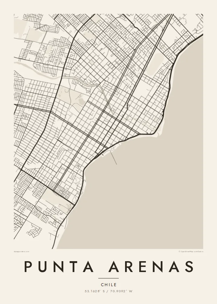
The city's whole eastern side faces the strait. On the poster it appears as a broad open plane, with the city running along one shore and Tierra del Fuego across the water.
Poster de mapa minimalista · Chile
53.1628° S / 70.9092° W
A windswept grid on the Strait of Magellan, where straight streets run down to the water facing Tierra del Fuego




Uma cidade, cinco ambientes
Toque num estilo para o ver na parede. Todos os estilos custam o mesmo — impresso, emoldurado ou em ficheiros HD.
 Pixels reais · ficheiro de impressão 24 × 36″
Nitidez de impressão
Este é um recorte a 100% do ficheiro de impressão real. Todos os pósteres — impressos, emoldurados ou descarregados — são gerados nos nossos servidores a 300 DPI, até 7,200 × 10,800 pixels, para que até as ruas mais pequenas fiquem nítidas numa impressão de 24 × 36″.
Na parede


O mapa
Punta Arenas stretches along the western shore of the Strait of Magellan and is one of the southernmost cities in the world. From above, it is a disciplined grid of straight streets and square blocks. The grid runs from the coastline up gentle slopes toward the hills and the Patagonian steppe. The Costanera road follows the shore, and to the east lies the open water of the strait, with Tierra del Fuego on the far side.
The city was founded in 1848 as a Chilean outpost. It prospered as a port on the route between the Atlantic and Pacific before the Panama Canal opened, and later as a centre of the sheep-farming trade. Its central square, Plaza Muñoz Gamero, is laid out around a monument to Magellan. A Punta Arenas map poster shows the plaza at the heart of a regular plan that seems built to hold firm against the wind.
In black and white, the contrast between land and sea is stark. The dense grid stops at a clean coastline, and the strait fills the rest of the frame as a single calm field. Small rivers and ravines come down from the hills and break into the rows of blocks. The result is a graphic image of a city at the edge of the continent.
The city's whole eastern side faces the strait. On the poster it appears as a broad open plane, with the city running along one shore and Tierra del Fuego across the water.
The main square sits at the centre of the grid, surrounded by regular blocks. The Magellan monument stands there, and the square is the anchor of the whole plan.
Straight streets climb from the coast toward the western hills in long parallel rows. They give the city its orderly, almost drafted look against the open landscape.
Personalize-o
Acrescente uma data, um nome ou uma frase sua, e mude o estilo, o tamanho ou a orientação.
A pré-visualização gratuita é de baixa resolução e com marca de água. As impressões e os ficheiros HD são gerados a 300 DPI, até 7,200 × 10,800 px, sem marca de água.
Porquê Punta Arenas
Punta Arenas is often a gateway to Torres del Paine, Antarctic voyages and Tierra del Fuego, so its map works as a keepsake of a journey to the far south. For residents, it is a striking portrait of a city defined by its coastline.
You can personalise the title, subtitle and coordinates line, for example with an expedition date or a family name. Choose from five styles: Classic black & white, Noir, Paper, Blueprint and Sand. Blueprint suits the seafaring history of the port. Order it as a digital file or as a printed poster.
Encomendar o póster Punta Arenas| Tamanho de impressão | Resolução | Ficheiros |
|---|---|---|
| 30 × 40 cm11.8 × 15.7″ | 3,543 × 4,724 px | PNG · PDF |
| 29.7 × 42 cm (A3)11.7 × 16.5″ | 3,508 × 4,961 px | PNG · PDF |
| 42 × 59.4 cm (A2)16.5 × 23.4″ | 4,961 × 7,016 px | PNG · PDF |
| 45.7 × 61 cm18 × 24″ | 5,400 × 7,200 px | PNG · PDF |
| 50 × 70 cm19.7 × 27.6″ | 5,906 × 8,268 px | PNG · PDF |
| 61 × 91.4 cm24 × 36″ | 7,200 × 10,800 px | PNG · PDF |
Para comparação, a pré-visualização gratuita tem 900 px de largura, marca de água e destina-se a ecrãs. Os ficheiros HD têm até 8× a resolução em cada direção e imprimem com nitidez no tamanho total do poster.
Escolha um estilo no topo da página e depois selecione Póster Impresso — um tamanho e, se quiser, uma moldura — ou Ficheiros Digitais HD. O checkout é feito num só passo, e a sua página de encomenda atualiza-se assim que o pagamento é confirmado.
É impresso em papel mate premium de 200 g/m² num de seis tamanhos, de 30 × 40 cm a 24 × 36″. Os pósteres impressos têm preços a partir de $39, portes incluídos.
Sim. Escolha uma moldura de madeira maciça em preto, branco, carvalho natural ou madeira escura. Vem com vidro anti-estilhaço e pronta a pendurar. Os pósteres emoldurados têm preços a partir de $99, portes incluídos.
O envio é grátis para mais de 60 países. Cada pôster é impresso pelo parceiro de impressão mais próximo, entre os nossos parceiros em mais de 30 países, e costuma chegar em 3 a 7 dias úteis. Você pode acompanhar o status e o rastreamento em Meus Pedidos. Alguns países levam de 2 a 5 semanas e, onde ainda não entregamos, o site avisa antes do pagamento.
Envie-nos uma foto até 14 dias após a entrega e reimprimimos gratuitamente ou reembolsamos.
Sim. No editor desta página, altere o título, o subtítulo e a linha de coordenadas como preferir, e escolha um estilo e tamanho. As encomendas impressas, emolduradas e digitais usam exatamente o seu design.
Por $9 recebe ficheiros PNG a 300 DPI e PDF prontos para impressão nos seis tamanhos, sem marca de água, para imprimir onde quiser. Ainda não tem a certeza? Descarregue primeiro uma pré-visualização gratuita com marca de água.
Nas proximidades
