Misumi West Port
A carefully engineered Meiji-era harbour of cut stone, with canals and quays, lies near the tip of the peninsula. It is one of the few ports of its era to survive largely intact.
Poster de mapa minimalista · Japão
32.6222° N / 130.6618° E
A coastal city at the root of the Uto Peninsula, facing two inland seas with a Meiji-era stone port at its western tip.



Uma cidade, cinco ambientes
Toque num estilo para o ver na parede. Todos os estilos custam o mesmo — impresso, emoldurado ou em ficheiros HD.
 Pixels reais · ficheiro de impressão 24 × 36″
Nitidez de impressão
Este é um recorte a 100% do ficheiro de impressão real. Todos os pósteres — impressos, emoldurados ou descarregados — são gerados nos nossos servidores a 300 DPI, até 7,200 × 10,800 pixels, para que até as ruas mais pequenas fiquem nítidas numa impressão de 24 × 36″.
Na parede


O mapa
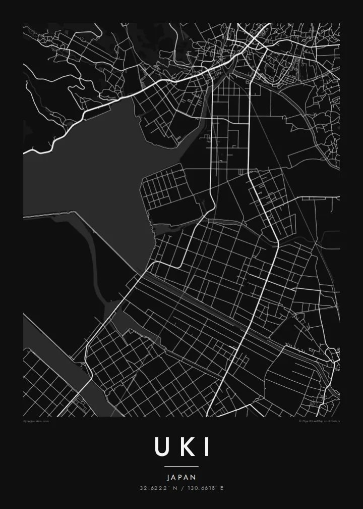
Uki sits in Kumamoto Prefecture at the base of the Uto Peninsula, which reaches west toward the Amakusa islands. On a map the city stretches along the peninsula. The Ariake Sea lies to the north and the Yatsushiro Sea to the south, and small towns and fishing harbours are strung along both shores. Hills run down the centre of the peninsula, with farmland and orchards on their lower slopes.
At the western end lies Misumi West Port, a stone harbour built in the late nineteenth century to Dutch designs. It is now a UNESCO World Heritage site as part of the Sites of Japan's Meiji Industrial Revolution. The Yatsushiro Sea off Uki's coast is also associated with the shiranui, a rare optical phenomenon of flickering lights on the water described in local tradition.
A Uki map poster traces a long, narrow city defined by its shorelines. Coastal roads follow the edge of the land, while a railway runs out along the peninsula toward the port. Smaller settlements appear as clusters where valleys meet the sea. The water surrounding almost every side gives the map a strong, clean silhouette.
A carefully engineered Meiji-era harbour of cut stone, with canals and quays, lies near the tip of the peninsula. It is one of the few ports of its era to survive largely intact.
The Ariake Sea and the Yatsushiro Sea border the city on opposite sides. On the map the peninsula becomes a long strip of land between two open bodies of water.
Hills run along the centre of the peninsula, with roads and small valleys branching toward the coasts. This inland ridge divides the city's northern and southern shores.
Personalize-o
Acrescente uma data, um nome ou uma frase sua, e mude o estilo, o tamanho ou a orientação.
A pré-visualização gratuita é de baixa resolução e com marca de água. As impressões e os ficheiros HD são gerados a 300 DPI, até 7,200 × 10,800 px, sem marca de água.
Porquê Uki
Uki is a place of coastal drives, fishing harbours and evenings looking across the water toward Amakusa. A map of the peninsula keeps that geography in view for residents, for visitors and for anyone with family roots in Kumamoto.
Choose Classic black & white, Noir, Paper, Blueprint or Sand, and add your own title, subtitle and coordinates. The free preview lets you check the framing first. HD files cost $9, and printed posters can ship from partners in more than 30 countries.
Encomendar o póster Uki| Tamanho de impressão | Resolução | Ficheiros |
|---|---|---|
| 30 × 40 cm (11.8 × 15.7″) | 3,543 × 4,724 px | PNG · PDF |
| 29.7 × 42 cm (A3, 11.7 × 16.5″) | 3,508 × 4,961 px | PNG · PDF |
| 42 × 59.4 cm (A2, 16.5 × 23.4″) | 4,961 × 7,016 px | PNG · PDF |
| 45.7 × 61 cm (18 × 24″) | 5,400 × 7,200 px | PNG · PDF |
| 50 × 70 cm (19.7 × 27.6″) | 5,906 × 8,268 px | PNG · PDF |
| 61 × 91.4 cm (24 × 36″) | 7,200 × 10,800 px | PNG · PDF |
Para comparação, a pré-visualização gratuita tem 900 px de largura, marca de água e destina-se a ecrãs. Os ficheiros HD têm até 8× a resolução em cada direção e imprimem com nitidez no tamanho total do poster.
Escolha um estilo no topo da página e depois selecione Póster Impresso — um tamanho e, se quiser, uma moldura — ou Ficheiros Digitais HD. O checkout é feito num só passo, e a sua página de encomenda atualiza-se assim que o pagamento é confirmado.
É impresso em papel mate premium de 200 g/m² num de seis tamanhos, de 30 × 40 cm a 24 × 36″. Os pósteres impressos têm preços a partir de {printFrom}, portes incluídos.
Sim. Escolha uma moldura de madeira maciça em preto, branco, carvalho natural ou madeira escura. Vem com vidro anti-estilhaço e pronta a pendurar. Os pósteres emoldurados têm preços a partir de {framedFrom}, portes incluídos.
O envio é gratuito para todo o mundo. Cada pôster é impresso pelo parceiro de impressão mais próximo, em mais de 30 países, e costuma chegar em 3 a 7 dias úteis. Você acompanha o status e o rastreamento em Meus Pedidos. Alguns países levam de 2 a 5 semanas e, onde ainda não entregamos, o site avisa antes do pagamento.
Envie-nos uma foto até 14 dias após a entrega e reimprimimos gratuitamente ou reembolsamos.
Sim. No editor desta página, altere o título, o subtítulo e a linha de coordenadas como preferir, e escolha um estilo e tamanho. As encomendas impressas, emolduradas e digitais usam exatamente o seu design.
Por $9 recebe ficheiros PNG a 300 DPI e PDF prontos para impressão nos seis tamanhos, sem marca de água, para imprimir onde quiser. Ainda não tem a certeza? Descarregue primeiro uma pré-visualização gratuita com marca de água.
Nas proximidades
