İstiklal Avenue
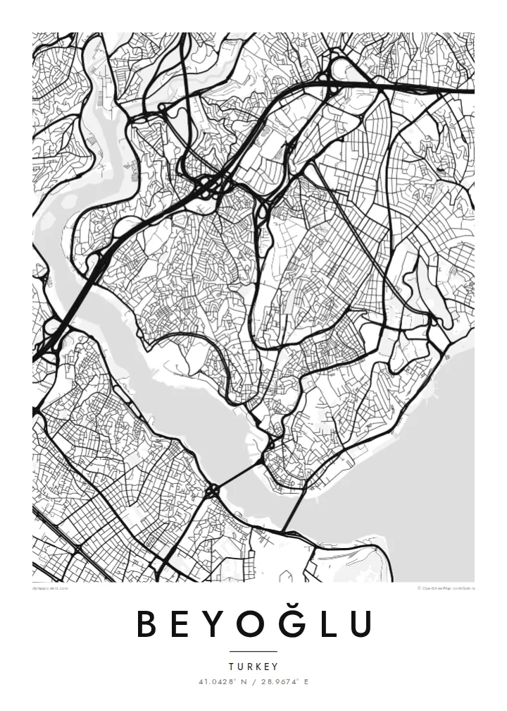
The pedestrian avenue from Taksim to Tünel follows the ridge in a long, slightly curving line. It is the clearest single stroke on the map.
Poster minimalist cu hartă · Turcia
41.0428° N / 28.9674° E
A hilly district above the Golden Horn and Bosphorus, with a pedestrian avenue running along the ridge from Taksim to Galata


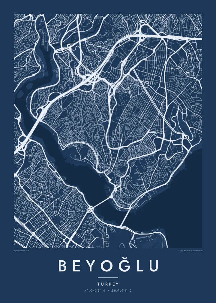

Un oraș, cinci atmosfere
Atinge un stil ca să-l vezi pe perete. Toate stilurile costă la fel — tipărite, înrămate sau ca fișiere HD.
 Pixeli reali · fișier de print 24 × 36″
Clar la tipar
Acesta este un decupaj 100% din fișierul de print real. Fiecare poster — tipărit, înrămat sau descărcat — este randat pe serverele noastre la 300 DPI, până la 7,200 × 10,800 pixeli, ca și cele mai fine străzi să rămână clare la un print de 24 × 36″.
Pe perete


Harta
Beyoğlu covers the high ground north of the Golden Horn, where the land rises steeply from the water to a long ridge. The streets follow that terrain. Short, steep lanes and stairways drop down towards Karaköy and the Bosphorus shore, while the main avenue runs along the top. On the map, the district looks like a spine with ribs.
That spine is İstiklal Avenue, a pedestrian street about a kilometre and a half long. It links Taksim Square at the northern end to Tünel near the Galata Tower. A red heritage tram runs along it. At the southern end, the Tünel funicular, opened in 1875, carries passengers down the slope to Karaköy and is one of the oldest underground railways in the world.
Once known as Pera, the district was home to embassies, merchants and a large non-Muslim population in the late Ottoman period. Many of its apartment buildings and arcades date from that time. A Beyoğlu map poster shows how steep ground, a single strong avenue and two bodies of water shaped one of Istanbul's most distinctive districts.
The pedestrian avenue from Taksim to Tünel follows the ridge in a long, slightly curving line. It is the clearest single stroke on the map.
The medieval stone tower stands on the southern slope above Karaköy. It marks the point where the district begins its descent to the Golden Horn.
Short, steep streets and flights of steps connect the ridge to the waterfront, giving the map a dense, fine-grained texture on its southern and eastern edges.
Personalizează-l
Adaugă o dată, un nume sau un rând scris de tine, schimbă stilul, dimensiunea sau orientarea.
Previzualizarea gratuită are rezoluție redusă și filigran. Posterele tipărite și fișierele HD sunt randate la 300 DPI, până la 7,200 × 10,800 px, fără filigran.
De ce Beyoğlu
Beyoğlu is where many people lived their Istanbul years, whether as students, new arrivals or night owls. A map of its ridge and slopes holds those streets together more faithfully than any photograph.
Personalise the title and subtitle with a date, an address or a line of your own. Choose one of five styles. Noir suits the district's late evenings, while Paper gives it the look of an old city plan.
Comandă posterul Beyoğlu| Dimensiune tipar | Rezoluție | Fișiere |
|---|---|---|
| 30 × 40 cm (11.8 × 15.7″) | 3,543 × 4,724 px | PNG · PDF |
| 29.7 × 42 cm (A3, 11.7 × 16.5″) | 3,508 × 4,961 px | PNG · PDF |
| 42 × 59.4 cm (A2, 16.5 × 23.4″) | 4,961 × 7,016 px | PNG · PDF |
| 45.7 × 61 cm (18 × 24″) | 5,400 × 7,200 px | PNG · PDF |
| 50 × 70 cm (19.7 × 27.6″) | 5,906 × 8,268 px | PNG · PDF |
| 61 × 91.4 cm (24 × 36″) | 7,200 × 10,800 px | PNG · PDF |
Pentru comparație, previzualizarea gratuită are 900 px lățime, are filigran și este destinată ecranelor. Fișierele HD au o rezoluție de până la 8 ori mai mare pe fiecare direcție și se tipăresc impecabil la dimensiunea completă a posterului.
Alege un stil în partea de sus a paginii, apoi selectează Poster Tipărit — o dimensiune și, dacă vrei, o ramă — sau Fișiere Digitale HD. Plata se face într-un singur pas, iar pagina comenzii tale se actualizează imediat ce plata este confirmată.
Este tipărit pe hârtie mată premium de 200 g/m² în una din șase dimensiuni, de la 30 × 40 cm la 24 × 36″. Posterele tipărite pornesc de la {printFrom}, livrare inclusă.
Da. Alege o ramă din lemn masiv în negru, alb, stejar natural sau lemn închis la culoare. Vine cu geam antișoc și e gata de agățat pe perete. Posterele înrămate pornesc de la {framedFrom}, livrare inclusă.
Livrarea este gratuită oriunde în lume. Fiecare poster este tipărit de cel mai apropiat dintre partenerii noștri de printare din peste 30 de țări și ajunge de obicei în 3–7 zile lucrătoare. Poți urmări statusul și tracking-ul în Comenzile Mele.
Trimite-ne o poză în termen de 14 zile de la livrare și îl vom retipări gratuit sau îți vom returna banii.
Da. În editorul de pe această pagină, schimbă titlul, subtitlul și linia cu coordonatele cum dorești, apoi alege un stil și o dimensiune. Comenzile tipărite, înrămate și digitale folosesc exact designul tău.
Pentru $9 primești fișiere PNG la 300 DPI și PDF pregătite pentru print, în toate cele șase dimensiuni, fără filigran, gata de tipărit oriunde. Nu ești sigur încă? Descarcă mai întâi o previzualizare gratuită cu filigran.
În apropiere
