Lake-strewn land
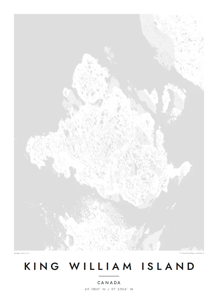
Thousands of small lakes cover the flat interior. They give the map a dense, dotted texture unlike most island outlines.
Poster minimalist cu hartă · Canada
69.1800° N / 97.3506° W
A flat Arctic island scattered with lakes, in the channels where the Franklin expedition was lost


Un oraș, cinci atmosfere
Atinge un stil ca să-l vezi pe perete. Toate stilurile costă la fel — tipărite, înrămate sau ca fișiere HD.
 Pixeli reali · fișier de print 24 × 36″
Clar la tipar
Acesta este un decupaj 100% din fișierul de print real. Fiecare poster — tipărit, înrămat sau descărcat — este randat pe serverele noastre la 300 DPI, până la 7,200 × 10,800 pixeli, ca și cele mai fine străzi să rămână clare la un print de 24 × 36″.
Pe perete


Harta
King William Island lies in the Kitikmeot Region of Nunavut, in the Canadian Arctic. From above it is a broad, low island. The terrain is almost level, and the landscape is dotted with countless lakes and ponds left by glaciation, so the map looks finely speckled with water.
The only community is Gjoa Haven, on the southeastern coast. It takes its name from the Gjøa, the ship in which Roald Amundsen spent two winters in the harbour in the early 1900s while searching for the Northwest Passage. Inuit taught him skills that helped his expedition succeed.
The waters around the island are where Sir John Franklin's 1840s expedition was lost. The wrecks of HMS Erebus and HMS Terror were found nearby in 2014 and 2016. A King William Island map poster sets this history against a quiet pattern of lakes and shoreline.
Thousands of small lakes cover the flat interior. They give the map a dense, dotted texture unlike most island outlines.
The single settlement sits beside a sheltered harbour on the southeast coast, a small cluster of streets on an otherwise open island.
Narrow channels separate the island from the mainland and neighbouring islands. These are the passages at the heart of the Northwest Passage story.
Personalizează-l
Adaugă o dată, un nume sau un rând scris de tine, schimbă stilul, dimensiunea sau orientarea.
Previzualizarea gratuită are rezoluție redusă și filigran. Posterele tipărite și fișierele HD sunt randate la 300 DPI, până la 7,200 × 10,800 px, fără filigran.
De ce King William Island
For people from Gjoa Haven, and for anyone who has followed the Franklin search or the Northwest Passage, this map carries real meaning. Its lake pattern is also striking as pure design.
Add your own title, subtitle and coordinates line, such as a family name, a year or a place. Choose Classic black & white, Noir, Paper, Blueprint or Sand.
Comandă posterul King William Island| Dimensiune tipar | Rezoluție | Fișiere |
|---|---|---|
| 30 × 40 cm11.8 × 15.7″ | 3,543 × 4,724 px | PNG · PDF |
| 29.7 × 42 cm (A3)11.7 × 16.5″ | 3,508 × 4,961 px | PNG · PDF |
| 42 × 59.4 cm (A2)16.5 × 23.4″ | 4,961 × 7,016 px | PNG · PDF |
| 45.7 × 61 cm18 × 24″ | 5,400 × 7,200 px | PNG · PDF |
| 50 × 70 cm19.7 × 27.6″ | 5,906 × 8,268 px | PNG · PDF |
| 61 × 91.4 cm24 × 36″ | 7,200 × 10,800 px | PNG · PDF |
Pentru comparație, previzualizarea gratuită are 900 px lățime, are filigran și este destinată ecranelor. Fișierele HD au o rezoluție de până la 8 ori mai mare pe fiecare direcție și se tipăresc impecabil la dimensiunea completă a posterului.
Alege un stil în partea de sus a paginii, apoi selectează Poster Tipărit — o dimensiune și, dacă vrei, o ramă — sau Fișiere Digitale HD. Plata se face într-un singur pas, iar pagina comenzii tale se actualizează imediat ce plata este confirmată.
Este tipărit pe hârtie mată premium de 200 g/m² în una din șase dimensiuni, de la 30 × 40 cm la 24 × 36″. Posterele tipărite pornesc de la $39, livrare inclusă.
Da. Alege o ramă din lemn masiv în negru, alb, stejar natural sau lemn închis la culoare. Vine cu geam antișoc și e gata de agățat pe perete. Posterele înrămate pornesc de la $99, livrare inclusă.
Transportul este gratuit în peste 60 de țări. Fiecare poster este tipărit de cel mai apropiat partener de tipar dintre cei din peste 30 de țări și ajunge, de obicei, în 3–7 zile lucrătoare. Poți urmări starea comenzii și coletul în Comenzile mele. În câteva țări livrarea durează 2–5 săptămâni, iar acolo unde încă nu livrăm, site-ul te anunță înainte de plată.
Trimite-ne o poză în termen de 14 zile de la livrare și îl vom retipări gratuit sau îți vom returna banii.
Da. În editorul de pe această pagină, schimbă titlul, subtitlul și linia cu coordonatele cum dorești, apoi alege un stil și o dimensiune. Comenzile tipărite, înrămate și digitale folosesc exact designul tău.
Pentru $9 primești fișiere PNG la 300 DPI și PDF pregătite pentru print, în toate cele șase dimensiuni, fără filigran, gata de tipărit oriunde. Nu ești sigur încă? Descarcă mai întâi o previzualizare gratuită cu filigran.
În apropiere
