Aegina harbour
The main port on the west coast, where ferries from Piraeus arrive. The town's streets fan out behind the waterfront, the most detailed part of a map otherwise made of country roads.
Posta faʻafanua faigofie · Greece
37.7243° N / 23.4914° E
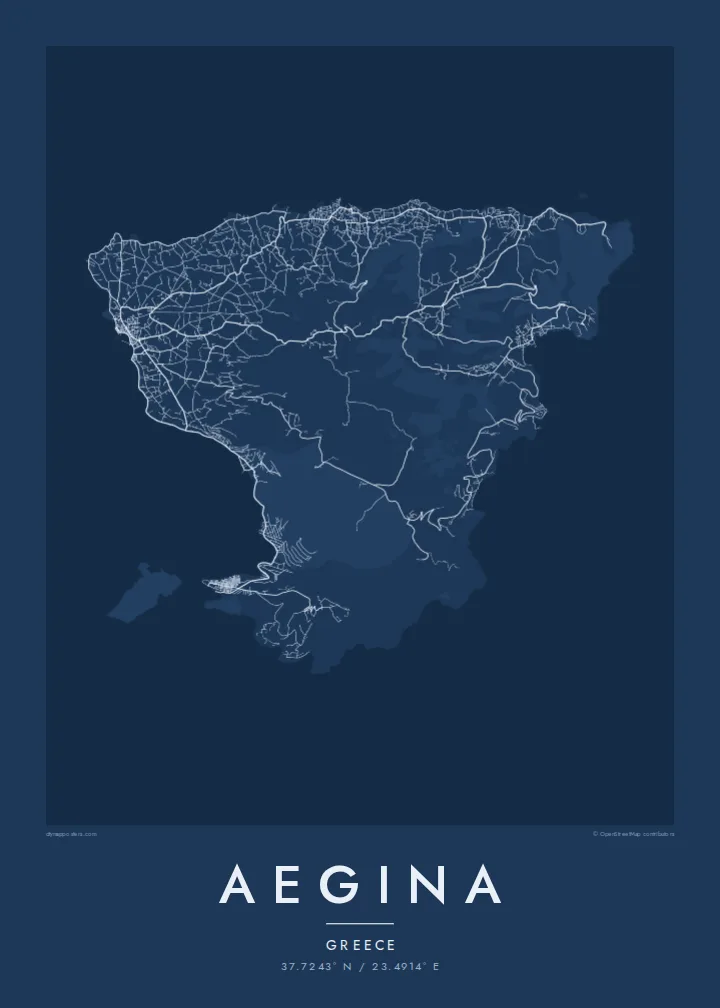
A triangular island in the Saronic Gulf, a harbour town on the west and a volcanic cone rising in the south



Tasi le aai, lagona e lima
Tapi se sitaili e vaai ai i luga o le puipui. E tutusa uma le tau o sitaili — pe lolomiina, faapipiiina, pe avea ma faila HD.
 Pika Moni · Faila Lolomi 24 × 36″
Manino mo le lolomi
O se vaega atoa (100%) lenei mai le faila lolomi moni. O posita uma — pe lolomiina, faapipiiina pe download mai — e faia i luga o a matou server i le 300 DPI, e oo atu i le 7,200 × 10,800 pika, ina ia manino pea auala laiti i luga o se lolomiga 24 × 36″.
I luga o le puipui


Le faʻafanua
Aegina lies in the Saronic Gulf, a short ferry ride from Piraeus, and is one of the closest islands to Athens. Its outline is roughly triangular, with a gently curving west coast and a rougher, steeper east. In the south the land rises to the cone of Mount Oros, an extinct volcano and the island's highest point, visible from far across the gulf.
Aegina Town, on the west coast, gathers around a harbour marked by the small white chapel of Agios Nikolaos. After independence the town served briefly as the first capital of modern Greece, and its neoclassical buildings date from that period. Just north of the harbour, the hill of Kolona keeps a single standing column from an ancient temple of Apollo.
Pistachio orchards cover much of the inland countryside, and Aegina's pistachios are among the best known in Greece. The Doric Temple of Aphaia stands on a pine-covered hill in the northeast and is one of the best-preserved temples of its era. An Aegina map poster traces the harbour town, the country roads between the orchards and the long climb toward Oros.
The main port on the west coast, where ferries from Piraeus arrive. The town's streets fan out behind the waterfront, the most detailed part of a map otherwise made of country roads.
An ancient Doric temple on a hilltop in the northeast, above the resort of Agia Marina. It looks out across the gulf toward Athens.
The volcanic cone in the south and the highest ground on the island. Roads stop short of the summit, so on the poster it appears as quiet, open space surrounded by coast.
Fai mo oe
Faʻaopoopo se aso, se igoa po o sau lava upu, sui le sitaili, lapoʻa po o le itu.
O le preview e leai se totogi e maualalo le resolution ma iai se watermark. O lolomi ma faila HD e faia i le 300 DPI, e oo atu i le 7,200 × 10,800 px, e aunoa ma se watermark.
Aisea Aegina
Aegina is close enough to Athens for weekend trips and summer houses, and many families have known it for generations. Its clean triangular outline, the harbour town and the orchard country inland make the map a fond keepsake for anyone who spent summers there.
Personalise the title and subtitle, perhaps with a family name or the year a house was bought, and adjust the coordinates line. Choose from five styles, from Classic black & white to Paper. The $9 download includes six print sizes, each as a 300 DPI PNG and a print-ready PDF.
Faatau le posita Aegina| Lapoʻa lolomi | Manino | Faila |
|---|---|---|
| 30 × 40 cm11.8 × 15.7″ | 3,543 × 4,724 px | PNG · PDF |
| 29.7 × 42 cm (A3)11.7 × 16.5″ | 3,508 × 4,961 px | PNG · PDF |
| 42 × 59.4 cm (A2)16.5 × 23.4″ | 4,961 × 7,016 px | PNG · PDF |
| 45.7 × 61 cm18 × 24″ | 5,400 × 7,200 px | PNG · PDF |
| 50 × 70 cm19.7 × 27.6″ | 5,906 × 8,268 px | PNG · PDF |
| 61 × 91.4 cm24 × 36″ | 7,200 × 10,800 px | PNG · PDF |
Ae faʻatusatusa, o le faʻataʻitaʻiga e leai se totogi e 900 px le lautele, e iai le faʻailoga vai ma e mo mata. O faila HD e oʻo atu i le 8× le manino i itu taʻitasi ma e lolomi manino i le lapoʻa atoa o le posta.
Filifili se sitaili i le pito i luga o le itulau, ona filifili lea o le Posita Lolomi — se lapopoa ma, afai e te fiafia, se faavaa — po o Faila HD Numera. E na o le tasi laasaga o le Checkout, ma o le a fesuia'i lou itulau o oka i le taimi lava e mae'a ai le totogi.
E lolomiina i luga o pepa matte maualuga le tulaga e 200 gsm, i se tasi o lapopoa e ono, mai le 30 × 40 cm i le 24 × 36″. E amata le tau o posita lolomi mai le $39, aofia ai le auina atu.
Ioe. Filifili se faavaa laau malosi i le lanu uliuli, sina, oak masani, po o le laau pogisa. E aofia ai se tioata e le gau ma ua saunia e tautau i luga. E amata le tau o posita faavaa mai le $99, aofia ai le auina atu.
E leai se totogi o le auina atu i atunuu e 60+. O pepa ata taʻitasi e lolomiina e le tasi o matou paaga lolomi e latalata mai i atunuu e 30+, ma e masani ona taunuu i le 3–7 aso faigaluega. E mafai ona e mulimulitaia le tulaga ma le sailiga i lalo o My Orders. O nisi atunuu e 2–5 vaiaso, ma i nofoaga e lei matou auina atu iai, e taʻu atu e le saite ia te oe a o lei totogi.
Auina mai se ata i totonu o le 14 aso talu ona taunuu, ma o le a matou toe lolomiina e leai se totogi po o le toe faafoi atu lau tupe.
Ioe. I totonu o le editor i lenei itulau, suia le ulutala, le ulutala laititi ma le laina o coordinates i soo se mea e te fiafia i ai, ma filifili se sitaili ma le lapopoa. O oka lolomi, faavaa ma numera e faaaoga uma lava lau mamanu.
Mo le $9 e te maua ai faila PNG 300 DPI ma PDF ua saunia mo le lolomi i lapopoa uma e ono, e aunoa ma se watermark, e mafai ona lolomi i soo se mea. Le mautinoa lava? Download muamua se preview e leai se totogi ma le watermark.
Latalata ane
