Chain of lakes
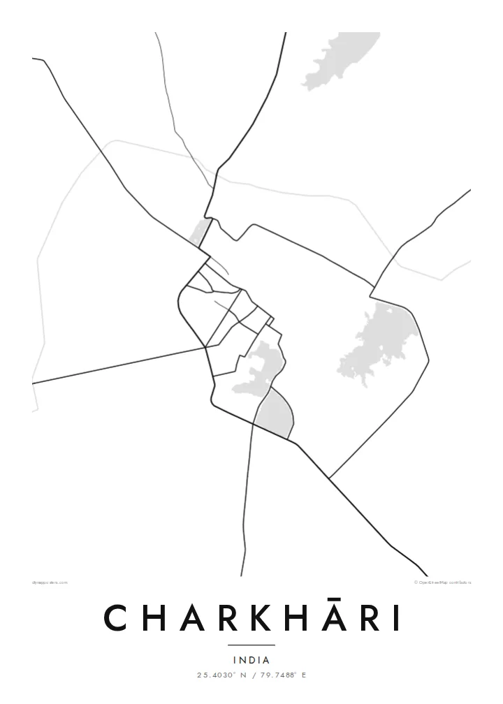
Several lakes and tanks sit close together around the town. They form the largest shapes on the map and give Charkhāri its distinctive silhouette.
Posta faʻafanua faigofie · India
25.4030° N / 79.7488° E
A former princely town in Bundelkhand, framed by a hill fort and a chain of lakes that dominate its map.


Tasi le aai, lagona e lima
Tapi se sitaili e vaai ai i luga o le puipui. E tutusa uma le tau o sitaili — pe lolomiina, faapipiiina, pe avea ma faila HD.
 Pika Moni · Faila Lolomi 24 × 36″
Manino mo le lolomi
O se vaega atoa (100%) lenei mai le faila lolomi moni. O posita uma — pe lolomiina, faapipiiina pe download mai — e faia i luga o a matou server i le 300 DPI, e oo atu i le 7,200 × 10,800 pika, ina ia manino pea auala laiti i luga o se lolomiga 24 × 36″.
I luga o le puipui


Le faʻafanua
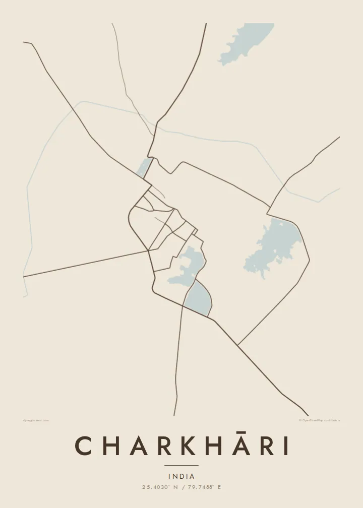
Charkhāri lies in Mahoba district, in the Bundelkhand region of southern Uttar Pradesh, and it looks unusual on a map. The town wraps around a series of large lakes and tanks, so its streets bend around water on several sides, and the hill of the old fort rises above them. The plan is defined as much by open water as by buildings.
The lakes are why the town is sometimes called the Kashmir of Bundelkhand. On a Charkhāri map poster, they appear as broad pale shapes linked by embankments and roads. Temples, ghats and the remains of the former royal quarter sit around them, and the rocky, dry country of Bundelkhand stretches beyond.
Charkhāri was the capital of a princely state until Indian independence. Mangalgarh fort stands on the hill above the town, and the reservoirs that still shape Charkhāri date from the same princely era. It remains small and slow-paced, which makes its unusual geography all the more striking from above.
Several lakes and tanks sit close together around the town. They form the largest shapes on the map and give Charkhāri its distinctive silhouette.
The hill fort rises above the town and its lakes. Its outline and approach roads are visible where the map shows the high ground.
Roads run along the edges of the water and across the embankments between the lakes. They draw thin lines that separate one pool from the next.
Fai mo oe
Faʻaopoopo se aso, se igoa po o sau lava upu, sui le sitaili, lapoʻa po o le itu.
O le preview e leai se totogi e maualalo le resolution ma iai se watermark. O lolomi ma faila HD e faia i le 300 DPI, e oo atu i le 7,200 × 10,800 px, e aunoa ma se watermark.
Aisea Charkhāri
A map of Charkhāri appeals to people from Bundelkhand, to those interested in India's former princely states, and to anyone drawn to places shaped by water. Few small towns have such a graphic plan, and it holds its own on a wall.
Name the poster, add a subtitle or a family date, and adjust the coordinates line. Classic black & white shows the lakes most sharply, while Paper and Sand give a softer finish. Download six print sizes as PNG and PDF, or order a printed, framed poster.
Faatau le posita Charkhāri| Lapoʻa lolomi | Manino | Faila |
|---|---|---|
| 30 × 40 cm (11.8 × 15.7″) | 3,543 × 4,724 px | PNG · PDF |
| 29.7 × 42 cm (A3, 11.7 × 16.5″) | 3,508 × 4,961 px | PNG · PDF |
| 42 × 59.4 cm (A2, 16.5 × 23.4″) | 4,961 × 7,016 px | PNG · PDF |
| 45.7 × 61 cm (18 × 24″) | 5,400 × 7,200 px | PNG · PDF |
| 50 × 70 cm (19.7 × 27.6″) | 5,906 × 8,268 px | PNG · PDF |
| 61 × 91.4 cm (24 × 36″) | 7,200 × 10,800 px | PNG · PDF |
Ae faʻatusatusa, o le faʻataʻitaʻiga e leai se totogi e 900 px le lautele, e iai le faʻailoga vai ma e mo mata. O faila HD e oʻo atu i le 8× le manino i itu taʻitasi ma e lolomi manino i le lapoʻa atoa o le posta.
Filifili se sitaili i le pito i luga o le itulau, ona filifili lea o le Posita Lolomi — se lapopoa ma, afai e te fiafia, se faavaa — po o Faila HD Numera. E na o le tasi laasaga o le Checkout, ma o le a fesuia'i lou itulau o oka i le taimi lava e mae'a ai le totogi.
E lolomiina i luga o pepa matte maualuga le tulaga e 200 gsm, i se tasi o lapopoa e ono, mai le 30 × 40 cm i le 24 × 36″. E amata le tau o posita lolomi mai le $39, aofia ai le auina atu.
Ioe. Filifili se faavaa laau malosi i le lanu uliuli, sina, oak masani, po o le laau pogisa. E aofia ai se tioata e le gau ma ua saunia e tautau i luga. E amata le tau o posita faavaa mai le $99, aofia ai le auina atu.
E leai se totogi mo le uta i le lalolagi atoa. O poster ta'itasi e lolomi e le paaga lolomi e latalata mai i matou i atunuu e 30+, ma e masani ona taunuu i aso faigaluega e 3–7. E mafai ona e mulimuli i le tulaga ma le tracking i le "Aʻu Oka". O nisi atunuu e 2–5 vaiaso, ma i atunuu matou te lei tuuina atu ai, e taʻu atu e le saite iā te oe ae e te leʻi totogiina.
Auina mai se ata i totonu o le 14 aso talu ona taunuu, ma o le a matou toe lolomiina e leai se totogi po o le toe faafoi atu lau tupe.
Ioe. I totonu o le editor i lenei itulau, suia le ulutala, le ulutala laititi ma le laina o coordinates i soo se mea e te fiafia i ai, ma filifili se sitaili ma le lapopoa. O oka lolomi, faavaa ma numera e faaaoga uma lava lau mamanu.
Mo le $9 e te maua ai faila PNG 300 DPI ma PDF ua saunia mo le lolomi i lapopoa uma e ono, e aunoa ma se watermark, e mafai ona lolomi i soo se mea. Le mautinoa lava? Download muamua se preview e leai se totogi ma le watermark.
Latalata ane
