Rwenzori foothills
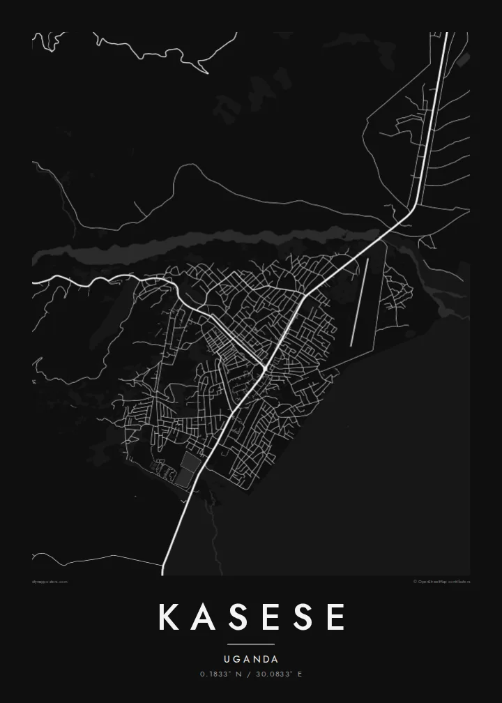
The Rwenzori range shapes the western edge of the map. Its lower slopes rise within sight of town and send streams down across the plain in thin, branching lines.
Posta faʻafanua faigofie · Uganda
0.1833° N / 30.0833° E
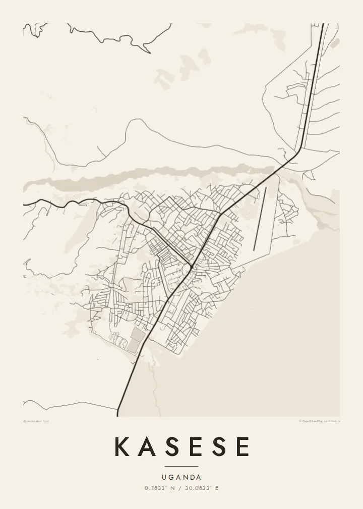
A compact grid on the plain below the Rwenzori, with roads fanning out toward the mountains, the lakes and the savanna.



Tasi le aai, lagona e lima
Tapi se sitaili e vaai ai i luga o le puipui. E tutusa uma le tau o sitaili — pe lolomiina, faapipiiina, pe avea ma faila HD.
 Pika Moni · Faila Lolomi 24 × 36″
Manino mo le lolomi
O se vaega atoa (100%) lenei mai le faila lolomi moni. O posita uma — pe lolomiina, faapipiiina pe download mai — e faia i luga o a matou server i le 300 DPI, e oo atu i le 7,200 × 10,800 pika, ina ia manino pea auala laiti i luga o se lolomiga 24 × 36″.
I luga o le puipui


Le faʻafanua
Kasese sits almost on the equator in western Uganda, on a broad, dry plain that runs up to the foot of the Rwenzori Mountains. From above, the town reads as a tight cluster of short blocks and market streets. At the edges these loosen into scattered plots and farm tracks. The mountains stand just to the west, and their foothills press close enough that the map begins to fold before the town has finished.
The town grew around the copper mines at Kilembe, in the hills a short way up the valley, and around the railway that was extended west to carry the ore out. That history still shows in the layout: a transport line pointing east, a road climbing into the mountains, and a commercial core where the two meet. Rivers come down from the Rwenzori in narrow, braided threads across the plain.
South of town the land opens toward Queen Elizabeth National Park and the channel that links Lake George and Lake Edward. A wider frame therefore picks up water and protected land on one side and high relief on the other. A Kasese map poster works best when it keeps both: the small, orderly town and the enormous landscape that surrounds it.
The Rwenzori range shapes the western edge of the map. Its lower slopes rise within sight of town and send streams down across the plain in thin, branching lines.
A road leaves town and climbs a valley into the hills toward Kilembe. This old copper-mining settlement gave Kasese much of its early purpose and its rail connection.
In a wider view, Lake George and its channel toward Lake Edward appear to the south. They bring broad water shapes into a composition that is otherwise made of fine streets and river threads.
Fai mo oe
Faʻaopoopo se aso, se igoa po o sau lava upu, sui le sitaili, lapoʻa po o le itu.
O le preview e leai se totogi e maualalo le resolution ma iai se watermark. O lolomi ma faila HD e faia i le 300 DPI, e oo atu i le 7,200 × 10,800 px, e aunoa ma se watermark.
Aisea Kasese
Kasese matters to people who grew up there and to those who passed through on the way to the mountains or the national park. The map shows the town and its setting together, which is what most people remember about the place.
You can set your own title, subtitle and coordinates line, such as a trek date or a family name, and choose from five styles. Blueprint or Sand suit the plain and the foothills well, while Classic black & white keeps the street pattern crisp.
Faatau le posita Kasese| Lapoʻa lolomi | Manino | Faila |
|---|---|---|
| 30 × 40 cm (11.8 × 15.7″) | 3,543 × 4,724 px | PNG · PDF |
| 29.7 × 42 cm (A3, 11.7 × 16.5″) | 3,508 × 4,961 px | PNG · PDF |
| 42 × 59.4 cm (A2, 16.5 × 23.4″) | 4,961 × 7,016 px | PNG · PDF |
| 45.7 × 61 cm (18 × 24″) | 5,400 × 7,200 px | PNG · PDF |
| 50 × 70 cm (19.7 × 27.6″) | 5,906 × 8,268 px | PNG · PDF |
| 61 × 91.4 cm (24 × 36″) | 7,200 × 10,800 px | PNG · PDF |
Ae faʻatusatusa, o le faʻataʻitaʻiga e leai se totogi e 900 px le lautele, e iai le faʻailoga vai ma e mo mata. O faila HD e oʻo atu i le 8× le manino i itu taʻitasi ma e lolomi manino i le lapoʻa atoa o le posta.
Filifili se sitaili i le pito i luga o le itulau, ona filifili lea o le Posita Lolomi — se lapopoa ma, afai e te fiafia, se faavaa — po o Faila HD Numera. E na o le tasi laasaga o le Checkout, ma o le a fesuia'i lou itulau o oka i le taimi lava e mae'a ai le totogi.
E lolomiina i luga o pepa matte maualuga le tulaga e 200 gsm, i se tasi o lapopoa e ono, mai le 30 × 40 cm i le 24 × 36″. E amata le tau o posita lolomi mai le $39, aofia ai le auina atu.
Ioe. Filifili se faavaa laau malosi i le lanu uliuli, sina, oak masani, po o le laau pogisa. E aofia ai se tioata e le gau ma ua saunia e tautau i luga. E amata le tau o posita faavaa mai le $99, aofia ai le auina atu.
E leai se totogi mo le uta i le lalolagi atoa. O poster ta'itasi e lolomi e le paaga lolomi e latalata mai i matou i atunuu e 30+, ma e masani ona taunuu i aso faigaluega e 3–7. E mafai ona e mulimuli i le tulaga ma le tracking i le "Aʻu Oka". O nisi atunuu e 2–5 vaiaso, ma i atunuu matou te lei tuuina atu ai, e taʻu atu e le saite iā te oe ae e te leʻi totogiina.
Auina mai se ata i totonu o le 14 aso talu ona taunuu, ma o le a matou toe lolomiina e leai se totogi po o le toe faafoi atu lau tupe.
Ioe. I totonu o le editor i lenei itulau, suia le ulutala, le ulutala laititi ma le laina o coordinates i soo se mea e te fiafia i ai, ma filifili se sitaili ma le lapopoa. O oka lolomi, faavaa ma numera e faaaoga uma lava lau mamanu.
Mo le $9 e te maua ai faila PNG 300 DPI ma PDF ua saunia mo le lolomi i lapopoa uma e ono, e aunoa ma se watermark, e mafai ona lolomi i soo se mea. Le mautinoa lava? Download muamua se preview e leai se totogi ma le watermark.
Latalata ane
