Rail through centre
The commuter line runs straight through town, with the station close to the historic centre. It's the clearest single line on the map and ties Mansfield to Boston and Providence.
Ata mapa faigafua · United States
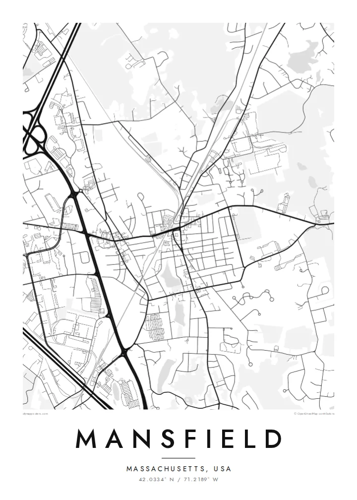
42.0334° N / 71.2189° W
A New England town between Boston and Providence, with a village centre, a commuter rail line and wooded parcels all around


Kolo e tahi, lanu e nima
Tuki he sitaili ke sio ai ʻi te holo. ʻE tatau pē te totogi ʻo te sitaili fuli pē — mokā tā, fakakātoa, peʻe ko he ʻu faila HD.
 Ngaahi pikiseli moʻoni · faila tā 24 × 36″
Mahino lelei ki te pulūti
Ko he konga 100% ʻo te faila tā moʻoni ʻaeni. Ko te ʻu posita fuli pē — mokā tā, fakakātoa peʻe download — ʻe fakatupu ʻi ʻomātou seva ʻi te 300 DPI, aʻu ki te 7,200 × 10,800 pikiseli, koia ʻe nofo mahino ai te ʻu ala liliki ʻi he tā 24 × 36″.
ʻI Te Puipui


Te mapa
Mansfield lies in Bristol County, southeastern Massachusetts, roughly midway between Boston and Providence. The map shows a classic New England arrangement. A small town centre gathers around the railroad, and residential streets curve away from it into woodland, ponds and conservation land. Major highways pass near the town's edges, while the local roads keep an older, looser pattern.
The town sits on the commuter rail line between Boston and Providence, and its station is a daily anchor for many residents. Mansfield is also widely known for its large outdoor amphitheatre. It has hosted summer concerts for decades and draws audiences from across the region.
A Mansfield map poster shows how a traditional town fits into the modern corridor between two cities. The rail line cuts straight through, subdivisions branch off in cul-de-sacs, and patches of forest and water break the pattern. Rendered in clean lines, the balance between village, suburb and woods becomes easy to read.
The commuter line runs straight through town, with the station close to the historic centre. It's the clearest single line on the map and ties Mansfield to Boston and Providence.
Away from the centre, looping streets and cul-de-sacs fan out into the woods. They show how the town grew outward during the later twentieth century.
Stretches of forest, wetland and small ponds interrupt the streets. They leave soft, open shapes that give the poster breathing room between the built areas.
Faʻu ke ʻau ʻa ʻau
Tuku he ʻaho, he hingoa peʻe he kiʻi palalau ʻa ʻau, fetogi te faʻahiga, te lahi peʻe te hake.
Ko te faʻata fua noa ʻe māʻulalo hono lelei pea ʻe ʻi ai he fakaʻilonga. Ko te ʻu tā mo te ʻu faila HD ʻe fakatupu ʻi te 300 DPI, aʻu ki te 7,200 × 10,800 px, ʻe mole ʻi ai he fakaʻilonga.
Koteā ko Mansfield
For commuters, families and everyone who has spent summer nights at a Mansfield concert, this map holds everyday routes and good memories. It suits a hallway or a first home, marking the place between two cities that became home ground.
Personalise the title and add a meaningful date or your coordinates. Then pick one of five styles: Classic black & white, Noir, Paper, Blueprint or Sand. A free watermarked preview lets you check the layout before choosing the $9 files or a printed poster.
Fakatau te posita Mansfield| Lahi ʻo te pulūti | Mahino | Faile |
|---|---|---|
| 30 × 40 cm11.8 × 15.7″ | 3,543 × 4,724 px | PNG · PDF |
| 29.7 × 42 cm (A3)11.7 × 16.5″ | 3,508 × 4,961 px | PNG · PDF |
| 42 × 59.4 cm (A2)16.5 × 23.4″ | 4,961 × 7,016 px | PNG · PDF |
| 45.7 × 61 cm18 × 24″ | 5,400 × 7,200 px | PNG · PDF |
| 50 × 70 cm19.7 × 27.6″ | 5,906 × 8,268 px | PNG · PDF |
| 61 × 91.4 cm24 × 36″ | 7,200 × 10,800 px | PNG · PDF |
Ko te ata ʻe mole totogi ʻe 900 px tona laulahi, mo te fakaʻilonga, ki te sioʻata pē. Ko te ʻu faile HD ʻe aʻu ki te liuga 8 tona mahino, pea ʻe pulūti lelei ʻi te lahi kātoa.
Fili he sitaili ʻi te tuʻa ʻo te pasina, pea fili leva te Posita Tā — he lahi pea, kapau ʻe ke loto ai, he fakakātoa — peʻe ko te ʻu Faila HD Fakakomipiuta. ʻE tahi pē te sitepu ʻo te totogi, pea ʻe fakafou fakavavevave pē tau pasina fakatau mai te taimi ʻe fai ai te totogi.
ʻE tā ʻi he pepa lelei ʻaupito 200 gsm matte, ʻi he tahi ʻo te ono lahi, mai te 30 × 40 cm ki te 24 × 36″. ʻE kamata te ʻu posita tā ʻi te $39, kātoa mo te ʻave.
ʻIo. Fili he fakakātoa ʻakau moʻoni ʻi te kili, hinahina, ʻakau natula peʻe ʻakau ʻuliʻuli. ʻE ʻi ai mo he sioga mālohi ʻe mole mafesi, pea kua teu ke tautau. ʻE kamata te ʻu posita fakakātoa ʻi te $99, kātoa mo te ʻave.
Ko te fakahoko e mole totogi ki te ʼu fenua e 60+. Ko te pōsita taki taha ʼe tā e te tahi ʼo ʼemau ʼu kaufakalogo tā ʼe ofi mai, ʼi te ʼu fenua e 30+, pea ʼe hoko mai ʼi te ʼu ʼaho gaue e 3–7. ʼE feala hau ke ke vakaʼi te tuʼunga mo te tracking ʼi Oku Fakamaʼu. ʼE ʼi ai te ʼu fenua ʼe 2–5 te ʼu vaiaho, pea ʼi te ʼu fenua ʼaē ʼe heʼeki tou fakahoko ki ai, ʼe fakahā e te saite ʼi muʼa ʼo tau totogi.
Fekau mai he ʻata ʻi loto ʻi te ʻaho e 14 talu mai te aʻu mai, pea mātou toe tā noa peʻe toe totogi atu.
ʻIo. ʻI te meʻa fakatonutonu ʻi te pasina ʻaeni, fetogi te kupu tāfito, te kupu lalo pea mo te laina koʻoliteti ki he meʻa fuli pē ʻe ke loto ai, pea fili he sitaili mo he lahi. Ko te ʻu fakatau tā, fakakātoa mo fakakomipiuta ʻe fakaʻaogaʻi katoa pē tou fakatātā.
Mo te $9 ʻe ke maʻu ai te ʻu faila PNG 300 DPI mo PDF kua teu ke tā, ʻi te ono lahi kātoa, ʻe mole ʻi ai he fakaʻilonga, ke ke tā ai ʻi soʻo he potu. Kei tā fakafiafia? Download muʻa he faʻata mokā mo he fakaʻilonga, ʻe fua noa.
Ofi
