Museum Island
The northern end of the Spree island holds five major museums between two arms of the river. It is a compact shape, recognizable on any map of Berlin.
Ata mapa faigafua · Germany
52.5222° N / 13.3977° E
The Spree splits around Museum Island while Unter den Linden draws a straight line west to the Brandenburg Gate.


Kolo e tahi, lanu e nima
Tuki he sitaili ke sio ai ʻi te holo. ʻE tatau pē te totogi ʻo te sitaili fuli pē — mokā tā, fakakātoa, peʻe ko he ʻu faila HD.
 Ngaahi pikiseli moʻoni · faila tā 24 × 36″
Mahino lelei ki te pulūti
Ko he konga 100% ʻo te faila tā moʻoni ʻaeni. Ko te ʻu posita fuli pē — mokā tā, fakakātoa peʻe download — ʻe fakatupu ʻi ʻomātou seva ʻi te 300 DPI, aʻu ki te 7,200 × 10,800 pikiseli, koia ʻe nofo mahino ai te ʻu ala liliki ʻi he tā 24 × 36″.
ʻI Te Puipui


Te mapa
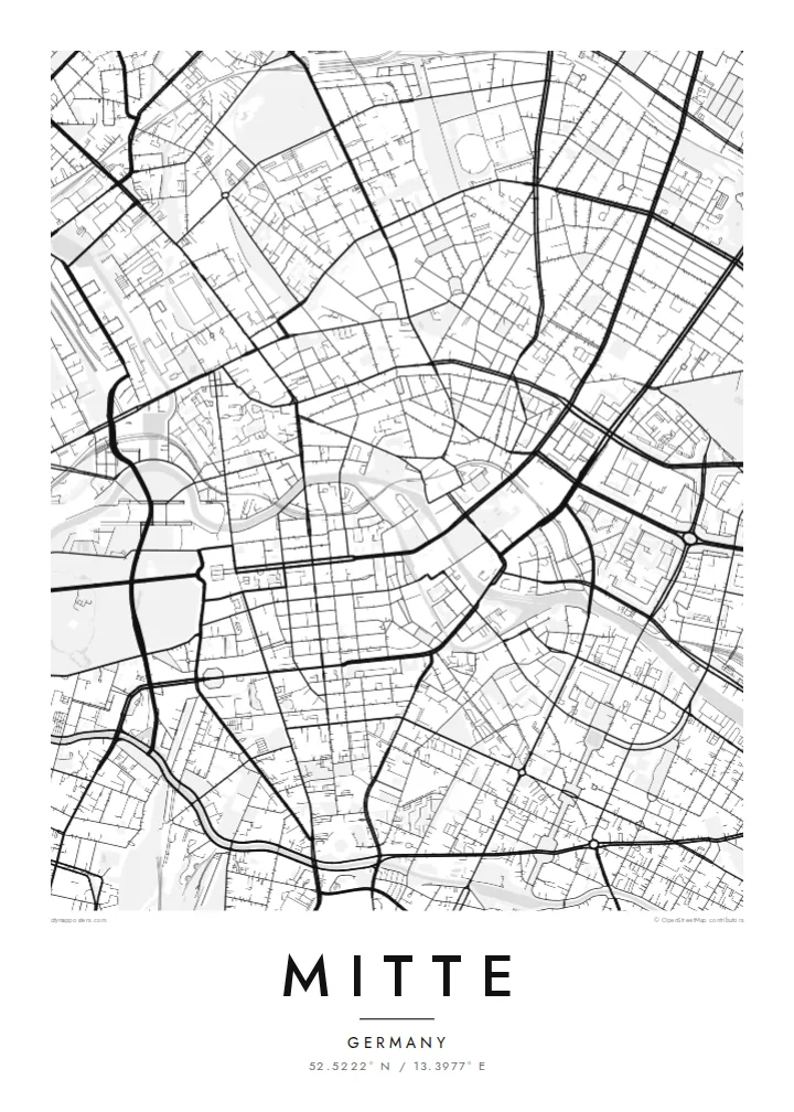
Mitte is Berlin's historic core, and its map is organized around the Spree. The river divides into two arms here, enclosing an island whose northern tip holds Museum Island, a UNESCO World Heritage ensemble of five museums. West of the water, Unter den Linden runs in a broad straight line to the Brandenburg Gate and the Tiergarten. Friedrichstraße crosses it on a long north–south axis.
East of the river, the plan changes. Alexanderplatz opens as a large irregular space beneath the television tower, completed in 1969, and wide postwar boulevards replace the older baroque grid. The Berlin Wall ran along much of Mitte's western and southern edges. You can still trace its former line where newer buildings fill strips that once stood empty.
A Mitte map poster brings these layers together on one sheet: the curving river, the ordered blocks of Friedrichstadt south of Unter den Linden, squares such as Gendarmenmarkt, and the looser plan around Alexanderplatz. The center of the image is dense and opens toward the park on one side, which gives the composition a natural sense of weight.
The northern end of the Spree island holds five major museums between two arms of the river. It is a compact shape, recognizable on any map of Berlin.
A wide tree-lined boulevard runs from the island west to the Brandenburg Gate. It is one of the clearest straight lines in the city.
Within the Friedrichstadt grid, this square framed by two domed churches and a concert hall stands out as a precise open rectangle among regular blocks.
Faʻu ke ʻau ʻa ʻau
Tuku he ʻaho, he hingoa peʻe he kiʻi palalau ʻa ʻau, fetogi te faʻahiga, te lahi peʻe te hake.
Ko te faʻata fua noa ʻe māʻulalo hono lelei pea ʻe ʻi ai he fakaʻilonga. Ko te ʻu tā mo te ʻu faila HD ʻe fakatupu ʻi te 300 DPI, aʻu ki te 7,200 × 10,800 px, ʻe mole ʻi ai he fakaʻilonga.
Koteā ko Mitte
Mitte is where many visitors first meet Berlin, and where many residents work, study or first settle. Its map carries the city's divided past without spelling it out, which makes it a thoughtful piece for a wall.
You can personalize the title and subtitle with a year or an address, and keep or edit the coordinates. Choose one of five styles. Blueprint suits the river and the grid especially well. Download the files for $9 or order a printed poster.
Fakatau te posita Mitte| Lahi ʻo te pulūti | Mahino | Faile |
|---|---|---|
| 30 × 40 cm (11.8 × 15.7″) | 3,543 × 4,724 px | PNG · PDF |
| 29.7 × 42 cm (A3, 11.7 × 16.5″) | 3,508 × 4,961 px | PNG · PDF |
| 42 × 59.4 cm (A2, 16.5 × 23.4″) | 4,961 × 7,016 px | PNG · PDF |
| 45.7 × 61 cm (18 × 24″) | 5,400 × 7,200 px | PNG · PDF |
| 50 × 70 cm (19.7 × 27.6″) | 5,906 × 8,268 px | PNG · PDF |
| 61 × 91.4 cm (24 × 36″) | 7,200 × 10,800 px | PNG · PDF |
Ko te ata ʻe mole totogi ʻe 900 px tona laulahi, mo te fakaʻilonga, ki te sioʻata pē. Ko te ʻu faile HD ʻe aʻu ki te liuga 8 tona mahino, pea ʻe pulūti lelei ʻi te lahi kātoa.
Fili he sitaili ʻi te tuʻa ʻo te pasina, pea fili leva te Posita Tā — he lahi pea, kapau ʻe ke loto ai, he fakakātoa — peʻe ko te ʻu Faila HD Fakakomipiuta. ʻE tahi pē te sitepu ʻo te totogi, pea ʻe fakafou fakavavevave pē tau pasina fakatau mai te taimi ʻe fai ai te totogi.
ʻE tā ʻi he pepa lelei ʻaupito 200 gsm matte, ʻi he tahi ʻo te ono lahi, mai te 30 × 40 cm ki te 24 × 36″. ʻE kamata te ʻu posita tā ʻi te {printFrom}, kātoa mo te ʻave.
ʻIo. Fili he fakakātoa ʻakau moʻoni ʻi te kili, hinahina, ʻakau natula peʻe ʻakau ʻuliʻuli. ʻE ʻi ai mo he sioga mālohi ʻe mole mafesi, pea kua teu ke tautau. ʻE kamata te ʻu posita fakakātoa ʻi te {framedFrom}, kātoa mo te ʻave.
ʻE fua noa te ʻave ki te lalolagi kātoa. ʻE tā takitaha posita e te kaugā tā ʻe ovi ki ai ʻi te lolotoga ʻo te ʻu puleʻanga e 30 tupu, pea ʻe aʻu mai tuʻumaʻu ʻi te ʻaho gāue e 3 ki te 7. ʻE feala ke ke sio ki te tuʻu pea mo te ʻalu ʻi lalo ʻo Taku ʻu Fakatau.
Fekau mai he ʻata ʻi loto ʻi te ʻaho e 14 talu mai te aʻu mai, pea mātou toe tā noa peʻe toe totogi atu.
ʻIo. ʻI te meʻa fakatonutonu ʻi te pasina ʻaeni, fetogi te kupu tāfito, te kupu lalo pea mo te laina koʻoliteti ki he meʻa fuli pē ʻe ke loto ai, pea fili he sitaili mo he lahi. Ko te ʻu fakatau tā, fakakātoa mo fakakomipiuta ʻe fakaʻaogaʻi katoa pē tou fakatātā.
Mo te $9 ʻe ke maʻu ai te ʻu faila PNG 300 DPI mo PDF kua teu ke tā, ʻi te ono lahi kātoa, ʻe mole ʻi ai he fakaʻilonga, ke ke tā ai ʻi soʻo he potu. Kei tā fakafiafia? Download muʻa he faʻata mokā mo he fakaʻilonga, ʻe fua noa.
