Køge Bay shoreline
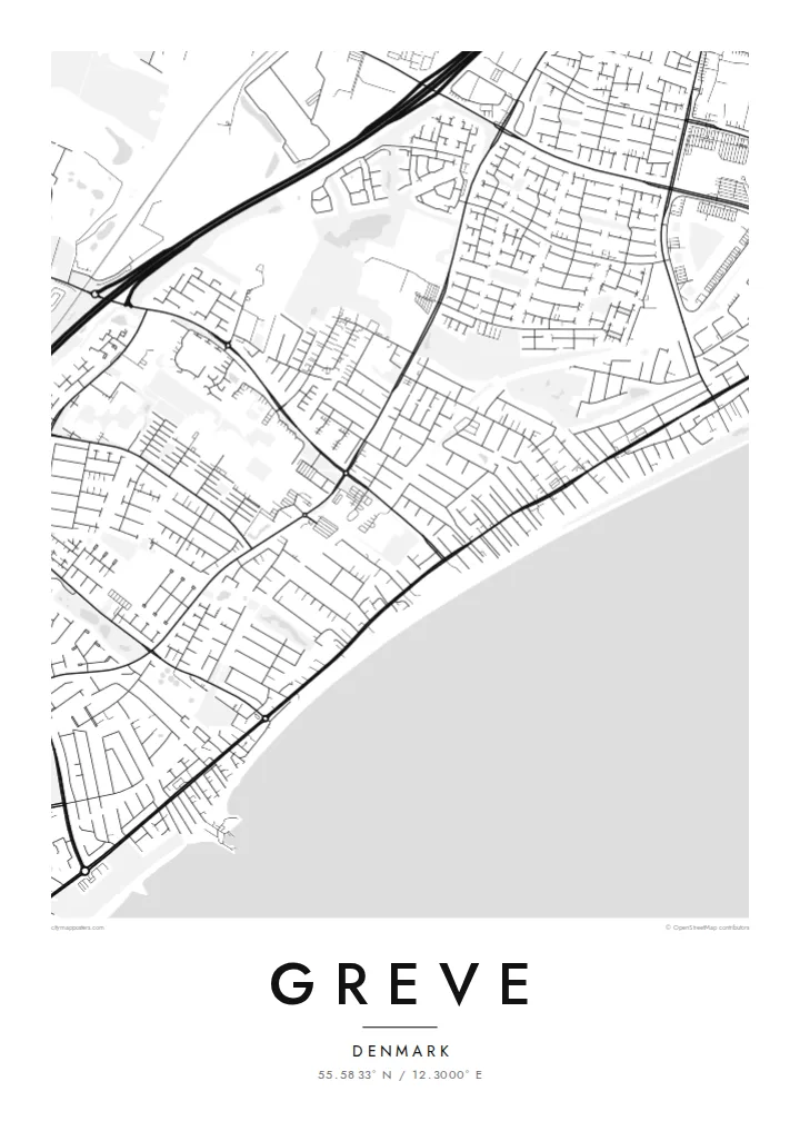
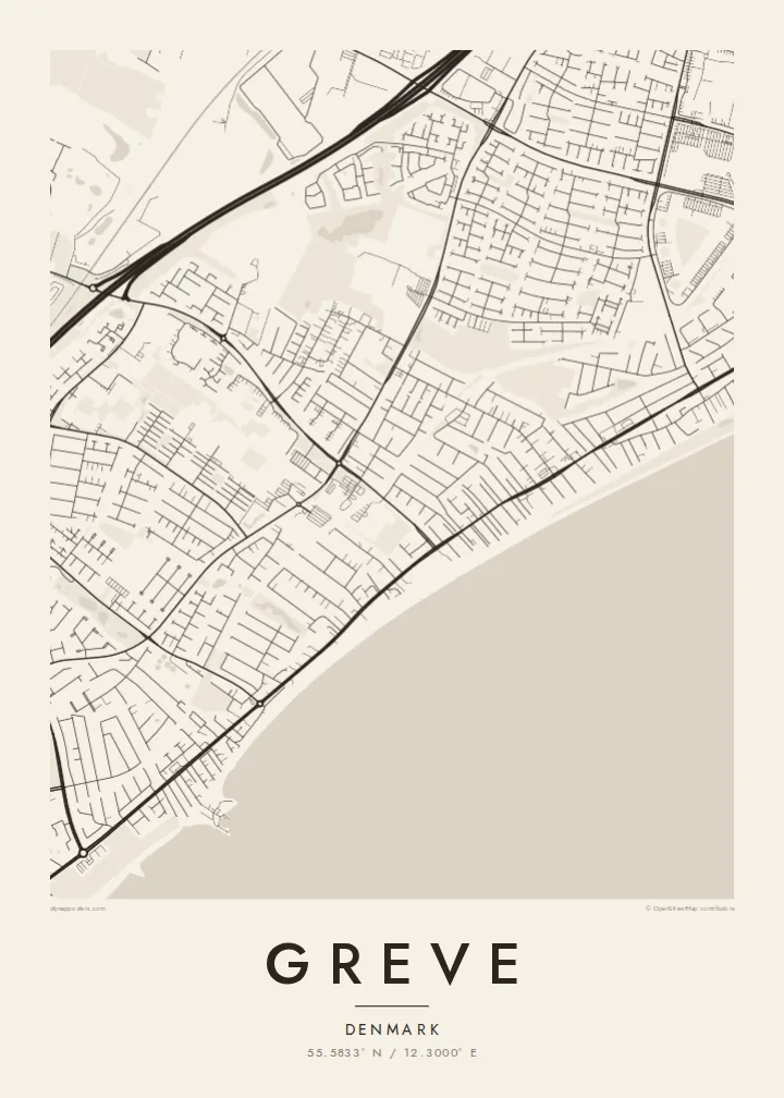
The eastern edge of the map is one long, gently curving coastline. The open water of Køge Bay takes up the side of the frame and gives the composition a calm, horizontal weight.
Qeeqabak kaartah poster · Denmark
55.5833° N / 12.3000° E
A long, straight shoreline on Køge Bay, with a railway and a motorway running beside it and low suburban streets filling the land between



Inki magaala, konoy gaba
Qande inkih tibbixeeh derre baguley table. Kulli qande missoowa caagid—daabbisimta, dirbaabu-le kaadu HD fayla akah.
 Cagalah pixels · 24 × 36″ daabbi fayla
Maxxaacah qeeqa
Tama usuk cagalah daabbi faylak 100% qambaala. Kulli poster — daabbisimta, dirbaabu-le kaadu download geytimta — ni-server-ittal 300 DPI-l ederimta, 7,200 × 10,800 pixels fanah, tokkel iyyi ellee catoy 24 × 36″ daabbi baxsi bahisak raaqu.
Gidarih


Kaarta
Seen from above, Greve is shaped by lines that run side by side. The coast of Køge Bay runs roughly north to south along its eastern edge. Just inland, a railway follows the same direction, and further west a motorway does too. Between these parallel strokes, the town fills in with residential streets, cul-de-sacs and small green pockets. The result is a pattern that is long and narrow and clearly tied to the water.
Much of Greve's shoreline is part of Køge Bugt Strandpark, a man-made beach park built along the bay in the late twentieth century. It brought sand, dunes and sheltered lagoons to a coast that had been flat and marshy. On the map, this shows up as a smooth outer edge of beach with a thin band of enclosed water behind it. It is one of the most distinctive shapes around Copenhagen's southern suburbs.
A Greve map poster shows how the town grew up as a coastal suburb of the capital. Denser pieces of street pattern gather around the stations. Older village cores sit a little further inland, and newer housing spreads in loops and branches between them. Printed in plain black and white, the drawing reads like a cross-section of Zealand's east coast, running from open water through beach and rail to farmland at the far edge.
The eastern edge of the map is one long, gently curving coastline. The open water of Køge Bay takes up the side of the frame and gives the composition a calm, horizontal weight.
Behind the reshaped beach, narrow lagoons and dunes form a second, inner line parallel to the sea. This double edge is easy to spot and sets Greve apart from neighbouring stretches of coast.
A suburban railway and a major motorway both run north to south through the municipality. They divide the town into long bands, with residential streets tucked between them and bridges or underpasses stitching the sides together.
Kok tanim ab
Ayro, migaq hinnay kok tan xagar osis; gaba, ballaqa hinnay xiqa soorris.
Free preview qansarissi kee watermark-le. Daabbisimtaan kee HD fayla 300 DPI-l, 7,200 × 10,800 px fanah, watermark maleh ederimta.
Macah Greve
Greve is where many people have their first home outside Copenhagen, or their summer mornings on the beach. For them, this map is a quiet reminder of walks along the bay and train rides into the city. It also marks the part of the coast they still think of as theirs.
You can personalise the title, subtitle and coordinates line with a street name, a date or a family name. Then choose one of five styles: Classic black & white, Noir, Paper, Blueprint or Sand. Download the HD files for $9, or order a printed poster with an optional wooden frame.
Greve poster orme| Maxxaacah ballaqa | Qeeqa | Faylal |
|---|---|---|
| 30 × 40 cm (11.8 × 15.7″) | 3,543 × 4,724 px | PNG · PDF |
| 29.7 × 42 cm (A3, 11.7 × 16.5″) | 3,508 × 4,961 px | PNG · PDF |
| 42 × 59.4 cm (A2, 16.5 × 23.4″) | 4,961 × 7,016 px | PNG · PDF |
| 45.7 × 61 cm (18 × 24″) | 5,400 × 7,200 px | PNG · PDF |
| 50 × 70 cm (19.7 × 27.6″) | 5,906 × 8,268 px | PNG · PDF |
| 61 × 91.4 cm (24 × 36″) | 7,200 × 10,800 px | PNG · PDF |
Tabbaltah, limo-wayta xaqqa-le ablo 900 px ballaqa le, asta le, iskiriinih keh tan. HD faylal gexsoh inkih addal 8× fanah qeeqa le, poster ballaqa inkih addal meqeh maxxaacimta.
Baxxaqqa qari le qandiy dooriy, tohuk lakal Daabbisimtah Poster — kutuk kee, faxximek, dirbaabu — hinnay HD Digital Fayla dooru. Checkout inki wagitti geytima, kaadu ku-orme page keenih adissa akke waqdi caagoy kummite.
Usuk 200 gsm-le catam kutuk warqatal, lica katiy caagitte {printFrom}-ik hane ayta 30 × 40 cm-ik 24 × 36″ fanah, xaagu keenil warreeh.
Ee. Sarrah-le dirbaabu doori — bad, gudduc, oak-le hinnay bad-madabuy. Usuk finqisiimam ellee sange qarab-le kaadu qari umukku iyya keenih taagu. Dirbaabu-le poster {framedFrom}-ik hane, xaagu keenil warreeh.
Shipping is free worldwide. Each poster is printed by the nearest of our print partners in 30+ countries and usually arrives in 3–7 business days. You can follow the status and tracking under My Orders. A few countries take 2–5 weeks, and where we don't ship yet, the site tells you before you pay.
Geytimeek 14 ayróy addal foto naah rubbaay, cisab-le daabbisiynah hinnay ku-lacay gacisnaah.
Ee. Tama page-l edito addal, migaaq, subtitle kee coordinates sarrah faxxem fanah badal, kaadu qande kee katiy doori. Daabbisimtah, dirbaabu-le kaadu digital orme inkih ku-design cagalah yekkelen.
$9 bacisak 300 DPI PNG kee daabbisimtah adissime PDF fayla lica katiy inkih, watermark maleh, ayyi meki daabbisimtah geeytitta. Cisab makkoysemty ana? Awqak, watermark-le free preview download-eh.
