Town grid
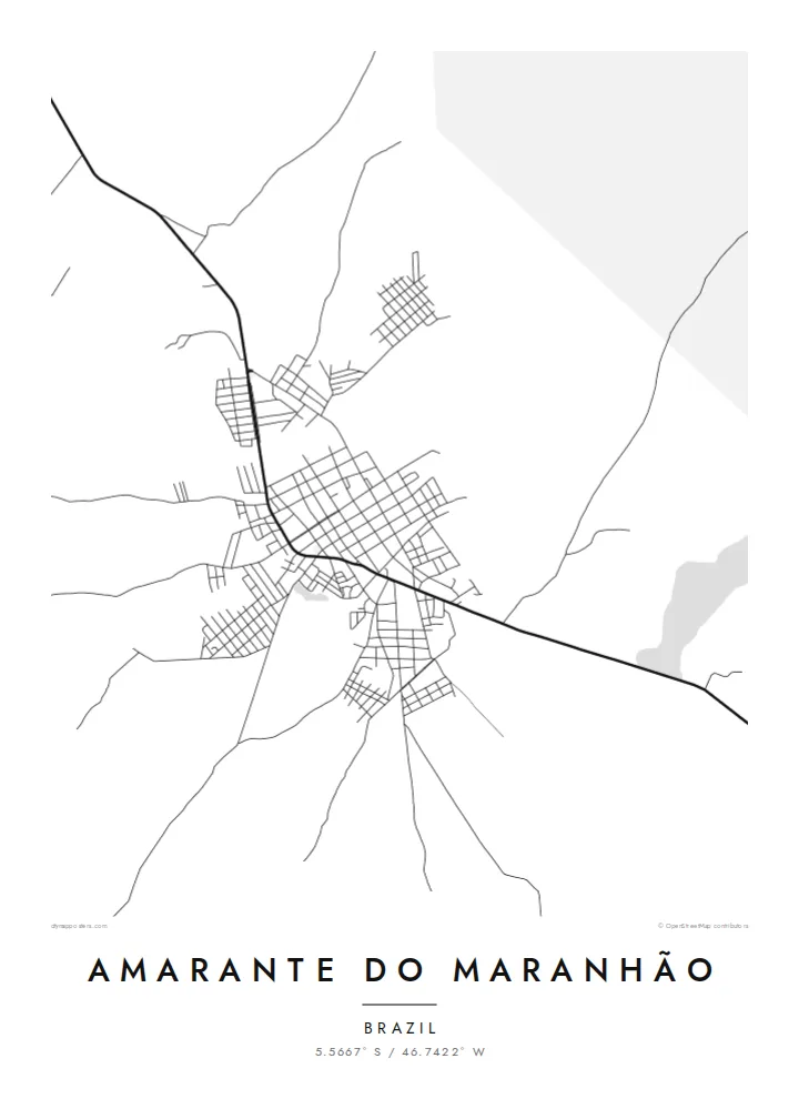
The centre is laid out as a fairly regular grid of streets, which stands out clearly against the much looser pattern of the surrounding countryside.
Minimalist map poster · Brazil
5.5667° S / 46.7422° W
A small interior town in western Maranhão, a tidy street grid set among forest, farmland and long rural roads
One city, five moods
Tap a style to see it on the wall. Every style costs the same — printed, framed or as HD files.
 Actual pixels · 24 × 36″ print file
Print-sharp
This is a 100% crop of the real print file. Every poster — printed, framed or downloaded — is rendered on our servers at 300 DPI, up to 7,200 × 10,800 pixels, so even the smallest lanes stay crisp on a 24 × 36″ print.
On the wall


The map
Amarante do Maranhão lies in the interior of the Brazilian state of Maranhão, in the transition zone between the Amazon forest to the west and the drier savanna further east. From above, the town is a compact grid of streets surrounded by a large municipal territory where the density of roads drops off quickly. Unpaved tracks lead out into farmland and forest.
The municipality covers a wide area, much of it rural, and the landscape shows the mixture of cleared pasture, remaining forest and watercourses that is typical of this part of the state. Indigenous territories lie within the wider region, which is part of what makes the area distinctive. The town itself acts as a local centre for commerce and services.
An Amarante do Maranhão map poster focuses on the town's regular core and the roads that radiate from it. In black and white, the grid reads cleanly, and the thinning network at the edges suggests the open country beyond. It is a straightforward, honest map for people who know the place and want a picture of it on the wall.
The centre is laid out as a fairly regular grid of streets, which stands out clearly against the much looser pattern of the surrounding countryside.
Roads and tracks lead away from the town into farmland and forest, becoming sparser with distance and hinting at the size of the municipality.
The area sits between the Amazon forest and the drier landscapes to the east, giving the countryside a varied mix of cleared and wooded land.
Make it yours
Add a date, a name or a line of your own, switch style, size or orientation.
The free preview is low-resolution with a watermark. Prints and HD files are rendered at 300 DPI, up to 7,200 × 10,800 px, without a watermark.
Why Amarante do Maranhão
People from Amarante do Maranhão often live far from home, in São Luís or in other states. A map of the town is a quiet, personal reminder of its streets and the country around it, simple enough to suit any room.
The title, subtitle and coordinates line can be personalised, for example with a family name or the year someone left. Five styles are available: Classic black & white, Noir, Paper, Blueprint and Sand, from the stark to the warm.
Order the Amarante do Maranhão poster| Print size | Resolution | Files |
|---|---|---|
| 30 × 40 cm11.8 × 15.7″ | 3,543 × 4,724 px | PNG · PDF |
| 29.7 × 42 cm (A3)11.7 × 16.5″ | 3,508 × 4,961 px | PNG · PDF |
| 42 × 59.4 cm (A2)16.5 × 23.4″ | 4,961 × 7,016 px | PNG · PDF |
| 45.7 × 61 cm18 × 24″ | 5,400 × 7,200 px | PNG · PDF |
| 50 × 70 cm19.7 × 27.6″ | 5,906 × 8,268 px | PNG · PDF |
| 61 × 91.4 cm24 × 36″ | 7,200 × 10,800 px | PNG · PDF |
For comparison, the free preview is 900 px wide, watermarked and meant for screens. The HD files have up to 8× the resolution in each direction and print cleanly at full poster size.
Pick a style at the top of the page, then choose Printed Poster — a size and, if you like, a frame — or Digital HD Files. Checkout takes one step, and your order page updates as soon as the payment goes through.
It is printed on premium 200 gsm matte paper in one of six sizes, from 30 × 40 cm to 24 × 36″. Printed posters start at $39, shipping included.
Yes. Choose a solid wood frame in black, white, natural oak or dark wood. It comes with shatterproof glazing and is ready to hang. Framed posters start at $99, shipping included.
Shipping is free to 60+ countries. Each poster is printed by the nearest of our print partners in 30+ countries and usually arrives in 3–7 business days. You can follow the status and tracking under My Orders. A few countries take 2–5 weeks, and where we don't ship yet, the site tells you before you pay.
Send us a photo within 14 days of delivery and we will reprint it for free or refund you.
Yes. In the editor on this page, change the title, the subtitle and the coordinates line to anything you like, and pick a style and size. Printed, framed and digital orders all use exactly your design.
For $9 you get 300 DPI PNG and print-ready PDF files in all six sizes, without a watermark, to print anywhere. Not sure yet? Download a free watermarked preview first.
Nearby
