Nakdong River bend
The river curves along the south side of the centre, and the crossings over it, including the long wooden Woryeonggyo footbridge, make clean graphic lines across the water.
Minimalist map poster · South Korea
36.5664° N / 128.7227° E
A city held in a bend of the Nakdong River, with branching reservoirs upstream and a folk village in a loop downstream.

One city, five moods
Tap a style to see it on the wall. Every style costs the same — printed, framed or as HD files.
 Actual pixels · 24 × 36″ print file
Print-sharp
This is a 100% crop of the real print file. Every poster — printed, framed or downloaded — is rendered on our servers at 300 DPI, up to 7,200 × 10,800 pixels, so even the smallest lanes stay crisp on a 24 × 36″ print.
On the wall

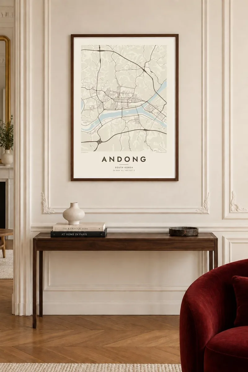
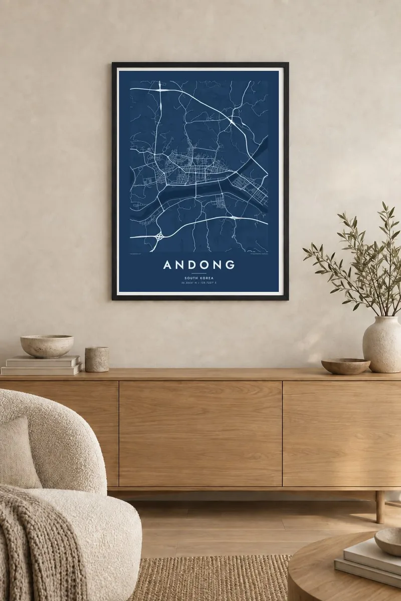
The map
Andong lies among the hills of North Gyeongsang Province, where the upper Nakdong River begins to gather strength. The city centre sits on the north bank, and the river curves along its southern edge before continuing west. Upstream, the Andong and Imha dams hold back large reservoirs whose shorelines branch deep into the surrounding valleys, giving the wider map a remarkable, finger-like pattern of water.
Andong is often described as a centre of Korean Confucian culture. Hahoe Folk Village, a UNESCO World Heritage site, lies west of the city inside a tight bend of the Nakdong, and Dosan Seowon, the academy associated with the scholar Toegye Yi Hwang, lies to the north. The city is also known for its mask dance tradition and for dishes such as Andong jjimdak.
An Andong map poster is shaped by water as much as by streets. The river's broad curve gives the centre its southern edge, bridges cross at intervals, and the reservoirs begin just east of town. Depending on the scale, the print can focus on the compact downtown or widen to catch the meandering valleys that make this part of Korea so distinctive.
The river curves along the south side of the centre, and the crossings over it, including the long wooden Woryeonggyo footbridge, make clean graphic lines across the water.
The reservoir behind Andong Dam spreads into dozens of narrow arms among the hills, an intricate shoreline that looks almost hand-drawn when seen from above.
West of the city, the Nakdong wraps nearly all the way around Hahoe Village. The bend gives the village its setting and its name, which refers to the turning river.
Make it yours
Add a date, a name or a line of your own, switch style, size or orientation.
The free preview is low-resolution with a watermark. Prints and HD files are rendered at 300 DPI, up to 7,200 × 10,800 px, without a watermark.
Why Andong
Andong draws people interested in Korean tradition, hanok villages and slow travel, and many visitors remember it as the calmest stop of their trip. Students and families from the region also hang it as a map of home, a city where the river is always part of the view.
Set a personalised title and subtitle, such as a family name or the year of a visit, and keep or edit the coordinates line. Five styles are available, and the $9 digital download includes print-ready files in six sizes, from 30×40 cm to 24×36″.
Order the Andong poster| Print size | Resolution | Files |
|---|---|---|
| 30 × 40 cm11.8 × 15.7″ | 3,543 × 4,724 px | PNG · PDF |
| 29.7 × 42 cm (A3)11.7 × 16.5″ | 3,508 × 4,961 px | PNG · PDF |
| 42 × 59.4 cm (A2)16.5 × 23.4″ | 4,961 × 7,016 px | PNG · PDF |
| 45.7 × 61 cm18 × 24″ | 5,400 × 7,200 px | PNG · PDF |
| 50 × 70 cm19.7 × 27.6″ | 5,906 × 8,268 px | PNG · PDF |
| 61 × 91.4 cm24 × 36″ | 7,200 × 10,800 px | PNG · PDF |
For comparison, the free preview is 900 px wide, watermarked and meant for screens. The HD files have up to 8× the resolution in each direction and print cleanly at full poster size.
Pick a style at the top of the page, then choose Printed Poster — a size and, if you like, a frame — or Digital HD Files. Checkout takes one step, and your order page updates as soon as the payment goes through.
It is printed on premium 200 gsm matte paper in one of six sizes, from 30 × 40 cm to 24 × 36″. Printed posters start at $39, shipping included.
Yes. Choose a solid wood frame in black, white, natural oak or dark wood. It comes with shatterproof glazing and is ready to hang. Framed posters start at $99, shipping included.
Shipping is free to 60+ countries. Each poster is printed by the nearest of our print partners in 30+ countries and usually arrives in 3–7 business days. You can follow the status and tracking under My Orders. A few countries take 2–5 weeks, and where we don't ship yet, the site tells you before you pay.
Send us a photo within 14 days of delivery and we will reprint it for free or refund you.
Yes. In the editor on this page, change the title, the subtitle and the coordinates line to anything you like, and pick a style and size. Printed, framed and digital orders all use exactly your design.
For $9 you get 300 DPI PNG and print-ready PDF files in all six sizes, without a watermark, to print anywhere. Not sure yet? Download a free watermarked preview first.
Nearby
