Citadel hill
The walled citadel rises above Ulus, north-east of the centre. Its irregular ring of fortifications and tight inner lanes form the densest and oldest street pattern in the city.
Minimalist map poster · Turkey
39.9199° N / 32.8543° E
A plateau capital spreading from a citadel hill, cut through by a long boulevard running south toward the ministries and Çankaya.
One city, five moods
Tap a style to see it on the wall. Every style costs the same — printed, framed or as HD files.
 Actual pixels · 24 × 36″ print file
Print-sharp
This is a 100% crop of the real print file. Every poster — printed, framed or downloaded — is rendered on our servers at 300 DPI, up to 7,200 × 10,800 pixels, so even the smallest lanes stay crisp on a 24 × 36″ print.
On the wall


The map
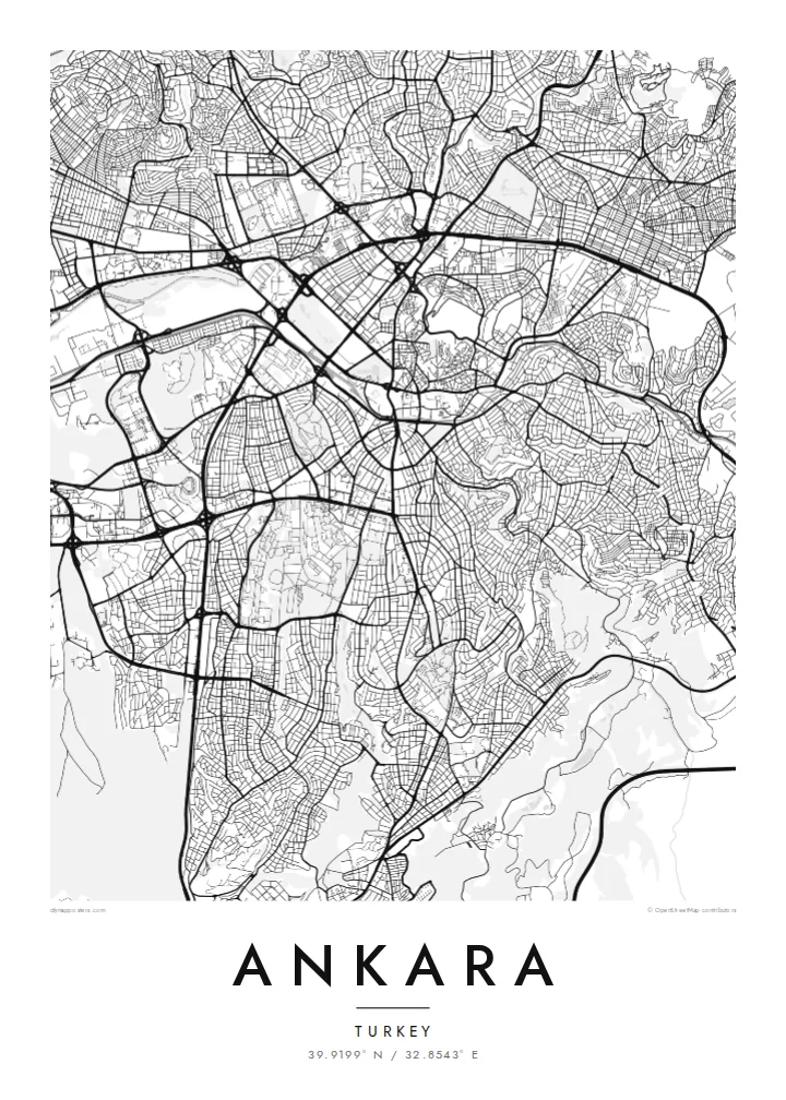
Ankara sits on the Anatolian plateau at more than 900 metres, and from above its oldest layer is easy to find: the citadel on its rocky hill north-east of the centre, wrapped in a tight knot of lanes that ignore any grid. Everything newer radiates away from that point. Over the twentieth century the city was pushed outward as a small provincial town became the seat of a republic.
Ankara became the capital in 1923, and the plan drawn up for it in the late 1920s by the German planner Hermann Jansen still shows in the map. Atatürk Boulevard runs as a long spine from Ulus through Kızılay to the government quarter. Gençlik Park is pressed against the old centre, and Anıtkabir, Atatürk's mausoleum, occupies its own hill to the west within a broad ceremonial park.
Further out, the city loses its early order and breaks into large residential districts, ring roads and campuses. The wooded grounds of the Middle East Technical University form one of the largest green shapes on the south-western edge, with the lakes of Eymir and Mogan beyond them. An Ankara map poster captures both the deliberately planned capital and the much larger city that grew around it.
The walled citadel rises above Ulus, north-east of the centre. Its irregular ring of fortifications and tight inner lanes form the densest and oldest street pattern in the city.
A straight north–south axis linking Ulus, Kızılay and Çankaya. On the map it reads as the city's backbone, with ministries, parks and embassies lined up along it.
Atatürk's mausoleum stands on a hilltop west of Kızılay, surrounded by a broad area of green and ceremonial ground that stands out clearly against the housing blocks around it.
Make it yours
Add a date, a name or a line of your own, switch style, size or orientation.
The free preview is low-resolution with a watermark. Prints and HD files are rendered at 300 DPI, up to 7,200 × 10,800 px, without a watermark.
Why Ankara
Ankara tends to be personal for the people who hang it: students who spent years at one of its universities, diplomats posted to Çankaya, families who moved to the capital for work. The map holds the route from the citadel down the boulevard, a walk most of them made many times.
You can change the title and subtitle, add a date that matters and adjust the coordinates line. Choose Classic black & white, Noir, Paper, Blueprint or Sand, then download the $9 HD files to print at home, or order a matte print.
Order the Ankara poster| Print size | Resolution | Files |
|---|---|---|
| 30 × 40 cm11.8 × 15.7″ | 3,543 × 4,724 px | PNG · PDF |
| 29.7 × 42 cm (A3)11.7 × 16.5″ | 3,508 × 4,961 px | PNG · PDF |
| 42 × 59.4 cm (A2)16.5 × 23.4″ | 4,961 × 7,016 px | PNG · PDF |
| 45.7 × 61 cm18 × 24″ | 5,400 × 7,200 px | PNG · PDF |
| 50 × 70 cm19.7 × 27.6″ | 5,906 × 8,268 px | PNG · PDF |
| 61 × 91.4 cm24 × 36″ | 7,200 × 10,800 px | PNG · PDF |
For comparison, the free preview is 900 px wide, watermarked and meant for screens. The HD files have up to 8× the resolution in each direction and print cleanly at full poster size.
Pick a style at the top of the page, then choose Printed Poster — a size and, if you like, a frame — or Digital HD Files. Checkout takes one step, and your order page updates as soon as the payment goes through.
It is printed on premium 200 gsm matte paper in one of six sizes, from 30 × 40 cm to 24 × 36″. Printed posters start at $39, shipping included.
Yes. Choose a solid wood frame in black, white, natural oak or dark wood. It comes with shatterproof glazing and is ready to hang. Framed posters start at $99, shipping included.
Shipping is free to 60+ countries. Each poster is printed by the nearest of our print partners in 30+ countries and usually arrives in 3–7 business days. You can follow the status and tracking under My Orders. A few countries take 2–5 weeks, and where we don't ship yet, the site tells you before you pay.
Send us a photo within 14 days of delivery and we will reprint it for free or refund you.
Yes. In the editor on this page, change the title, the subtitle and the coordinates line to anything you like, and pick a style and size. Printed, framed and digital orders all use exactly your design.
For $9 you get 300 DPI PNG and print-ready PDF files in all six sizes, without a watermark, to print anywhere. Not sure yet? Download a free watermarked preview first.
Nearby
