Subang Airport
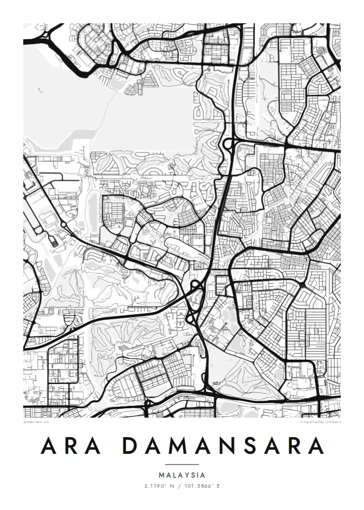
The airport runway runs alongside the township as a long, clean rectangle. It dominates one edge of the map and sets it apart from other suburbs.
Minimalist map poster · Malaysia
A township beside Subang Airport in Petaling Jaya, where housing, offices and a light rail line meet near the runway.
3.1190° N / 101.5866° E


One city, five moods
Tap a style to see it on the wall. Every style is included in the same $9 price.
 Actual pixels · 24 × 36″ HD file
Print-sharp
This is a crop of the real HD file at 100%. The paid download is rendered on our servers at 300 DPI, up to 7,200 × 10,800 pixels, so even the smallest lanes stay crisp on a 24 × 36″ print.
The map
Ara Damansara lies in the southwest of Petaling Jaya, Selangor, right beside Sultan Abdul Aziz Shah Airport, better known as Subang Airport. It was developed as a mixed township of houses, condominiums and commercial blocks. On a map, its most striking neighbour is the long, straight runway, a bold shape set against the finer pattern of the streets.
The Kelana Jaya LRT line runs through the area and has its own Ara Damansara station. The township also connects to the expressways that crisscross this part of the Klang Valley. Residential streets curve into loops and cul-de-sacs, while the commercial areas have a tighter, more rectangular layout, so the map shows two distinct textures side by side.
An Ara Damansara map poster suits people who live or work here, aviation enthusiasts who know Subang and anyone who likes a map with strong graphic contrasts. The runway, the rail line and the expressways give the design a clear structure, and the residential loops fill it with detail.
The airport runway runs alongside the township as a long, clean rectangle. It dominates one edge of the map and sets it apart from other suburbs.
The elevated Kelana Jaya line passes through the township, with a station serving the area. It cuts a steady line through curving streets and commercial blocks.
Residential loops, gridded commercial areas and expressway ramps sit close together. This creates a varied, layered composition within a relatively small frame.
Make it yours
Add a date, a name or a line of your own, switch style, size or orientation.
Free preview is low-resolution with a watermark. The HD version is 7,200 × 10,800 px, 300 DPI, no watermark.
Why Ara Damansara
Ara Damansara is where many people in the Klang Valley started out on their own: a first condo, a first office, planes passing low overhead. A map poster records that chapter precisely, and it looks sharp in a modern home or workspace.
Personalise the title, subtitle and coordinates line, then choose one of five styles: Classic black & white, Noir, Paper, Blueprint or Sand. HD files cost $9 for six sizes at 300 DPI with no watermark, and printed posters ship from partners in over 30 countries.
Get the Ara Damansara poster — $9| Print size | Resolution | Files |
|---|---|---|
| 30 × 40 cm (11.8 × 15.7″) | 3,543 × 4,724 px | PNG · PDF |
| 50 × 70 cm (19.7 × 27.6″) | 5,906 × 8,268 px | PNG · PDF |
| 29.7 × 42 cm (A3, 11.7 × 16.5″) | 3,508 × 4,961 px | PNG · PDF |
| 42 × 59.4 cm (A2, 16.5 × 23.4″) | 4,961 × 7,016 px | PNG · PDF |
| 45.7 × 61 cm (18 × 24″) | 5,400 × 7,200 px | PNG · PDF |
| 61 × 91.4 cm (24 × 36″) | 7,200 × 10,800 px | PNG · PDF |
For comparison, the free preview is 900 px wide, watermarked and meant for screens. The HD files have up to 8× the resolution in each direction and print cleanly at full poster size.
Yes. Drag and zoom the map in the editor — centre it on your neighbourhood, the old town or the whole metro area. The text updates independently.
The HD purchase includes 30×40 cm, 50×70 cm, A3, A2, 18×24″ and 24×36″, each as a 300 DPI PNG and a print-ready PDF.
You can download a free 900 px preview with a watermark. The paid HD files have no watermark and are sharp enough for large prints.
Send the PDF to any local print shop or online printing service and ask for the matching paper size. Matte paper and a thin black or oak frame suit this style best.
Nearby
