The Hawassa road
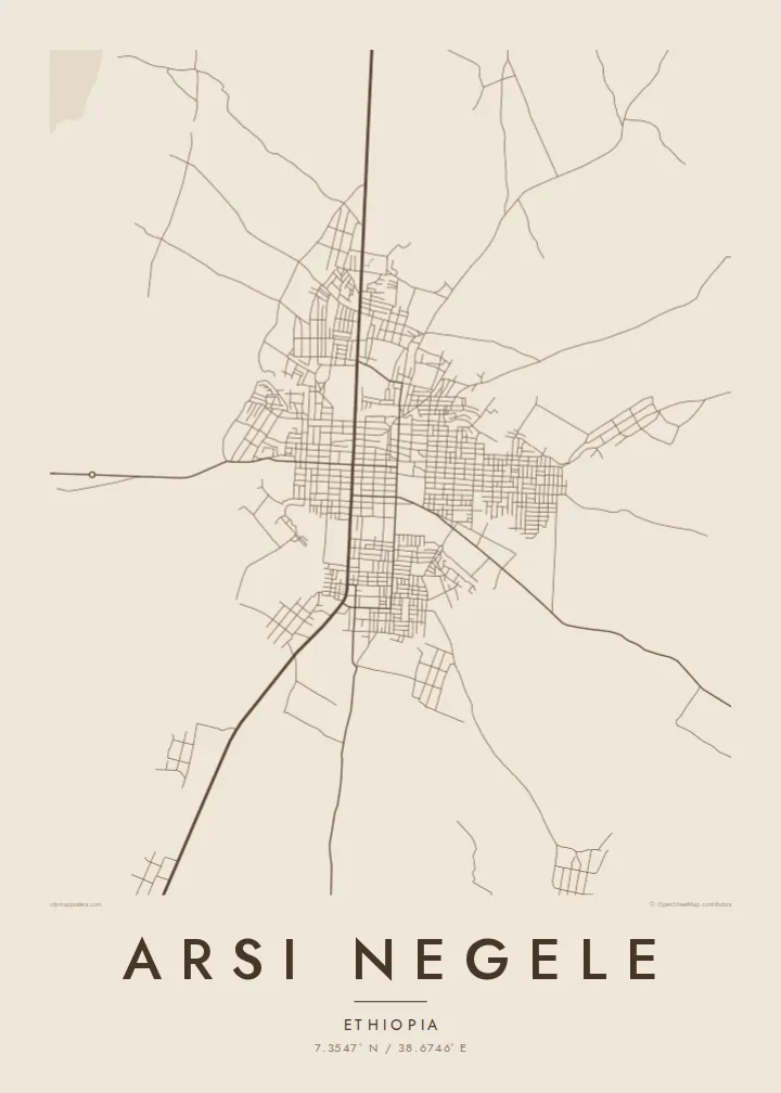
The highway from Addis Ababa to Hawassa runs through the town as a straight, central line, organising the streets around it.
Minimalist map poster · Ethiopia
A Rift Valley town on the road south from Addis Ababa, near a chain of lakes and acacia plains
7.3547° N / 38.6746° E


One city, five moods
Tap a style to see it on the wall. Every style is included in the same $9 price.
 Actual pixels · 24 × 36″ HD file
Print-sharp
This is a crop of the real HD file at 100%. The paid download is rendered on our servers at 300 DPI, up to 7,200 × 10,800 pixels, so even the smallest lanes stay crisp on a 24 × 36″ print.
The map
Arsi Negele lies in the Ethiopian Rift Valley in Oromia, on the main road between Addis Ababa and Hawassa. On a map the highway runs straight through the town, with streets branching from it into residential neighbourhoods and farmland beyond.
The town sits close to the Rift Valley lakes, including Langano, Abijatta and Shalla, which lie a short distance away within a wider landscape of volcanic ground and acacia woodland. On a broader frame these lakes appear as large, calm shapes that give the region its character.
An Arsi Negele map poster brings together the town's main road and the scattered streets around it. The simplicity of the layout, set in open country, gives the design a strong centre and plenty of space.
The highway from Addis Ababa to Hawassa runs through the town as a straight, central line, organising the streets around it.
Lakes Langano, Abijatta and Shalla lie nearby, and on a wider print they appear as broad blank shapes on the valley floor.
Built-up streets give way quickly to fields and rural paths, leaving the poster open and uncluttered around its compact centre.
Make it yours
Add a date, a name or a line of your own, switch style, size or orientation.
Free preview is low-resolution with a watermark. The HD version is 7,200 × 10,800 px, 300 DPI, no watermark.
Why Arsi Negele
Arsi Negele is a meaningful place for people who grew up in the Rift Valley or passed through on journeys south. A map poster is a simple, lasting way to remember it.
Add a name, a date or the coordinates of a special place, then choose Classic black & white, Noir, Paper, Blueprint or Sand. Download the HD files or order a print from a partner in over 30 countries.
Get the Arsi Negele poster — $9| Print size | Resolution | Files |
|---|---|---|
| 30 × 40 cm | 3,543 × 4,724 px | PNG · PDF |
| 50 × 70 cm | 5,906 × 8,268 px | PNG · PDF |
| A3 · 29.7 × 42 cm | 3,508 × 4,961 px | PNG · PDF |
| A2 · 42 × 59.4 cm | 4,961 × 7,016 px | PNG · PDF |
| 18 × 24" | 5,400 × 7,200 px | PNG · PDF |
| 24 × 36" | 7,200 × 10,800 px | PNG · PDF |
For comparison, the free preview is 900 px wide, watermarked and meant for screens. The HD files have up to 8× the resolution in each direction and print cleanly at full poster size.
Yes. Drag and zoom the map in the editor — centre it on your neighbourhood, the old town or the whole metro area. The text updates independently.
The HD purchase includes 30×40 cm, 50×70 cm, A3, A2, 18×24″ and 24×36″, each as a 300 DPI PNG and a print-ready PDF.
You can download a free 900 px preview with a watermark. The paid HD files have no watermark and are sharp enough for large prints.
Send the PDF to any local print shop or online printing service and ask for the matching paper size. Matte paper and a thin black or oak frame suit this style best.
Nearby
