Lake Saint-Louis shore
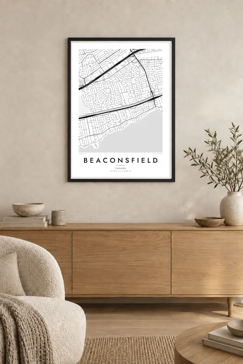
The southern edge is a long, uneven waterline of small points and coves. In black and white the lake becomes a broad open field that frames the town like the margin of a page.
Minimalist map poster · Canada
45.4334° N / 73.8659° W
A West Island suburb stretched along Lake Saint-Louis, its shoreline lots and curving streets pressed between the water and Autoroute 20.

One city, five moods
Tap a style to see it on the wall. Every style costs the same — printed, framed or as HD files.
 Actual pixels · 24 × 36″ print file
Print-sharp
This is a 100% crop of the real print file. Every poster — printed, framed or downloaded — is rendered on our servers at 300 DPI, up to 7,200 × 10,800 pixels, so even the smallest lanes stay crisp on a 24 × 36″ print.
On the wall


The map
Beaconsfield covers a strip of the western end of Montreal Island facing Lake Saint-Louis, a broad widening of the St. Lawrence. On a map the town is defined by its southern edge, a long, irregular shoreline of points, small bays and waterfront lots. Residential streets run inland from the lake in gentle curves instead of following a strict grid.
A rail line and Autoroute 20 run close together across the town, two firm east–west bands carrying commuter trains and traffic toward downtown Montreal. North of them the street pattern changes, with larger crescents and cul-de-sacs laid out during the suburban growth of the mid-twentieth century. The contrast between the lakeside half and the inland half gives the map a clear structure.
Beaconsfield became part of the merged city of Montreal in 2002, voted to leave it and became a separate municipality again in 2006. It remains a mostly residential, heavily treed community. A Beaconsfield map poster shows that quiet order: water to the south, transport corridors through the middle and winding streets filling everything else.
The southern edge is a long, uneven waterline of small points and coves. In black and white the lake becomes a broad open field that frames the town like the margin of a page.
A commuter rail line and the autoroute cross the town side by side. The two parallel strokes separate the lakeside neighbourhoods from the newer streets to the north.
North of the corridors, streets bend into crescents and closed loops. This suburban pattern fills the upper half of the poster with soft, repeating curves.
Make it yours
Add a date, a name or a line of your own, switch style, size or orientation.
The free preview is low-resolution with a watermark. Prints and HD files are rendered at 300 DPI, up to 7,200 × 10,800 px, without a watermark.
Why Beaconsfield
Beaconsfield is a family town, the kind of place people come back to for holidays or leave for university and then miss. A map of its shoreline and streets makes a personal gift for a new homeowner or for a parent who has lived by the lake for decades.
Add a title in English or French, a subtitle with a street name or a year, and keep or edit the coordinates line. Blueprint and Noir make the lake especially strong, Paper and Sand give it a softer, warmer tone, and Classic black & white stays closest to a printed atlas.
Order the Beaconsfield poster| Print size | Resolution | Files |
|---|---|---|
| 30 × 40 cm11.8 × 15.7″ | 3,543 × 4,724 px | PNG · PDF |
| 29.7 × 42 cm (A3)11.7 × 16.5″ | 3,508 × 4,961 px | PNG · PDF |
| 42 × 59.4 cm (A2)16.5 × 23.4″ | 4,961 × 7,016 px | PNG · PDF |
| 45.7 × 61 cm18 × 24″ | 5,400 × 7,200 px | PNG · PDF |
| 50 × 70 cm19.7 × 27.6″ | 5,906 × 8,268 px | PNG · PDF |
| 61 × 91.4 cm24 × 36″ | 7,200 × 10,800 px | PNG · PDF |
For comparison, the free preview is 900 px wide, watermarked and meant for screens. The HD files have up to 8× the resolution in each direction and print cleanly at full poster size.
Pick a style at the top of the page, then choose Printed Poster — a size and, if you like, a frame — or Digital HD Files. Checkout takes one step, and your order page updates as soon as the payment goes through.
It is printed on premium 200 gsm matte paper in one of six sizes, from 30 × 40 cm to 24 × 36″. Printed posters start at $39, shipping included.
Yes. Choose a solid wood frame in black, white, natural oak or dark wood. It comes with shatterproof glazing and is ready to hang. Framed posters start at $99, shipping included.
Shipping is free to 60+ countries. Each poster is printed by the nearest of our print partners in 30+ countries and usually arrives in 3–7 business days. You can follow the status and tracking under My Orders. A few countries take 2–5 weeks, and where we don't ship yet, the site tells you before you pay.
Send us a photo within 14 days of delivery and we will reprint it for free or refund you.
Yes. In the editor on this page, change the title, the subtitle and the coordinates line to anything you like, and pick a style and size. Printed, framed and digital orders all use exactly your design.
For $9 you get 300 DPI PNG and print-ready PDF files in all six sizes, without a watermark, to print anywhere. Not sure yet? Download a free watermarked preview first.
Nearby
