The Kama riverfront
The broad Kama runs along the city's western side. It gives the poster a strong, calm edge and separates Berezniki from Usolye on the opposite bank.
Minimalist map poster · Russia
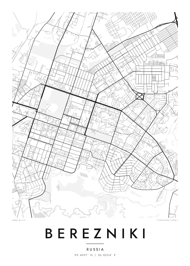
An industrial town on the east bank of the Kama, its planned blocks bordered by potash works and wide river water.
59.4091° N / 56.8204° E


One city, five moods
Tap a style to see it on the wall. Every style is included in the same $9 price.
 Actual pixels · 24 × 36″ HD file
Print-sharp
This is a crop of the real HD file at 100%. The paid download is rendered on our servers at 300 DPI, up to 7,200 × 10,800 pixels, so even the smallest lanes stay crisp on a 24 × 36″ print.
The map
Berezniki grew up in the 1930s around chemical plants on the Kama River, in the foreland of the northern Urals, and its map still reads like a planned industrial settlement. Straight avenues run through blocks of mid-century housing, rail sidings lead toward the works, and the broad Kama forms a soft western border. The older town of Usolye faces it from the opposite bank.
The ground beneath the city is the Verkhnekamskoye potash deposit, one of the largest in the world, and mining has shaped Berezniki in a way few towns experience. Since 2006, flooded workings have opened large sinkholes inside the city limits, and some housing and a section of railway have been moved as a result. On a street map these changes show up as gaps and rerouted lines rather than dramatic scars.
A Berezniki map poster captures that practical geometry: the long river edge, the orderly residential grid, the industrial zones laid out in wide rectangles, and the roads heading north toward Solikamsk. In black and white, the plan becomes a clear drawing of how a Soviet company town was organised, and of how it keeps adapting to the ground it was built on.
The broad Kama runs along the city's western side. It gives the poster a strong, calm edge and separates Berezniki from Usolye on the opposite bank.
Central Berezniki follows Soviet planning logic, with straight avenues and large rectangular blocks. Drawn in fine black lines, this becomes a clean, regular pattern.
Chemical and potash plants spread around the residential core, served by rail spurs and wide access roads that add long, angular lines to the outer parts of the map.
Make it yours
Add a date, a name or a line of your own, switch style, size or orientation.
Free preview is low-resolution with a watermark. The HD version is 7,200 × 10,800 px, 300 DPI, no watermark.
Why Berezniki
Many people in Berezniki have close ties to mining and chemistry, and a map of the town can mark a hometown, a first job or a family connection to the Kama. You can set the title, subtitle and coordinates line yourself, perhaps adding a year that matters to you.
There are five styles to choose from: Classic black & white, Noir, Paper, Blueprint and Sand. Blueprint suits the town's engineering character. The $9 digital HD files cover six print sizes as 300 DPI PNG and print-ready PDF. You can also order a matte printed poster with an optional wooden frame.
Get the Berezniki poster — $9| Print size | Resolution | Files |
|---|---|---|
| 30 × 40 cm (11.8 × 15.7″) | 3,543 × 4,724 px | PNG · PDF |
| 50 × 70 cm (19.7 × 27.6″) | 5,906 × 8,268 px | PNG · PDF |
| 29.7 × 42 cm (A3, 11.7 × 16.5″) | 3,508 × 4,961 px | PNG · PDF |
| 42 × 59.4 cm (A2, 16.5 × 23.4″) | 4,961 × 7,016 px | PNG · PDF |
| 45.7 × 61 cm (18 × 24″) | 5,400 × 7,200 px | PNG · PDF |
| 61 × 91.4 cm (24 × 36″) | 7,200 × 10,800 px | PNG · PDF |
For comparison, the free preview is 900 px wide, watermarked and meant for screens. The HD files have up to 8× the resolution in each direction and print cleanly at full poster size.
Yes. Drag and zoom the map in the editor — centre it on your neighbourhood, the old town or the whole metro area. The text updates independently.
The HD purchase includes 30×40 cm, 50×70 cm, A3, A2, 18×24″ and 24×36″, each as a 300 DPI PNG and a print-ready PDF.
You can download a free 900 px preview with a watermark. The paid HD files have no watermark and are sharp enough for large prints.
Send the PDF to any local print shop or online printing service and ask for the matching paper size. Matte paper and a thin black or oak frame suit this style best.
Nearby
