Naval Hill
This isolated hill beside the centre holds the Franklin Game Reserve, so on the map it appears as an open, mostly street-free shape set against the dense grid around it.
Minimalist map poster · South Africa
29.1211° S / 26.2140° E
A colonial grid on the Free State highveld, with Naval Hill rising at its edge and a stream channelled through the centre.

One city, five moods
Tap a style to see it on the wall. Every style costs the same — printed, framed or as HD files.
 Actual pixels · 24 × 36″ print file
Print-sharp
This is a 100% crop of the real print file. Every poster — printed, framed or downloaded — is rendered on our servers at 300 DPI, up to 7,200 × 10,800 pixels, so even the smallest lanes stay crisp on a 24 × 36″ print.
On the wall


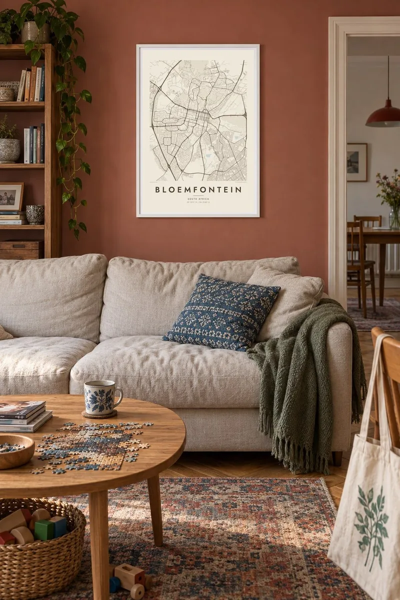
The map
Bloemfontein lies on the high, open grassland of the Free State, and its centre is a clear nineteenth-century grid. From above, the square blocks run to the foot of Naval Hill, a flat-topped rise just north of the centre that stays largely unbuilt. The Bloemspruit, a small stream, is carried through the city in a canalised channel, and suburbs spread outward along curving roads in every direction.
Founded in 1846 as a British outpost, the city later served as capital of the Orange Free State, and today it is South Africa's judicial capital, home of the Supreme Court of Appeal. It is also where J. R. R. Tolkien was born in 1892. Naval Hill holds a game reserve inside the city limits and a large statue of Nelson Mandela looking over the streets.
A Bloemfontein map poster captures that balance of order and open ground. The central grid provides structure, Naval Hill leaves a striking blank space almost at its heart, and parks such as the gardens around Loch Logan add softer shapes. In monochrome the city reads like a clean architectural drawing set on the highveld.
This isolated hill beside the centre holds the Franklin Game Reserve, so on the map it appears as an open, mostly street-free shape set against the dense grid around it.
The original town was laid out in regular rectangular blocks, and that pattern still defines the middle of the city, giving the poster a steady architectural rhythm.
The small lake and surrounding parkland near the centre add a patch of water and green, drawn as a gentle interruption in the otherwise straight street pattern.
Make it yours
Add a date, a name or a line of your own, switch style, size or orientation.
The free preview is low-resolution with a watermark. Prints and HD files are rendered at 300 DPI, up to 7,200 × 10,800 px, without a watermark.
Why Bloemfontein
Bloemfontein holds meaning for people who studied at its universities, worked in its courts or grew up under Naval Hill. The map suits a study or a living room, and it is also a thoughtful gift for Tolkien readers curious about his birthplace.
The title, subtitle and coordinates line can all be changed, so the poster can carry a name, a graduation year or a wedding date. Choose Classic black & white, Noir, Paper, Blueprint or Sand, then download the files or order a printed version.
Order the Bloemfontein poster| Print size | Resolution | Files |
|---|---|---|
| 30 × 40 cm11.8 × 15.7″ | 3,543 × 4,724 px | PNG · PDF |
| 29.7 × 42 cm (A3)11.7 × 16.5″ | 3,508 × 4,961 px | PNG · PDF |
| 42 × 59.4 cm (A2)16.5 × 23.4″ | 4,961 × 7,016 px | PNG · PDF |
| 45.7 × 61 cm18 × 24″ | 5,400 × 7,200 px | PNG · PDF |
| 50 × 70 cm19.7 × 27.6″ | 5,906 × 8,268 px | PNG · PDF |
| 61 × 91.4 cm24 × 36″ | 7,200 × 10,800 px | PNG · PDF |
For comparison, the free preview is 900 px wide, watermarked and meant for screens. The HD files have up to 8× the resolution in each direction and print cleanly at full poster size.
Pick a style at the top of the page, then choose Printed Poster — a size and, if you like, a frame — or Digital HD Files. Checkout takes one step, and your order page updates as soon as the payment goes through.
It is printed on premium 200 gsm matte paper in one of six sizes, from 30 × 40 cm to 24 × 36″. Printed posters start at $39, shipping included.
Yes. Choose a solid wood frame in black, white, natural oak or dark wood. It comes with shatterproof glazing and is ready to hang. Framed posters start at $99, shipping included.
Shipping is free to 60+ countries. Each poster is printed by the nearest of our print partners in 30+ countries and usually arrives in 3–7 business days. You can follow the status and tracking under My Orders. A few countries take 2–5 weeks, and where we don't ship yet, the site tells you before you pay.
Send us a photo within 14 days of delivery and we will reprint it for free or refund you.
Yes. In the editor on this page, change the title, the subtitle and the coordinates line to anything you like, and pick a style and size. Printed, framed and digital orders all use exactly your design.
For $9 you get 300 DPI PNG and print-ready PDF files in all six sizes, without a watermark, to print anywhere. Not sure yet? Download a free watermarked preview first.
Nearby
