Island-studded shore
The lake breaks into many small islands and narrow channels near Bol, giving the map an intricate, fragmented edge unlike any ordinary coastline.
Minimalist map poster · Chad
13.4673° N / 14.7135° E
A lakeside town on Lake Chad, where land and water break into islands, inlets and seasonal shorelines.

One city, five moods
Tap a style to see it on the wall. Every style costs the same — printed, framed or as HD files.
 Actual pixels · 24 × 36″ print file
Print-sharp
This is a 100% crop of the real print file. Every poster — printed, framed or downloaded — is rendered on our servers at 300 DPI, up to 7,200 × 10,800 pixels, so even the smallest lanes stay crisp on a 24 × 36″ print.
On the wall
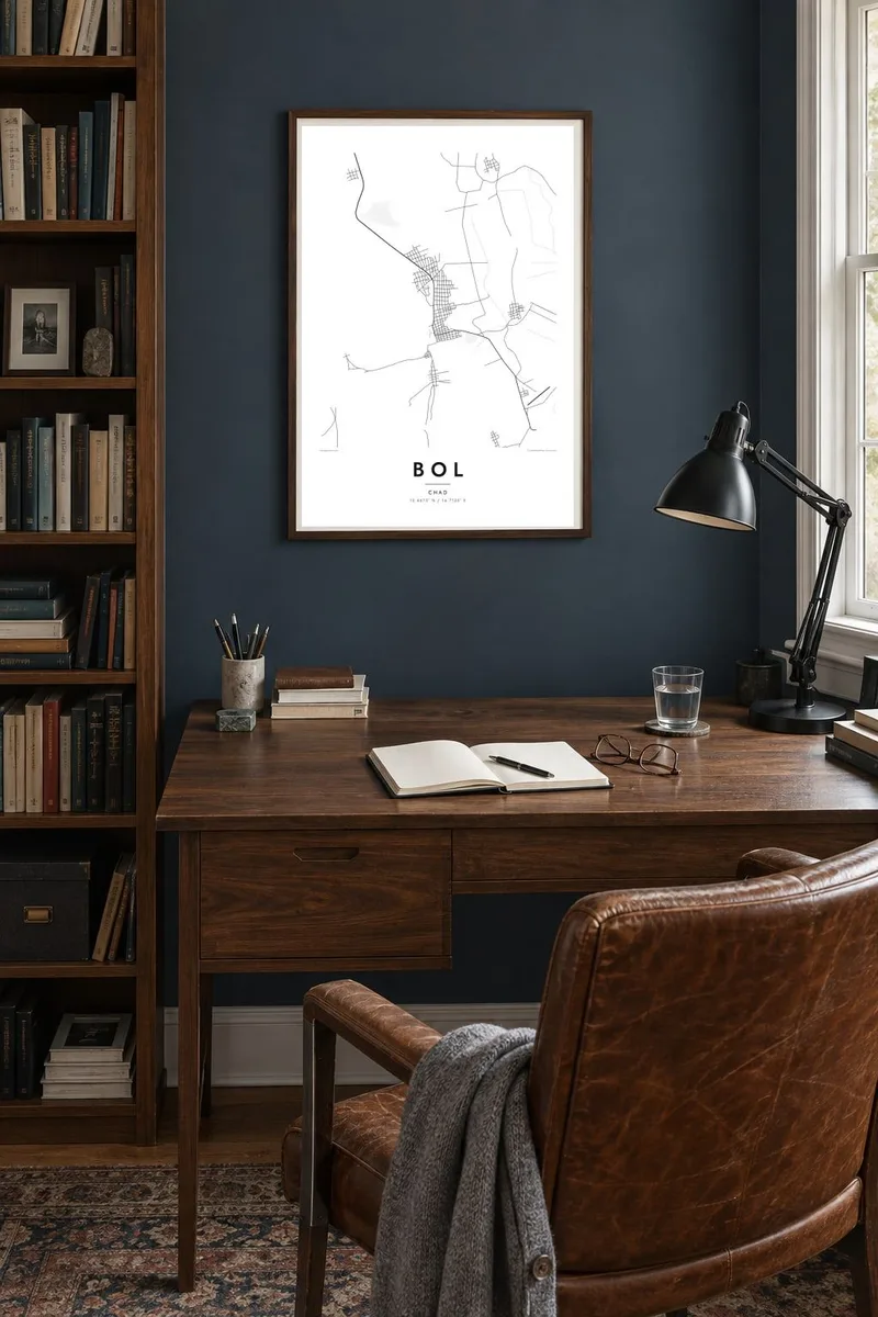


The map
Bol is the capital of Chad's Lac region and sits on the eastern shores of Lake Chad. Few towns have a map this changeable. The lake is shallow, and near Bol it breaks into a maze of islands, sand ridges and channels, so the line between land and water is irregular and often seasonal. The town itself is a compact grid of streets on firmer ground at the edge of all this.
Lake Chad is known for shrinking dramatically in the second half of the twentieth century. Its area and shape still vary a great deal from year to year and season to season. Around Bol, farmers work the exposed lakebed and polders, planting crops as the water recedes, and boats remain an everyday way to reach the islands and neighbouring communities.
A Bol map poster records a place where geography is still moving. The ordered streets of the town sit against a fragmented shoreline of islets and inlets, and in black and white the contrast is striking. It is a print for people connected to the Lac region and for anyone interested in how water shapes human settlement.
The lake breaks into many small islands and narrow channels near Bol, giving the map an intricate, fragmented edge unlike any ordinary coastline.
Lake Chad rises and falls with the seasons and the years, so the land-water boundary here is a snapshot of a continually changing shape.
On the drier ground at the lake's edge, Bol's streets form a small, regular grid that stands out clearly against the irregular water around it.
Make it yours
Add a date, a name or a line of your own, switch style, size or orientation.
The free preview is low-resolution with a watermark. Prints and HD files are rendered at 300 DPI, up to 7,200 × 10,800 px, without a watermark.
Why Bol
A map of Bol is unusual on a wall. It shows a town alongside one of Africa's best-known lakes, drawn at a moment in its long cycle of change. People hang it for family ties to the Lac region, for time spent working there, or for its striking graphic shape.
Personalise the title, subtitle and coordinates line, perhaps with a date to mark when the map was made. Five styles are available: Classic black & white, Noir, Paper, Blueprint and Sand. The $9 download covers six print sizes, and printed posters are available on matte paper.
Order the Bol poster| Print size | Resolution | Files |
|---|---|---|
| 30 × 40 cm11.8 × 15.7″ | 3,543 × 4,724 px | PNG · PDF |
| 29.7 × 42 cm (A3)11.7 × 16.5″ | 3,508 × 4,961 px | PNG · PDF |
| 42 × 59.4 cm (A2)16.5 × 23.4″ | 4,961 × 7,016 px | PNG · PDF |
| 45.7 × 61 cm18 × 24″ | 5,400 × 7,200 px | PNG · PDF |
| 50 × 70 cm19.7 × 27.6″ | 5,906 × 8,268 px | PNG · PDF |
| 61 × 91.4 cm24 × 36″ | 7,200 × 10,800 px | PNG · PDF |
For comparison, the free preview is 900 px wide, watermarked and meant for screens. The HD files have up to 8× the resolution in each direction and print cleanly at full poster size.
Pick a style at the top of the page, then choose Printed Poster — a size and, if you like, a frame — or Digital HD Files. Checkout takes one step, and your order page updates as soon as the payment goes through.
It is printed on premium 200 gsm matte paper in one of six sizes, from 30 × 40 cm to 24 × 36″. Printed posters start at $39, shipping included.
Yes. Choose a solid wood frame in black, white, natural oak or dark wood. It comes with shatterproof glazing and is ready to hang. Framed posters start at $99, shipping included.
Shipping is free to 60+ countries. Each poster is printed by the nearest of our print partners in 30+ countries and usually arrives in 3–7 business days. You can follow the status and tracking under My Orders. A few countries take 2–5 weeks, and where we don't ship yet, the site tells you before you pay.
Send us a photo within 14 days of delivery and we will reprint it for free or refund you.
Yes. In the editor on this page, change the title, the subtitle and the coordinates line to anything you like, and pick a style and size. Printed, framed and digital orders all use exactly your design.
For $9 you get 300 DPI PNG and print-ready PDF files in all six sizes, without a watermark, to print anywhere. Not sure yet? Download a free watermarked preview first.
Nearby
