The Burnett River
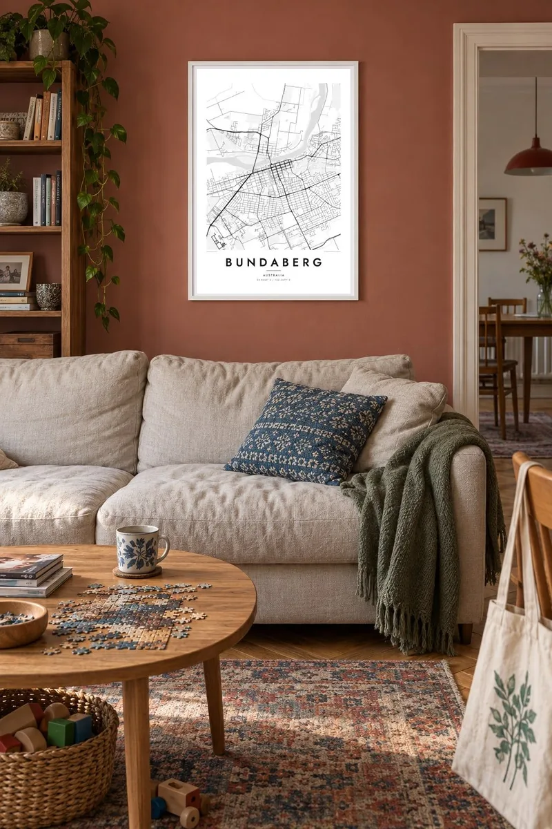
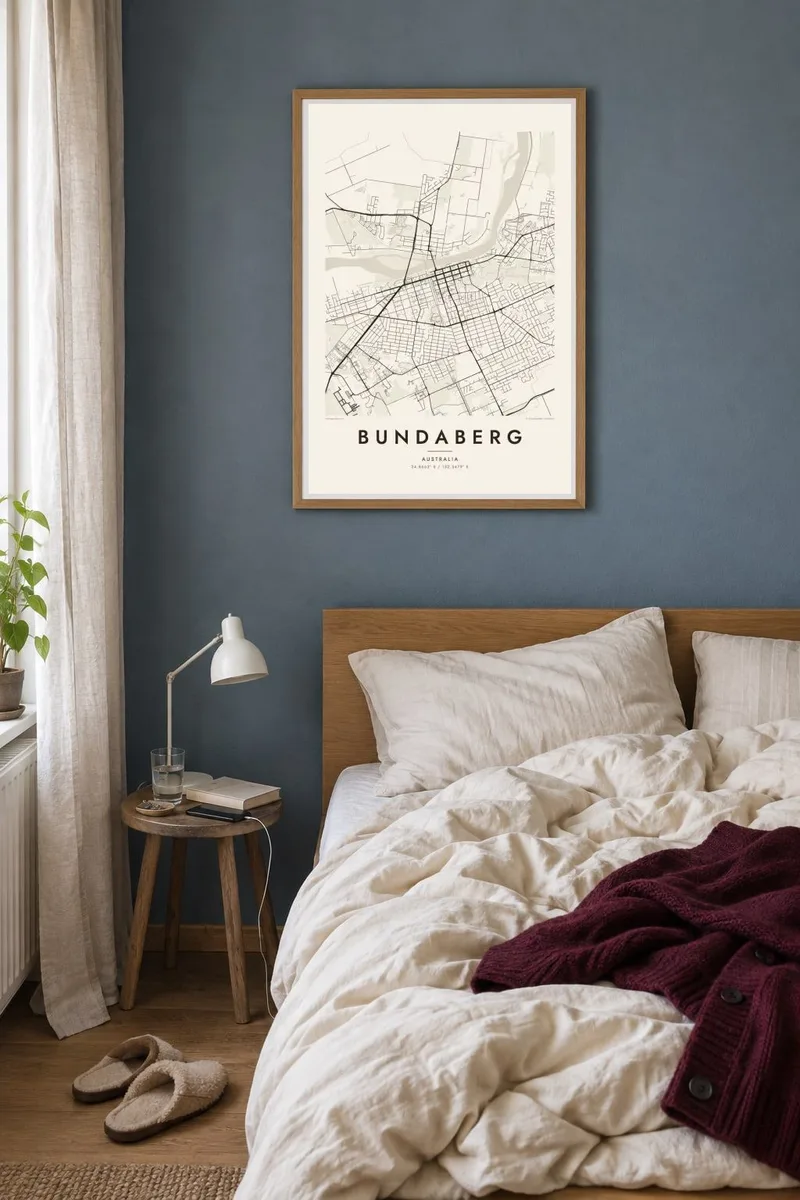
The river sweeps through Bundaberg in a wide curve, separating the central grid from the northern suburbs and giving the poster its strongest natural line.
Minimalist map poster · Australia
24.8662° S / 152.3479° E
A grid town on the Burnett River, ringed by cane fields that run east toward the coast and the southern reef.

One city, five moods
Tap a style to see it on the wall. Every style costs the same — printed, framed or as HD files.
 Actual pixels · 24 × 36″ print file
Print-sharp
This is a 100% crop of the real print file. Every poster — printed, framed or downloaded — is rendered on our servers at 300 DPI, up to 7,200 × 10,800 pixels, so even the smallest lanes stay crisp on a 24 × 36″ print.
On the wall

The map
Bundaberg is laid out as a clear grid on the southern bank of the Burnett River, with bridges crossing to the northern suburbs. The river curves through the map in a broad sweep, giving the town its main natural line. Beyond the built-up area, the land is divided into large, regular sugar cane fields that stretch in every direction.
Sugar has shaped the town's economy for well over a century, and Bundaberg Rum, distilled from local molasses, is known across Australia. The town is also the birthplace of Bert Hinkler, the aviator who made the first solo flight from England to Australia in 1928. His story is still part of local identity and appears in the town's museums.
East of the town, the land reaches the coast at Bargara and Mon Repos, where sea turtles nest on the beach each year. A Bundaberg map poster shows the whole arrangement: river, grid, fields and shoreline, a Queensland town set between farmland and the southern end of the Great Barrier Reef.
The river sweeps through Bundaberg in a wide curve, separating the central grid from the northern suburbs and giving the poster its strongest natural line.
Around the town, sugar cane fields form large rectangles divided by farm roads, an agricultural pattern that frames the urban grid on every side.
To the east, the coastline near Bargara and Mon Repos closes the map, with the beach known for its sea turtle nesting season each year.
Make it yours
Add a date, a name or a line of your own, switch style, size or orientation.
The free preview is low-resolution with a watermark. Prints and HD files are rendered at 300 DPI, up to 7,200 × 10,800 px, without a watermark.
Why Bundaberg
Bundaberg suits locals, cane farming families and anyone who has spent time on the coast watching turtles at Mon Repos. The map captures the town's steady grid and the river that runs through everyone's daily routine.
A family name, a street or an important date can go in the title and subtitle, and the coordinates line can be edited. Five styles are available; Sand echoes the colour of cane fields, and Blueprint suits the river and coast.
Order the Bundaberg poster| Print size | Resolution | Files |
|---|---|---|
| 30 × 40 cm11.8 × 15.7″ | 3,543 × 4,724 px | PNG · PDF |
| 29.7 × 42 cm (A3)11.7 × 16.5″ | 3,508 × 4,961 px | PNG · PDF |
| 42 × 59.4 cm (A2)16.5 × 23.4″ | 4,961 × 7,016 px | PNG · PDF |
| 45.7 × 61 cm18 × 24″ | 5,400 × 7,200 px | PNG · PDF |
| 50 × 70 cm19.7 × 27.6″ | 5,906 × 8,268 px | PNG · PDF |
| 61 × 91.4 cm24 × 36″ | 7,200 × 10,800 px | PNG · PDF |
For comparison, the free preview is 900 px wide, watermarked and meant for screens. The HD files have up to 8× the resolution in each direction and print cleanly at full poster size.
Pick a style at the top of the page, then choose Printed Poster — a size and, if you like, a frame — or Digital HD Files. Checkout takes one step, and your order page updates as soon as the payment goes through.
It is printed on premium 200 gsm matte paper in one of six sizes, from 30 × 40 cm to 24 × 36″. Printed posters start at $39, shipping included.
Yes. Choose a solid wood frame in black, white, natural oak or dark wood. It comes with shatterproof glazing and is ready to hang. Framed posters start at $99, shipping included.
Shipping is free to 60+ countries. Each poster is printed by the nearest of our print partners in 30+ countries and usually arrives in 3–7 business days. You can follow the status and tracking under My Orders. A few countries take 2–5 weeks, and where we don't ship yet, the site tells you before you pay.
Send us a photo within 14 days of delivery and we will reprint it for free or refund you.
Yes. In the editor on this page, change the title, the subtitle and the coordinates line to anything you like, and pick a style and size. Printed, framed and digital orders all use exactly your design.
For $9 you get 300 DPI PNG and print-ready PDF files in all six sizes, without a watermark, to print anywhere. Not sure yet? Download a free watermarked preview first.
Nearby
