The Punic ports
A rectangular basin next to a circular harbour with an island at its centre. These are the traces of the ancient naval and merchant ports, still clearly drawn on the coast.
Minimalist map poster · Tunisia
36.8611° N / 10.3316° E
Ancient harbours, a low hill and a line of seaside villas along the Gulf of Tunis, all in one small frame

One city, five moods
Tap a style to see it on the wall. Every style costs the same — printed, framed or as HD files.
 Actual pixels · 24 × 36″ print file
Print-sharp
This is a 100% crop of the real print file. Every poster — printed, framed or downloaded — is rendered on our servers at 300 DPI, up to 7,200 × 10,800 pixels, so even the smallest lanes stay crisp on a 24 × 36″ print.
On the wall

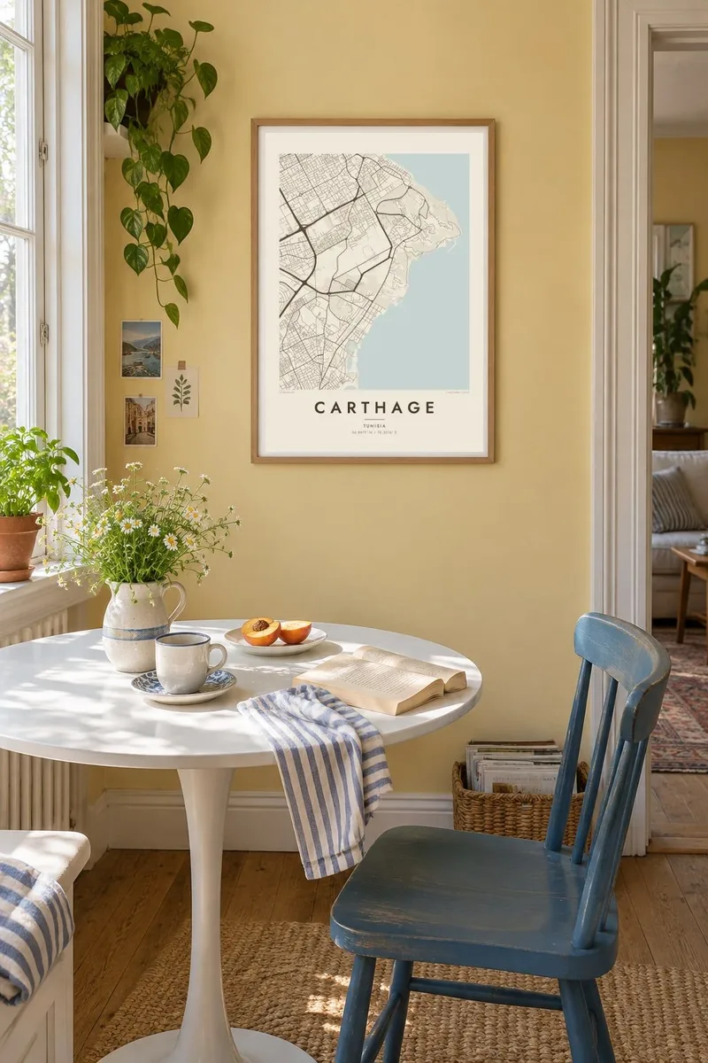
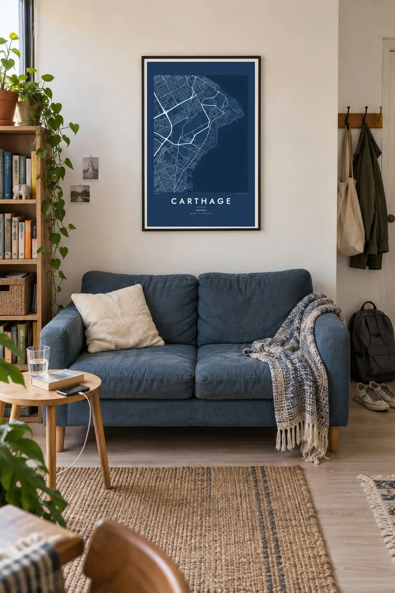
The map
Carthage occupies a short stretch of coast northeast of Tunis, between La Goulette and La Marsa. On a map it looks less like a city than a series of quiet residential streets, with archaeological sites and gardens between them. The shoreline of the Gulf of Tunis runs along one side, and the suburban rail line follows the coast through the neighbourhoods.
This was the capital of the Phoenician and Punic world. Rome destroyed it in 146 BC and later rebuilt it as a Roman city. Its remains, including the Antonine Baths on the waterfront and the settlement on Byrsa Hill, were inscribed as a UNESCO World Heritage Site in 1979. Today the area is also the seat of Tunisia's presidential palace.
The most recognisable detail on a Carthage map poster is the pair of Punic ports: a rectangular commercial basin and, beside it, the round military harbour with its small central island. Few places in the world have a 2,000-year-old outline you can still read on a street map, and these two basins make the print unmistakable.
A rectangular basin next to a circular harbour with an island at its centre. These are the traces of the ancient naval and merchant ports, still clearly drawn on the coast.
The low rise that served as the ancient citadel stands a little inland. Streets wrap around it and the archaeological park sits on top.
The TGM light railway runs parallel to the shore, linking Tunis with La Marsa. It stitches Carthage's stations and villa quarters into one thin line.
Make it yours
Add a date, a name or a line of your own, switch style, size or orientation.
The free preview is low-resolution with a watermark. Prints and HD files are rendered at 300 DPI, up to 7,200 × 10,800 px, without a watermark.
Why Carthage
Carthage appeals to people interested in history, archaeology or the Mediterranean, and to anyone who has walked from the harbours up to Byrsa. The map shows how ancient and modern layers share the same small piece of coast.
You can personalise the title, subtitle and coordinates line, for example with a trip date or a line in Arabic or French. Five styles are available: Classic black & white, Noir, Paper, Blueprint and Sand.
Order the Carthage poster| Print size | Resolution | Files |
|---|---|---|
| 30 × 40 cm11.8 × 15.7″ | 3,543 × 4,724 px | PNG · PDF |
| 29.7 × 42 cm (A3)11.7 × 16.5″ | 3,508 × 4,961 px | PNG · PDF |
| 42 × 59.4 cm (A2)16.5 × 23.4″ | 4,961 × 7,016 px | PNG · PDF |
| 45.7 × 61 cm18 × 24″ | 5,400 × 7,200 px | PNG · PDF |
| 50 × 70 cm19.7 × 27.6″ | 5,906 × 8,268 px | PNG · PDF |
| 61 × 91.4 cm24 × 36″ | 7,200 × 10,800 px | PNG · PDF |
For comparison, the free preview is 900 px wide, watermarked and meant for screens. The HD files have up to 8× the resolution in each direction and print cleanly at full poster size.
Pick a style at the top of the page, then choose Printed Poster — a size and, if you like, a frame — or Digital HD Files. Checkout takes one step, and your order page updates as soon as the payment goes through.
It is printed on premium 200 gsm matte paper in one of six sizes, from 30 × 40 cm to 24 × 36″. Printed posters start at $39, shipping included.
Yes. Choose a solid wood frame in black, white, natural oak or dark wood. It comes with shatterproof glazing and is ready to hang. Framed posters start at $99, shipping included.
Shipping is free to 60+ countries. Each poster is printed by the nearest of our print partners in 30+ countries and usually arrives in 3–7 business days. You can follow the status and tracking under My Orders. A few countries take 2–5 weeks, and where we don't ship yet, the site tells you before you pay.
Send us a photo within 14 days of delivery and we will reprint it for free or refund you.
Yes. In the editor on this page, change the title, the subtitle and the coordinates line to anything you like, and pick a style and size. Printed, framed and digital orders all use exactly your design.
For $9 you get 300 DPI PNG and print-ready PDF files in all six sizes, without a watermark, to print anywhere. Not sure yet? Download a free watermarked preview first.
Nearby
