Ridge-top centre
The core of the town runs along the crest of a ridge. It forms a narrow strip of streets and buildings with steep ground falling away on both sides.
Minimalist map poster · Nepal
27.7763° N / 85.7127° E
A hill town strung along a ridge in Sindhupalchok, its roads following the contours rather than any grid.

One city, five moods
Tap a style to see it on the wall. Every style costs the same — printed, framed or as HD files.
 Actual pixels · 24 × 36″ print file
Print-sharp
This is a 100% crop of the real print file. Every poster — printed, framed or downloaded — is rendered on our servers at 300 DPI, up to 7,200 × 10,800 pixels, so even the smallest lanes stay crisp on a 24 × 36″ print.
On the wall


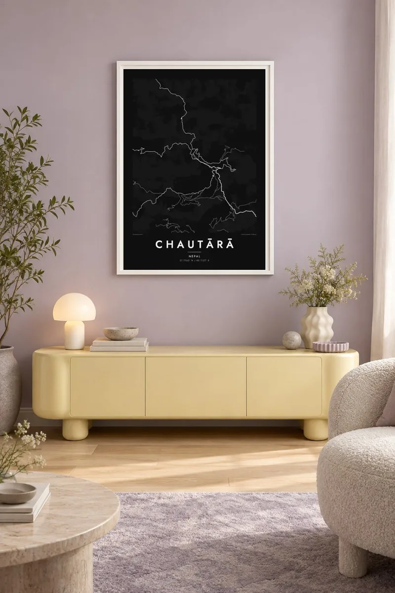
The map
Chautārā sits high on a ridge in Nepal's Bagmati Province and is the administrative headquarters of Sindhupalchok District. From above, the town is a thin band of built-up ground that follows the crest. Its roads bend around spurs and drop in switchbacks toward the valleys on either side. There is no grid here. The slope decides where every street goes.
The municipality reaches well beyond the central bazaar, taking in terraced hillsides, scattered villages and farm tracks that trace the folds of the land. On a map this makes a fine web of lines that follow the contours, dense near the ridge top and thinning as the ground falls away. The Chautārā map poster captures the contrast between a compact centre and the loose, branching pattern of the hills around it.
Sindhupalchok was among the districts hit hardest by the 2015 Gorkha earthquake, and Chautārā became a centre for relief and rebuilding in the months that followed. Much of what the map shows today reflects that period of reconstruction. The roads linking the town to the rest of the district and on toward the Kathmandu Valley are among the clearest lines in the composition.
The core of the town runs along the crest of a ridge. It forms a narrow strip of streets and buildings with steep ground falling away on both sides.
Roads leaving the town zigzag down the slopes in tight hairpins. On the poster they form one of its most striking graphic patterns.
Around the centre, farm tracks and footpaths follow the terraced slopes, so the edges of the municipality are drawn in soft, flowing lines.
Make it yours
Add a date, a name or a line of your own, switch style, size or orientation.
The free preview is low-resolution with a watermark. Prints and HD files are rendered at 300 DPI, up to 7,200 × 10,800 px, without a watermark.
Why Chautārā
For people from Sindhupalchok, or anyone who has worked or trekked in these hills, this map records a place shaped by its terrain. The ridge line and looping roads make a quiet, graphic image that works on a wall without colour or labels to explain it.
You can change the title, subtitle and coordinates line to add a family name or a date that matters. Then choose one of five styles: Classic black & white, Noir, Paper, Blueprint or Sand. The $9 digital set includes six print sizes, each as a 300 DPI PNG and a print-ready PDF.
Order the Chautārā poster| Print size | Resolution | Files |
|---|---|---|
| 30 × 40 cm11.8 × 15.7″ | 3,543 × 4,724 px | PNG · PDF |
| 29.7 × 42 cm (A3)11.7 × 16.5″ | 3,508 × 4,961 px | PNG · PDF |
| 42 × 59.4 cm (A2)16.5 × 23.4″ | 4,961 × 7,016 px | PNG · PDF |
| 45.7 × 61 cm18 × 24″ | 5,400 × 7,200 px | PNG · PDF |
| 50 × 70 cm19.7 × 27.6″ | 5,906 × 8,268 px | PNG · PDF |
| 61 × 91.4 cm24 × 36″ | 7,200 × 10,800 px | PNG · PDF |
For comparison, the free preview is 900 px wide, watermarked and meant for screens. The HD files have up to 8× the resolution in each direction and print cleanly at full poster size.
Pick a style at the top of the page, then choose Printed Poster — a size and, if you like, a frame — or Digital HD Files. Checkout takes one step, and your order page updates as soon as the payment goes through.
It is printed on premium 200 gsm matte paper in one of six sizes, from 30 × 40 cm to 24 × 36″. Printed posters start at $39, shipping included.
Yes. Choose a solid wood frame in black, white, natural oak or dark wood. It comes with shatterproof glazing and is ready to hang. Framed posters start at $99, shipping included.
Shipping is free to 60+ countries. Each poster is printed by the nearest of our print partners in 30+ countries and usually arrives in 3–7 business days. You can follow the status and tracking under My Orders. A few countries take 2–5 weeks, and where we don't ship yet, the site tells you before you pay.
Send us a photo within 14 days of delivery and we will reprint it for free or refund you.
Yes. In the editor on this page, change the title, the subtitle and the coordinates line to anything you like, and pick a style and size. Printed, framed and digital orders all use exactly your design.
For $9 you get 300 DPI PNG and print-ready PDF files in all six sizes, without a watermark, to print anywhere. Not sure yet? Download a free watermarked preview first.
Nearby
