Cidade Industrial
The industrial district on the border with Belo Horizonte appears as a zone of large lots and wide roads, clearly different from the tight residential streets around it.
Minimalist map poster · Brazil
19.9317° S / 44.0536° W
A hilly industrial city on Belo Horizonte's western edge, where factory districts, dense neighbourhoods and a reservoir share the map.

One city, five moods
Tap a style to see it on the wall. Every style costs the same — printed, framed or as HD files.
 Actual pixels · 24 × 36″ print file
Print-sharp
This is a 100% crop of the real print file. Every poster — printed, framed or downloaded — is rendered on our servers at 300 DPI, up to 7,200 × 10,800 pixels, so even the smallest lanes stay crisp on a 24 × 36″ print.
On the wall
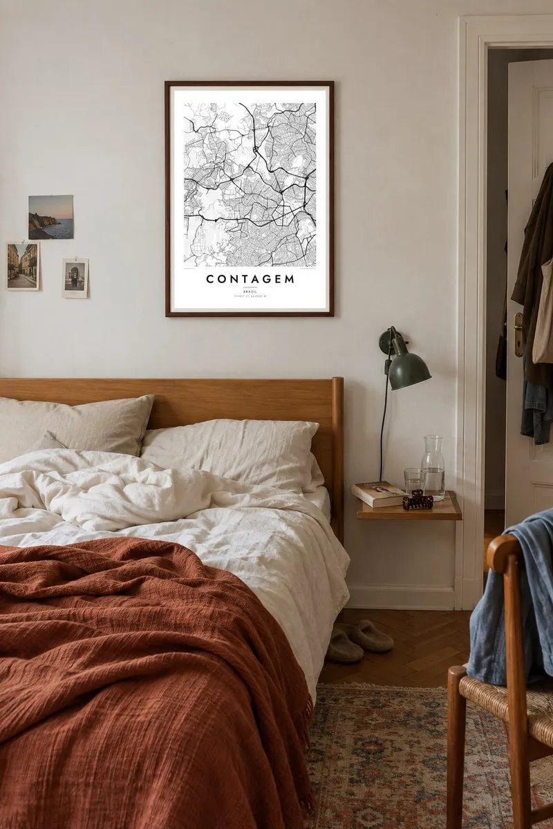


The map
Contagem borders Belo Horizonte to the west and belongs to the same continuous metropolitan area. The hills of central Minas Gerais shape its map: streets climb and wind along slopes, main roads follow the valleys, and neighbourhoods fill almost every available piece of ground. Major highways, including the BR-381 toward São Paulo, cut through the city.
The city grew quickly from the 1940s, when the Cidade Industrial was created on its border with Belo Horizonte and drew factories and workers from across Brazil. It became one of the most important industrial centres in Minas Gerais. Its name comes from an old colonial checkpoint, a contagem, where goods moving through the region were counted and taxed.
A Contagem map poster shows a city shaped by terrain rather than by a plan: irregular blocks, streets that curve with the hills, broad industrial lots and the outline of the Vargem das Flores reservoir to the north-west. The result is dense and textured, a good fit for anyone who likes busy, intricate maps.
The industrial district on the border with Belo Horizonte appears as a zone of large lots and wide roads, clearly different from the tight residential streets around it.
This reservoir, shared with neighbouring Betim, spreads its irregular arms across the rural north-west of the municipality and adds a large water shape to the map.
Across the city, roads twist along ridges and valleys, and many neighbourhoods form irregular, organic patterns that follow the steep terrain of central Minas.
Make it yours
Add a date, a name or a line of your own, switch style, size or orientation.
The free preview is low-resolution with a watermark. Prints and HD files are rendered at 300 DPI, up to 7,200 × 10,800 px, without a watermark.
Why Contagem
Contagem is home to hundreds of thousands of people and often lives in the shadow of the state capital. A map of the city itself gives it its own identity on the wall, whether as a gift for a family or a reminder of where a career began.
Customise the title, subtitle and coordinates line, perhaps with the name of a bairro, and choose from five styles, from Classic black & white to Noir or Sand. Buy the $9 HD files or order a printed poster on matte paper, framed if you prefer.
Order the Contagem poster| Print size | Resolution | Files |
|---|---|---|
| 30 × 40 cm11.8 × 15.7″ | 3,543 × 4,724 px | PNG · PDF |
| 29.7 × 42 cm (A3)11.7 × 16.5″ | 3,508 × 4,961 px | PNG · PDF |
| 42 × 59.4 cm (A2)16.5 × 23.4″ | 4,961 × 7,016 px | PNG · PDF |
| 45.7 × 61 cm18 × 24″ | 5,400 × 7,200 px | PNG · PDF |
| 50 × 70 cm19.7 × 27.6″ | 5,906 × 8,268 px | PNG · PDF |
| 61 × 91.4 cm24 × 36″ | 7,200 × 10,800 px | PNG · PDF |
For comparison, the free preview is 900 px wide, watermarked and meant for screens. The HD files have up to 8× the resolution in each direction and print cleanly at full poster size.
Pick a style at the top of the page, then choose Printed Poster — a size and, if you like, a frame — or Digital HD Files. Checkout takes one step, and your order page updates as soon as the payment goes through.
It is printed on premium 200 gsm matte paper in one of six sizes, from 30 × 40 cm to 24 × 36″. Printed posters start at $39, shipping included.
Yes. Choose a solid wood frame in black, white, natural oak or dark wood. It comes with shatterproof glazing and is ready to hang. Framed posters start at $99, shipping included.
Shipping is free to 60+ countries. Each poster is printed by the nearest of our print partners in 30+ countries and usually arrives in 3–7 business days. You can follow the status and tracking under My Orders. A few countries take 2–5 weeks, and where we don't ship yet, the site tells you before you pay.
Send us a photo within 14 days of delivery and we will reprint it for free or refund you.
Yes. In the editor on this page, change the title, the subtitle and the coordinates line to anything you like, and pick a style and size. Printed, framed and digital orders all use exactly your design.
For $9 you get 300 DPI PNG and print-ready PDF files in all six sizes, without a watermark, to print anywhere. Not sure yet? Download a free watermarked preview first.
Nearby
