Cap-Vert peninsula
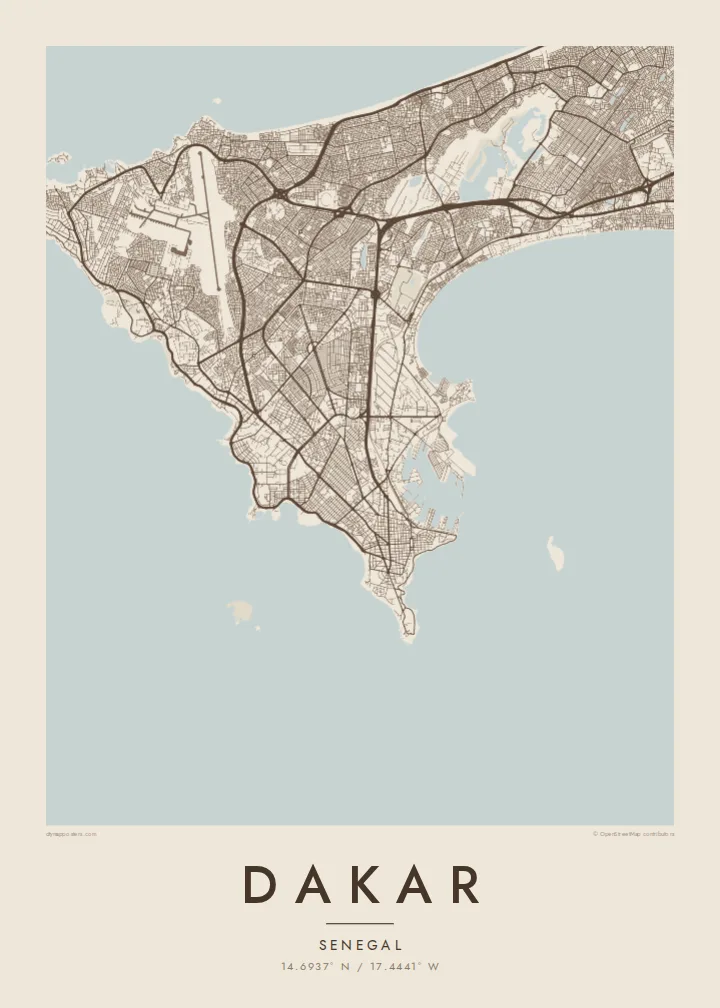
The city fills a hooked peninsula, with ocean on three sides and the mainland to the east, creating a strong, compact silhouette on the page.
Minimalist map poster · Senegal
A city at the tip of a peninsula reaching into the Atlantic, the westernmost point of mainland Africa.
14.6937° N / 17.4441° W


One city, five moods
Tap a style to see it on the wall. Every style is included in the same $9 price.
 Actual pixels · 24 × 36″ HD file
Print-sharp
This is a crop of the real HD file at 100%. The paid download is rendered on our servers at 300 DPI, up to 7,200 × 10,800 pixels, so even the smallest lanes stay crisp on a 24 × 36″ print.
The map
Dakar occupies the Cap-Vert peninsula, which pushes out into the Atlantic from the coast of Senegal. At its western end, the Pointe des Almadies is the westernmost point of the African mainland. On a map the city is almost surrounded by water, with the open ocean along the north and west and a sheltered bay and harbour to the south and east.
The historic centre, known as the Plateau, sits on the southern tip, with a regular colonial-era street grid, the port and the main government buildings. From there, the city extends north and west across the peninsula in a mix of planned districts and older neighbourhoods, and coastal roads follow the cliffs and beaches around the edges.
Near the western shore rise the two Mamelles hills, one topped by a lighthouse and the other by the African Renaissance Monument. Offshore lies the small island of Gorée, a UNESCO site associated with the Atlantic slave trade. A Dakar map poster includes that scatter of islands and headlands, which gives the city one of the most recognisable outlines in West Africa.
The city fills a hooked peninsula, with ocean on three sides and the mainland to the east, creating a strong, compact silhouette on the page.
At the southern tip, a tight grid of streets marks the old centre and administrative quarter, set right beside the port and the sheltered harbour.
Small islands sit off the coast, Gorée to the southeast near the harbour and Ngor off the western tip, adding details that frame the peninsula.
Make it yours
Add a date, a name or a line of your own, switch style, size or orientation.
Free preview is low-resolution with a watermark. The HD version is 7,200 × 10,800 px, 300 DPI, no watermark.
Why Dakar
Dakar is a place people leave and return to, whether for work, family or study, and its peninsula shape is instantly recognisable. A map of the city holds the coastline, the Plateau and the islands in a single calm image.
Make it personal with a title, a subtitle and your own coordinates, perhaps naming a quarter or a date. Five styles are available, including Paper and Sand for warmer rooms, and the HD download covers six print sizes as 300 DPI PNG and PDF files.
Get the Dakar poster — $9| Print size | Resolution | Files |
|---|---|---|
| 30 × 40 cm | 3,543 × 4,724 px | PNG · PDF |
| 50 × 70 cm | 5,906 × 8,268 px | PNG · PDF |
| A3 · 29.7 × 42 cm | 3,508 × 4,961 px | PNG · PDF |
| A2 · 42 × 59.4 cm | 4,961 × 7,016 px | PNG · PDF |
| 18 × 24" | 5,400 × 7,200 px | PNG · PDF |
| 24 × 36" | 7,200 × 10,800 px | PNG · PDF |
For comparison, the free preview is 900 px wide, watermarked and meant for screens. The HD files have up to 8× the resolution in each direction and print cleanly at full poster size.
Yes. Drag and zoom the map in the editor — centre it on your neighbourhood, the old town or the whole metro area. The text updates independently.
The HD purchase includes 30×40 cm, 50×70 cm, A3, A2, 18×24″ and 24×36″, each as a 300 DPI PNG and a print-ready PDF.
You can download a free 900 px preview with a watermark. The paid HD files have no watermark and are sharp enough for large prints.
Send the PDF to any local print shop or online printing service and ask for the matching paper size. Matte paper and a thin black or oak frame suit this style best.
Nearby
