City walls
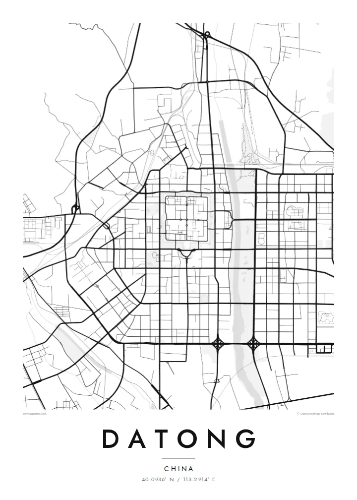
The restored ramparts enclose an almost square old town. The crisp outline anchors the whole map and makes the historic centre instantly recognisable.
Minimalist map poster · China
40.0936° N / 113.2914° E
A walled city on a northern plain, its square old town enclosed by restored ramparts, with the Yungang cliffs to the west.
One city, five moods
Tap a style to see it on the wall. Every style costs the same — printed, framed or as HD files.
 Actual pixels · 24 × 36″ print file
Print-sharp
This is a 100% crop of the real print file. Every poster — printed, framed or downloaded — is rendered on our servers at 300 DPI, up to 7,200 × 10,800 pixels, so even the smallest lanes stay crisp on a 24 × 36″ print.
On the wall


The map
Datong lies in the far north of Shanxi, close to the Great Wall, on a high plain beside the Yu River. Its historic centre is one of the clearest shapes on any Chinese city map. Restored city walls form a near-square enclosure, straight streets divide it into quarters, and the modern city spreads out beyond it in every direction.
From the late fourth century the city was Pingcheng, capital of the Northern Wei dynasty. Its importance in that period explains the Yungang Grottoes, a UNESCO World Heritage Site of Buddhist cave temples carved into sandstone cliffs west of the city. Inside the walls, the Nine-Dragon Screen, a large glazed-tile wall, and Huayan Monastery date from later dynasties.
Datong has long been a coal city, and mines and rail yards still shape its surroundings. Within the wider municipality, the Hanging Temple clings to a cliff face near Mount Heng. A Datong map poster focuses on the city itself. The square walled town sits at the centre like a compass rose within a wider grid of modern streets.
The restored ramparts enclose an almost square old town. The crisp outline anchors the whole map and makes the historic centre instantly recognisable.
Inside the walls, main streets divide the old town into quarters, and finer lanes fill each section. This classic northern Chinese plan is clearly readable from above.
The river runs along the eastern side of the city, with parks along its banks and newer districts extending to the opposite shore.
Make it yours
Add a date, a name or a line of your own, switch style, size or orientation.
The free preview is low-resolution with a watermark. Prints and HD files are rendered at 300 DPI, up to 7,200 × 10,800 px, without a watermark.
Why Datong
Datong appeals to anyone with ties to northern Shanxi and to people interested in Chinese architecture and city planning. The squared old town is graphic enough to work as a design piece, even for someone who has never visited.
Edit the title, subtitle and coordinates to suit the room or the occasion. Paper and Sand bring out the old-town feel, Classic black & white and Noir keep it sharp, and Blueprint rounds out the five styles. Try the free watermarked preview before you buy.
Order the Datong poster| Print size | Resolution | Files |
|---|---|---|
| 30 × 40 cm11.8 × 15.7″ | 3,543 × 4,724 px | PNG · PDF |
| 29.7 × 42 cm (A3)11.7 × 16.5″ | 3,508 × 4,961 px | PNG · PDF |
| 42 × 59.4 cm (A2)16.5 × 23.4″ | 4,961 × 7,016 px | PNG · PDF |
| 45.7 × 61 cm18 × 24″ | 5,400 × 7,200 px | PNG · PDF |
| 50 × 70 cm19.7 × 27.6″ | 5,906 × 8,268 px | PNG · PDF |
| 61 × 91.4 cm24 × 36″ | 7,200 × 10,800 px | PNG · PDF |
For comparison, the free preview is 900 px wide, watermarked and meant for screens. The HD files have up to 8× the resolution in each direction and print cleanly at full poster size.
Pick a style at the top of the page, then choose Printed Poster — a size and, if you like, a frame — or Digital HD Files. Checkout takes one step, and your order page updates as soon as the payment goes through.
It is printed on premium 200 gsm matte paper in one of six sizes, from 30 × 40 cm to 24 × 36″. Printed posters start at $39, shipping included.
Yes. Choose a solid wood frame in black, white, natural oak or dark wood. It comes with shatterproof glazing and is ready to hang. Framed posters start at $99, shipping included.
Shipping is free to 60+ countries. Each poster is printed by the nearest of our print partners in 30+ countries and usually arrives in 3–7 business days. You can follow the status and tracking under My Orders. A few countries take 2–5 weeks, and where we don't ship yet, the site tells you before you pay.
Send us a photo within 14 days of delivery and we will reprint it for free or refund you.
Yes. In the editor on this page, change the title, the subtitle and the coordinates line to anything you like, and pick a style and size. Printed, framed and digital orders all use exactly your design.
For $9 you get 300 DPI PNG and print-ready PDF files in all six sizes, without a watermark, to print anywhere. Not sure yet? Download a free watermarked preview first.
Nearby
