Fan-shaped outline
The curved edge of the former island is still the defining feature. Its clear arc among straighter blocks makes the site easy to recognise from above.
Minimalist map poster · Japan
32.7436° N / 129.8730° E
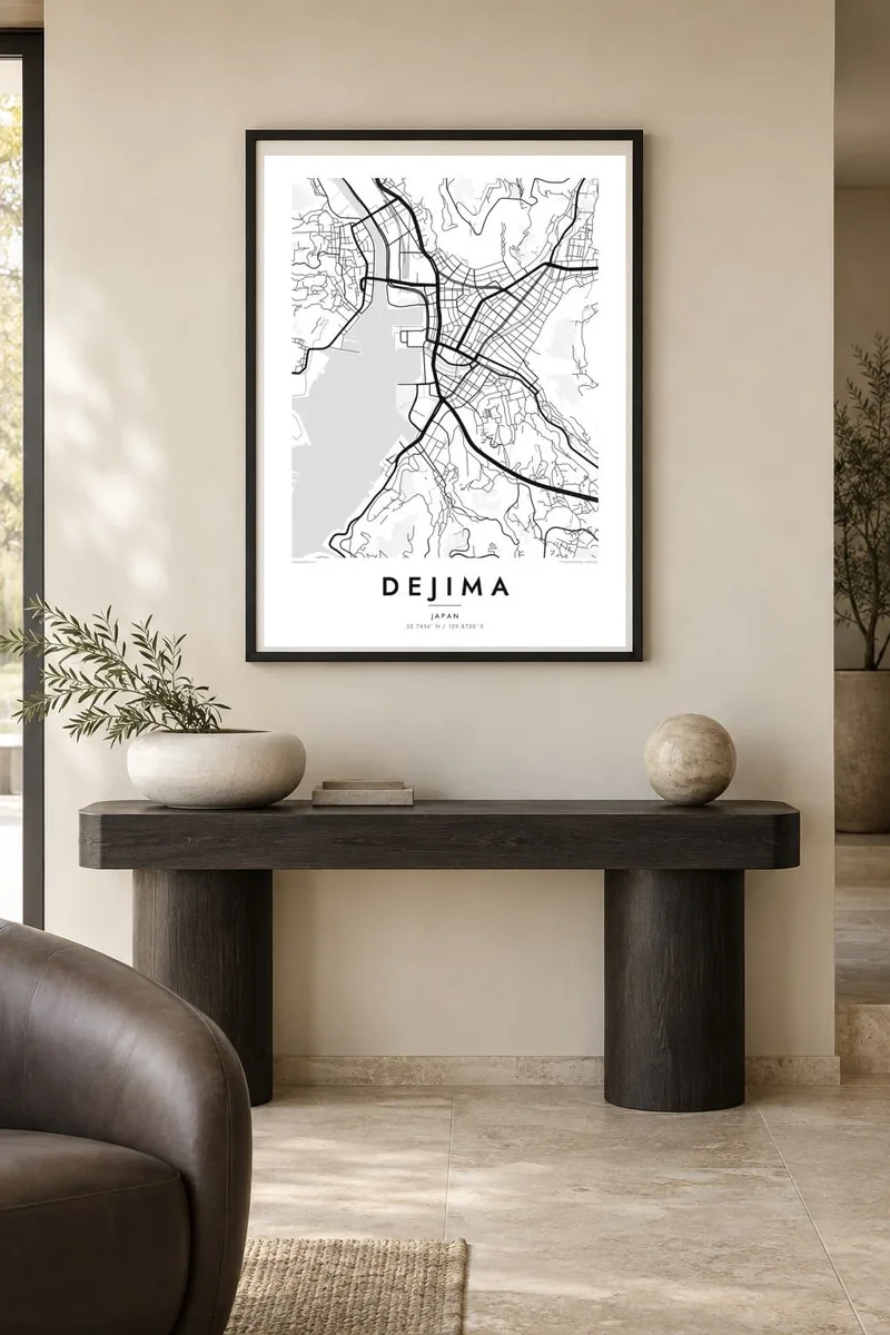
A small fan-shaped former island, now surrounded by land, whose outline survives among the waterfront streets of central Nagasaki.

One city, five moods
Tap a style to see it on the wall. Every style costs the same — printed, framed or as HD files.
 Actual pixels · 24 × 36″ print file
Print-sharp
This is a 100% crop of the real print file. Every poster — printed, framed or downloaded — is rendered on our servers at 300 DPI, up to 7,200 × 10,800 pixels, so even the smallest lanes stay crisp on a 24 × 36″ print.
On the wall


The district
Dejima was built in 1634 as an artificial island in Nagasaki harbour, shaped like an open fan and joined to the shore by a single bridge. From 1641 it housed the Dutch trading post. For more than two centuries it was one of the very few points of contact between Japan and Europe, during the long period of restricted foreign relations.
Over time the harbour was filled in around it, and the island was absorbed into the city. Today Dejima sits inland beside the Nakashima River, surrounded by roads and tram lines. Its curved outline is still visible on a map, set apart from the straight blocks of the modern waterfront. The site has been gradually restored, with reconstructed warehouses and residences.
Through Dejima came books, instruments and ideas that influenced Japanese science and medicine, a body of study known as rangaku, or Dutch learning. A Dejima map poster shows this small but significant shape in its setting: the fan-shaped former island embedded in the streets of Nagasaki, with the harbour and the surrounding hills close by.
The curved edge of the former island is still the defining feature. Its clear arc among straighter blocks makes the site easy to recognise from above.
The river runs along one side of Dejima, a reminder of the water that surrounded the island before the harbour around it was filled in.
The deep, narrow harbour lies close by, flanked by steep hills. It places Dejima within the wider setting that once made it a gateway for foreign trade.
Make it yours
Add a date, a name or a line of your own, switch style, size or orientation.
The free preview is low-resolution with a watermark. Prints and HD files are rendered at 300 DPI, up to 7,200 × 10,800 px, without a watermark.
Why Dejima
Dejima appeals to historians, travellers and anyone with ties between Japan and the Netherlands. It is a small place with a large story, and it makes a thoughtful poster for a study, especially with the surrounding streets and harbour shown for context.
Add your own title and subtitle, perhaps a travel date, edit the coordinates line and choose one of five styles. Paper and Sand suit the historical subject, while Blueprint brings out the geometry of the former island.
Order the Dejima poster| Print size | Resolution | Files |
|---|---|---|
| 30 × 40 cm11.8 × 15.7″ | 3,543 × 4,724 px | PNG · PDF |
| 29.7 × 42 cm (A3)11.7 × 16.5″ | 3,508 × 4,961 px | PNG · PDF |
| 42 × 59.4 cm (A2)16.5 × 23.4″ | 4,961 × 7,016 px | PNG · PDF |
| 45.7 × 61 cm18 × 24″ | 5,400 × 7,200 px | PNG · PDF |
| 50 × 70 cm19.7 × 27.6″ | 5,906 × 8,268 px | PNG · PDF |
| 61 × 91.4 cm24 × 36″ | 7,200 × 10,800 px | PNG · PDF |
For comparison, the free preview is 900 px wide, watermarked and meant for screens. The HD files have up to 8× the resolution in each direction and print cleanly at full poster size.
Pick a style at the top of the page, then choose Printed Poster — a size and, if you like, a frame — or Digital HD Files. Checkout takes one step, and your order page updates as soon as the payment goes through.
It is printed on premium 200 gsm matte paper in one of six sizes, from 30 × 40 cm to 24 × 36″. Printed posters start at $39, shipping included.
Yes. Choose a solid wood frame in black, white, natural oak or dark wood. It comes with shatterproof glazing and is ready to hang. Framed posters start at $99, shipping included.
Shipping is free to 60+ countries. Each poster is printed by the nearest of our print partners in 30+ countries and usually arrives in 3–7 business days. You can follow the status and tracking under My Orders. A few countries take 2–5 weeks, and where we don't ship yet, the site tells you before you pay.
Send us a photo within 14 days of delivery and we will reprint it for free or refund you.
Yes. In the editor on this page, change the title, the subtitle and the coordinates line to anything you like, and pick a style and size. Printed, framed and digital orders all use exactly your design.
For $9 you get 300 DPI PNG and print-ready PDF files in all six sizes, without a watermark, to print anywhere. Not sure yet? Download a free watermarked preview first.
Nearby
