River confluence
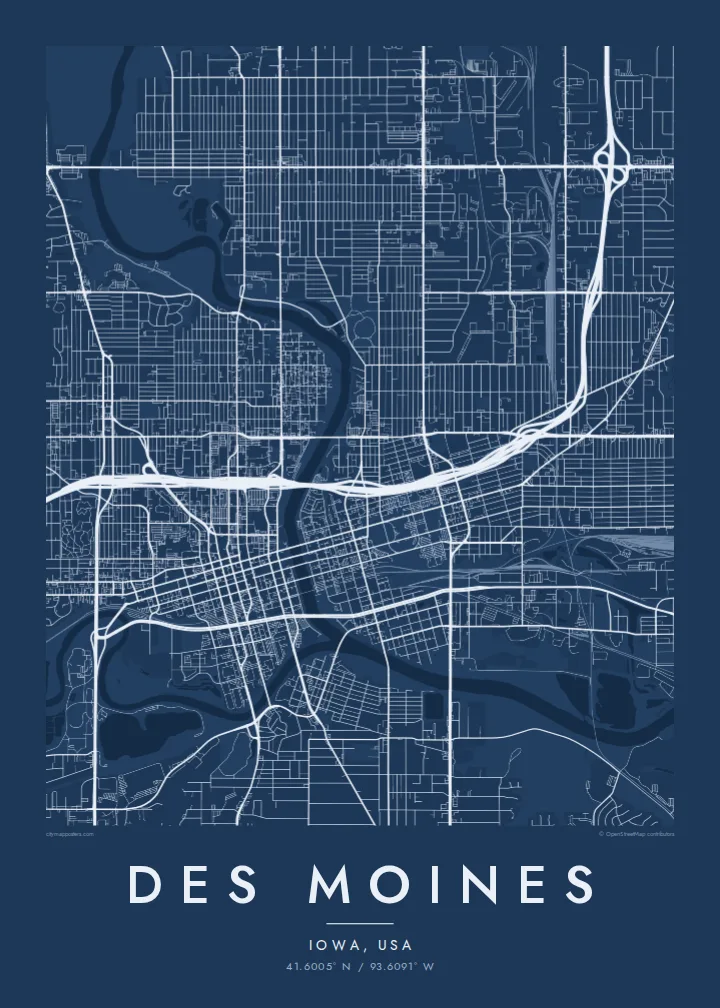
The Raccoon joins the Des Moines River just south of downtown, creating a Y-shaped meeting of water that anchors the whole composition.
Minimalist map poster · United States
A capital city where two rivers meet, with a compact downtown grid and a gold-domed capitol on the east bank.
41.6005° N / 93.6091° W



One city, five moods
Tap a style to see it on the wall. Every style is included in the same $9 price.
 Actual pixels · 24 × 36″ HD file
Print-sharp
This is a crop of the real HD file at 100%. The paid download is rendered on our servers at 300 DPI, up to 7,200 × 10,800 pixels, so even the smallest lanes stay crisp on a 24 × 36″ print.
The map
Des Moines, the capital of Iowa, grew at the confluence of the Des Moines and Raccoon rivers, and the two waterways still organise its map. The Des Moines River runs north to south through the centre, the Raccoon joins it from the west just below downtown, and together they split the city into distinct east and west sides linked by a series of bridges.
Downtown sits on the west bank in a tight, regular grid, connected above street level by an extensive network of enclosed skywalks. Across the river, the State Capitol stands on a rise at the end of a long axis, its gilded central dome one of the most recognisable landmarks in the Midwest. Beyond the core, residential grids extend across gently rolling prairie.
Des Moines is a major centre of the insurance industry, and each presidential cycle it draws national attention as the base of the Iowa caucuses. Parks and trails follow the rivers, and Gray's Lake forms a neat pool of open water south of downtown. A Des Moines map poster brings these rivers, grids and green spaces together in a balanced, legible composition.
The Raccoon joins the Des Moines River just south of downtown, creating a Y-shaped meeting of water that anchors the whole composition.
On the east side, the State Capitol grounds form a formal rectangle on higher ground, facing downtown across the river along a straight line of approach.
A lake and park south of downtown, circled by a walking trail, adding a clean patch of open water between the rivers and the street grid.
Make it yours
Add a date, a name or a line of your own, switch style, size or orientation.
Free preview is low-resolution with a watermark. The HD version is 7,200 × 10,800 px, 300 DPI, no watermark.
Why Des Moines
Des Moines is the kind of city people come to for work and end up calling home. Its map suits a first house on the east side, a graduation from Drake University or a long career downtown, and it reads well from across the room.
Set the title and subtitle to a name, neighbourhood or date, keep or edit the coordinates line, and choose one of five styles. Blueprint makes the rivers crisp, while Paper and Sand suit a warmer, more domestic setting.
Get the Des Moines poster — $9| Print size | Resolution | Files |
|---|---|---|
| 30 × 40 cm | 3,543 × 4,724 px | PNG · PDF |
| 50 × 70 cm | 5,906 × 8,268 px | PNG · PDF |
| A3 · 29.7 × 42 cm | 3,508 × 4,961 px | PNG · PDF |
| A2 · 42 × 59.4 cm | 4,961 × 7,016 px | PNG · PDF |
| 18 × 24" | 5,400 × 7,200 px | PNG · PDF |
| 24 × 36" | 7,200 × 10,800 px | PNG · PDF |
For comparison, the free preview is 900 px wide, watermarked and meant for screens. The HD files have up to 8× the resolution in each direction and print cleanly at full poster size.
Yes. Drag and zoom the map in the editor — centre it on your neighbourhood, the old town or the whole metro area. The text updates independently.
The HD purchase includes 30×40 cm, 50×70 cm, A3, A2, 18×24″ and 24×36″, each as a 300 DPI PNG and a print-ready PDF.
You can download a free 900 px preview with a watermark. The paid HD files have no watermark and are sharp enough for large prints.
Send the PDF to any local print shop or online printing service and ask for the matching paper size. Matte paper and a thin black or oak frame suit this style best.
Nearby
