Meeting of valleys
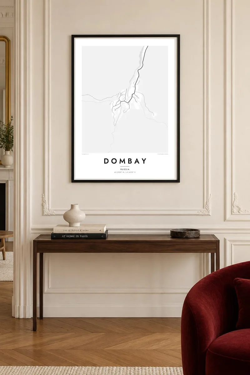
Several mountain streams join near the village. They form a branching pattern of rivers that gives the map its structure and points the eye toward the glaciers above.
Minimalist map poster · Russia
43.2900° N / 41.6239° E
A mountain village where glacial valleys meet, hemmed in by the jagged peaks of the western Greater Caucasus.

One city, five moods
Tap a style to see it on the wall. Every style costs the same — printed, framed or as HD files.
 Actual pixels · 24 × 36″ print file
Print-sharp
This is a 100% crop of the real print file. Every poster — printed, framed or downloaded — is rendered on our servers at 300 DPI, up to 7,200 × 10,800 pixels, so even the smallest lanes stay crisp on a 24 × 36″ print.
On the wall


The resort
Dombay is a mountain resort in Karachay-Cherkessia, in the western part of the Greater Caucasus. From above it sits where several valleys meet near the head of the Teberda river, with a small cluster of hotels and a road following the valley north. Steep ridges close in on all sides, and glaciers feed the streams that come together near the village.
The resort lies in the protected mountain landscape of the Teberda reserve. Its skyline is dominated by Dombay-Ulgen, the highest peak in the area at just over 4,000 metres, and by the distinctive profile of Belalakaya. Lifts climb the slopes of Mussa-Achitara, giving wide views across the surrounding peaks and glaciers.
A Dombay map poster is dramatic even in black and white. The village and its short streets take up only a small part of the frame, while rivers branch upward into narrow side valleys toward the glaciers. The composition feels enclosed and vertical, closer to a mountaineering map than a resort plan. It suits anyone who remembers the walls of rock closing in around them.
Several mountain streams join near the village. They form a branching pattern of rivers that gives the map its structure and points the eye toward the glaciers above.
The lift lines climbing from the village up Mussa-Achitara are the main man-made feature on the slopes, straight strokes crossing otherwise untouched terrain.
The single road into the resort follows the Teberda valley north toward the town of Teberda. This long, winding line is the village's only connection to the lowlands.
Make it yours
Add a date, a name or a line of your own, switch style, size or orientation.
The free preview is low-resolution with a watermark. Prints and HD files are rendered at 300 DPI, up to 7,200 × 10,800 px, without a watermark.
Why Dombay
Climbers, hikers and skiers who have spent time beneath Dombay-Ulgen often want a simple, exact record of it. The personalised title, subtitle and coordinates line turn the map into a note of a specific trip or ascent.
Choose Classic black & white, Noir, Paper, Blueprint or Sand. Blueprint brings out the branching rivers nicely. The $9 digital files come in six sizes, each as a 300 DPI PNG and a print-ready PDF with no watermark, ready for a local print shop.
Order the Dombay poster| Print size | Resolution | Files |
|---|---|---|
| 30 × 40 cm11.8 × 15.7″ | 3,543 × 4,724 px | PNG · PDF |
| 29.7 × 42 cm (A3)11.7 × 16.5″ | 3,508 × 4,961 px | PNG · PDF |
| 42 × 59.4 cm (A2)16.5 × 23.4″ | 4,961 × 7,016 px | PNG · PDF |
| 45.7 × 61 cm18 × 24″ | 5,400 × 7,200 px | PNG · PDF |
| 50 × 70 cm19.7 × 27.6″ | 5,906 × 8,268 px | PNG · PDF |
| 61 × 91.4 cm24 × 36″ | 7,200 × 10,800 px | PNG · PDF |
For comparison, the free preview is 900 px wide, watermarked and meant for screens. The HD files have up to 8× the resolution in each direction and print cleanly at full poster size.
Pick a style at the top of the page, then choose Printed Poster — a size and, if you like, a frame — or Digital HD Files. Checkout takes one step, and your order page updates as soon as the payment goes through.
It is printed on premium 200 gsm matte paper in one of six sizes, from 30 × 40 cm to 24 × 36″. Printed posters start at $39, shipping included.
Yes. Choose a solid wood frame in black, white, natural oak or dark wood. It comes with shatterproof glazing and is ready to hang. Framed posters start at $99, shipping included.
Shipping is free to 60+ countries. Each poster is printed by the nearest of our print partners in 30+ countries and usually arrives in 3–7 business days. You can follow the status and tracking under My Orders. A few countries take 2–5 weeks, and where we don't ship yet, the site tells you before you pay.
Send us a photo within 14 days of delivery and we will reprint it for free or refund you.
Yes. In the editor on this page, change the title, the subtitle and the coordinates line to anything you like, and pick a style and size. Printed, framed and digital orders all use exactly your design.
For $9 you get 300 DPI PNG and print-ready PDF files in all six sizes, without a watermark, to print anywhere. Not sure yet? Download a free watermarked preview first.
Nearby
