The airport
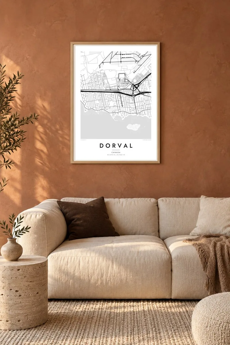
Crossing runways and taxiways form the largest shape on the map, a striking piece of geometry set right beside ordinary suburban streets.
Minimalist map poster · Canada
45.4473° N / 73.7533° W
A lakeside suburb on the island of Montreal, edged by Lac Saint-Louis and dominated by the long runways of the airport

One city, five moods
Tap a style to see it on the wall. Every style costs the same — printed, framed or as HD files.
 Actual pixels · 24 × 36″ print file
Print-sharp
This is a 100% crop of the real print file. Every poster — printed, framed or downloaded — is rendered on our servers at 300 DPI, up to 7,200 × 10,800 pixels, so even the smallest lanes stay crisp on a 24 × 36″ print.
On the wall


The map
Dorval stretches along the southern shore of the island of Montreal, facing Lac Saint-Louis, a widening of the St. Lawrence. The map falls into two distinct halves. Residential streets curve along the waterfront, and to the north lies the vast geometric outline of Montréal–Trudeau International Airport, most of which sits inside the city's boundaries.
Highway 20 and the rail lines run between the two halves, carrying commuter and intercity trains, and Dorval station serves as a transfer point toward the airport. The small Dorval islands sit offshore in the lake. The city is one of the older communities on the island, and its shoreline has long been lined with houses, parks and marinas.
A Dorval map poster makes the most of this contrast. The runways form bold, crossing strokes, the highway and railway draw firm parallel lines, and the neighbourhoods along the lake add a finer, gentler pattern. For many people Dorval is their first view of Montreal from the air, and the map shows that view with clarity.
Crossing runways and taxiways form the largest shape on the map, a striking piece of geometry set right beside ordinary suburban streets.
The southern edge of Dorval follows the lake in a gentle curve lined with parks and homes, with small islands just off the shoreline.
Highway 20 and the railway run side by side through the city and separate the lakeside neighbourhoods from the airport lands to the north.
Make it yours
Add a date, a name or a line of your own, switch style, size or orientation.
The free preview is low-resolution with a watermark. Prints and HD files are rendered at 300 DPI, up to 7,200 × 10,800 px, without a watermark.
Why Dorval
Dorval is home for some and a gateway for many more: a place of arrivals, departures and long goodbyes. A map of it suits both, whether it marks a childhood on the lakeshore or a career spent at the airport.
Personalise the title, subtitle and coordinates line with a flight, a street or a date, and choose between Classic black & white, Noir, Paper, Blueprint and Sand. Blueprint draws the runways with an almost technical precision.
Order the Dorval poster| Print size | Resolution | Files |
|---|---|---|
| 30 × 40 cm11.8 × 15.7″ | 3,543 × 4,724 px | PNG · PDF |
| 29.7 × 42 cm (A3)11.7 × 16.5″ | 3,508 × 4,961 px | PNG · PDF |
| 42 × 59.4 cm (A2)16.5 × 23.4″ | 4,961 × 7,016 px | PNG · PDF |
| 45.7 × 61 cm18 × 24″ | 5,400 × 7,200 px | PNG · PDF |
| 50 × 70 cm19.7 × 27.6″ | 5,906 × 8,268 px | PNG · PDF |
| 61 × 91.4 cm24 × 36″ | 7,200 × 10,800 px | PNG · PDF |
For comparison, the free preview is 900 px wide, watermarked and meant for screens. The HD files have up to 8× the resolution in each direction and print cleanly at full poster size.
Pick a style at the top of the page, then choose Printed Poster — a size and, if you like, a frame — or Digital HD Files. Checkout takes one step, and your order page updates as soon as the payment goes through.
It is printed on premium 200 gsm matte paper in one of six sizes, from 30 × 40 cm to 24 × 36″. Printed posters start at $39, shipping included.
Yes. Choose a solid wood frame in black, white, natural oak or dark wood. It comes with shatterproof glazing and is ready to hang. Framed posters start at $99, shipping included.
Shipping is free to 60+ countries. Each poster is printed by the nearest of our print partners in 30+ countries and usually arrives in 3–7 business days. You can follow the status and tracking under My Orders. A few countries take 2–5 weeks, and where we don't ship yet, the site tells you before you pay.
Send us a photo within 14 days of delivery and we will reprint it for free or refund you.
Yes. In the editor on this page, change the title, the subtitle and the coordinates line to anything you like, and pick a style and size. Printed, framed and digital orders all use exactly your design.
For $9 you get 300 DPI PNG and print-ready PDF files in all six sizes, without a watermark, to print anywhere. Not sure yet? Download a free watermarked preview first.
Nearby
