Soviet microdistricts
The residential city is organised into large blocks with courtyards between apartment buildings, arranged along broad straight avenues in a typical Soviet planned layout.
Minimalist map poster · Kazakhstan
51.7237° N / 75.3229° E
A planned Soviet coal city on the open Kazakh steppe, its microdistricts laid out beside vast open-pit mines.
One city, five moods
Tap a style to see it on the wall. Every style costs the same — printed, framed or as HD files.
 Actual pixels · 24 × 36″ print file
Print-sharp
This is a 100% crop of the real print file. Every poster — printed, framed or downloaded — is rendered on our servers at 300 DPI, up to 7,200 × 10,800 pixels, so even the smallest lanes stay crisp on a 24 × 36″ print.
On the wall


The map
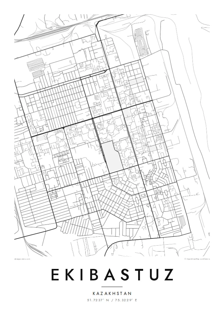
Ekibastuz lies on the flat steppe of north-eastern Kazakhstan, in Pavlodar Region, and its map is a study in planned geometry. The centre is built from large Soviet-era microdistricts arranged in a regular pattern of wide avenues and big residential blocks. Beyond the edge of the city the steppe opens in every direction, with enormous open-pit coal mines and industrial sites close by.
The city exists because of coal. The Ekibastuz basin holds some of the largest coal reserves in Kazakhstan, and the Bogatyr mine is among the biggest open-pit coal mines in the world. Two large power stations supply electricity across the country, and the chimney of the Ekibastuz GRES-2 plant, around 420 metres tall, is the tallest chimney ever built. Solzhenitsyn was held in a labour camp here in the early 1950s.
An Ekibastuz map poster shows a city designed on paper and built on an empty plain. The grid of avenues and courtyards, the rail lines leading to the mines and power stations, and the wide blank space of the steppe all come through clearly in black and white. It is a severe, graphic image with a strong industrial character.
The residential city is organised into large blocks with courtyards between apartment buildings, arranged along broad straight avenues in a typical Soviet planned layout.
Near the city, huge coal pits and their terraced edges form vast shapes in the landscape. They dwarf the urban area and show the reason Ekibastuz was built.
Outside the city limits there is almost nothing but open plain, so the map shows the city as a sharply defined island of streets surrounded by empty space.
Make it yours
Add a date, a name or a line of your own, switch style, size or orientation.
The free preview is low-resolution with a watermark. Prints and HD files are rendered at 300 DPI, up to 7,200 × 10,800 px, without a watermark.
Why Ekibastuz
Ekibastuz is a city many people moved to for work and stayed in for life, and its geometry is instantly familiar to those who know it. Add a personalised title, subtitle and coordinates line, and choose Classic black & white, Noir, Paper, Blueprint or Sand.
The digital HD files cost $9 and cover six print sizes, from 30×40 cm to 24×36″, each as a 300 DPI PNG and a print-ready PDF with no watermark. A free 900 px preview is available, and printed matte posters ship from partners in 30+ countries.
Order the Ekibastuz poster| Print size | Resolution | Files |
|---|---|---|
| 30 × 40 cm11.8 × 15.7″ | 3,543 × 4,724 px | PNG · PDF |
| 29.7 × 42 cm (A3)11.7 × 16.5″ | 3,508 × 4,961 px | PNG · PDF |
| 42 × 59.4 cm (A2)16.5 × 23.4″ | 4,961 × 7,016 px | PNG · PDF |
| 45.7 × 61 cm18 × 24″ | 5,400 × 7,200 px | PNG · PDF |
| 50 × 70 cm19.7 × 27.6″ | 5,906 × 8,268 px | PNG · PDF |
| 61 × 91.4 cm24 × 36″ | 7,200 × 10,800 px | PNG · PDF |
For comparison, the free preview is 900 px wide, watermarked and meant for screens. The HD files have up to 8× the resolution in each direction and print cleanly at full poster size.
Pick a style at the top of the page, then choose Printed Poster — a size and, if you like, a frame — or Digital HD Files. Checkout takes one step, and your order page updates as soon as the payment goes through.
It is printed on premium 200 gsm matte paper in one of six sizes, from 30 × 40 cm to 24 × 36″. Printed posters start at $39, shipping included.
Yes. Choose a solid wood frame in black, white, natural oak or dark wood. It comes with shatterproof glazing and is ready to hang. Framed posters start at $99, shipping included.
Shipping is free to 60+ countries. Each poster is printed by the nearest of our print partners in 30+ countries and usually arrives in 3–7 business days. You can follow the status and tracking under My Orders. A few countries take 2–5 weeks, and where we don't ship yet, the site tells you before you pay.
Send us a photo within 14 days of delivery and we will reprint it for free or refund you.
Yes. In the editor on this page, change the title, the subtitle and the coordinates line to anything you like, and pick a style and size. Printed, framed and digital orders all use exactly your design.
For $9 you get 300 DPI PNG and print-ready PDF files in all six sizes, without a watermark, to print anywhere. Not sure yet? Download a free watermarked preview first.
Nearby
