The Huguenot grid
The Baroque Neustadt is laid out as a regular grid of streets and blocks, one of the clearest planned town centres in Germany and the geometric heart of the poster.
Minimalist map poster · Germany
49.5910° N / 11.0078° E
A Baroque grid beside the Regnitz, bordered by a straight canal and a motorway on its western side

One city, five moods
Tap a style to see it on the wall. Every style costs the same — printed, framed or as HD files.
 Actual pixels · 24 × 36″ print file
Print-sharp
This is a 100% crop of the real print file. Every poster — printed, framed or downloaded — is rendered on our servers at 300 DPI, up to 7,200 × 10,800 pixels, so even the smallest lanes stay crisp on a 24 × 36″ print.
On the wall


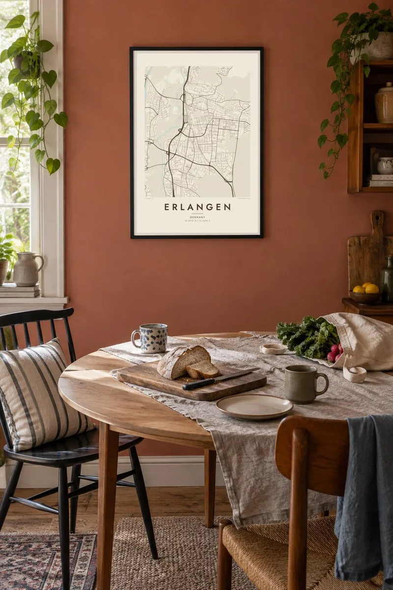
The map
Erlangen has one of the most orderly town plans in Bavaria. Its Neustadt was laid out from 1686 for Huguenot refugees from France, and the result still reads clearly from above: straight streets meeting at right angles, rectangular blocks and a long central axis. North of it, the older town and the castle garden give way to looser streets, and newer districts spread out in every direction.
The Regnitz flows along the western side of town, with the Schwabach joining it from the east. Beside the river runs the Main-Danube Canal, a hard straight line next to the natural curves of the valley. Erlangen is also a university city, home to Friedrich-Alexander-Universität since the eighteenth century, and it is known as the place where the MP3 format was developed.
An Erlangen map poster shows a city of clear contrasts. The disciplined grid of the Neustadt, the green rectangle of the Schlossgarten, the meandering Regnitz and the ruler-straight canal all sit close together. In black and white, those differences of shape become the whole picture, and the city's planned origin is easy to see.
The Baroque Neustadt is laid out as a regular grid of streets and blocks, one of the clearest planned town centres in Germany and the geometric heart of the poster.
West of the centre, the winding Regnitz and the straight Main-Danube Canal run side by side, one natural and one engineered, forming a striking pair of lines on the map.
The castle garden forms a neat open rectangle beside the old centre, while the Burgberg to the north, home of the Bergkirchweih festival, breaks the grid with curving streets.
Make it yours
Add a date, a name or a line of your own, switch style, size or orientation.
The free preview is low-resolution with a watermark. Prints and HD files are rendered at 300 DPI, up to 7,200 × 10,800 px, without a watermark.
Why Erlangen
Students, researchers and families who have lived in Erlangen often keep it as a quiet memory of a particular chapter. The clean grid and the river make a map that works well as a design object while still meaning something personal.
The title, subtitle and coordinates line can all be personalised, so the poster can mark a graduation year, a first flat or a move. Choose Classic black & white, Noir, Paper, Blueprint or Sand to match your space.
Order the Erlangen poster| Print size | Resolution | Files |
|---|---|---|
| 30 × 40 cm11.8 × 15.7″ | 3,543 × 4,724 px | PNG · PDF |
| 29.7 × 42 cm (A3)11.7 × 16.5″ | 3,508 × 4,961 px | PNG · PDF |
| 42 × 59.4 cm (A2)16.5 × 23.4″ | 4,961 × 7,016 px | PNG · PDF |
| 45.7 × 61 cm18 × 24″ | 5,400 × 7,200 px | PNG · PDF |
| 50 × 70 cm19.7 × 27.6″ | 5,906 × 8,268 px | PNG · PDF |
| 61 × 91.4 cm24 × 36″ | 7,200 × 10,800 px | PNG · PDF |
For comparison, the free preview is 900 px wide, watermarked and meant for screens. The HD files have up to 8× the resolution in each direction and print cleanly at full poster size.
Pick a style at the top of the page, then choose Printed Poster — a size and, if you like, a frame — or Digital HD Files. Checkout takes one step, and your order page updates as soon as the payment goes through.
It is printed on premium 200 gsm matte paper in one of six sizes, from 30 × 40 cm to 24 × 36″. Printed posters start at $39, shipping included.
Yes. Choose a solid wood frame in black, white, natural oak or dark wood. It comes with shatterproof glazing and is ready to hang. Framed posters start at $99, shipping included.
Shipping is free to 60+ countries. Each poster is printed by the nearest of our print partners in 30+ countries and usually arrives in 3–7 business days. You can follow the status and tracking under My Orders. A few countries take 2–5 weeks, and where we don't ship yet, the site tells you before you pay.
Send us a photo within 14 days of delivery and we will reprint it for free or refund you.
Yes. In the editor on this page, change the title, the subtitle and the coordinates line to anything you like, and pick a style and size. Printed, framed and digital orders all use exactly your design.
For $9 you get 300 DPI PNG and print-ready PDF files in all six sizes, without a watermark, to print anywhere. Not sure yet? Download a free watermarked preview first.
Nearby
