Canal network
Narrow waterways wind through the town and farmland, drawing thin continuous lines across the map that reflect Itako's long reliance on boat travel.
Póster de mapa minimalista · Japón
35.9333° N / 140.5500° E
A water town between lakes and rivers, its streets threaded with canals and ringed by flat rice fields

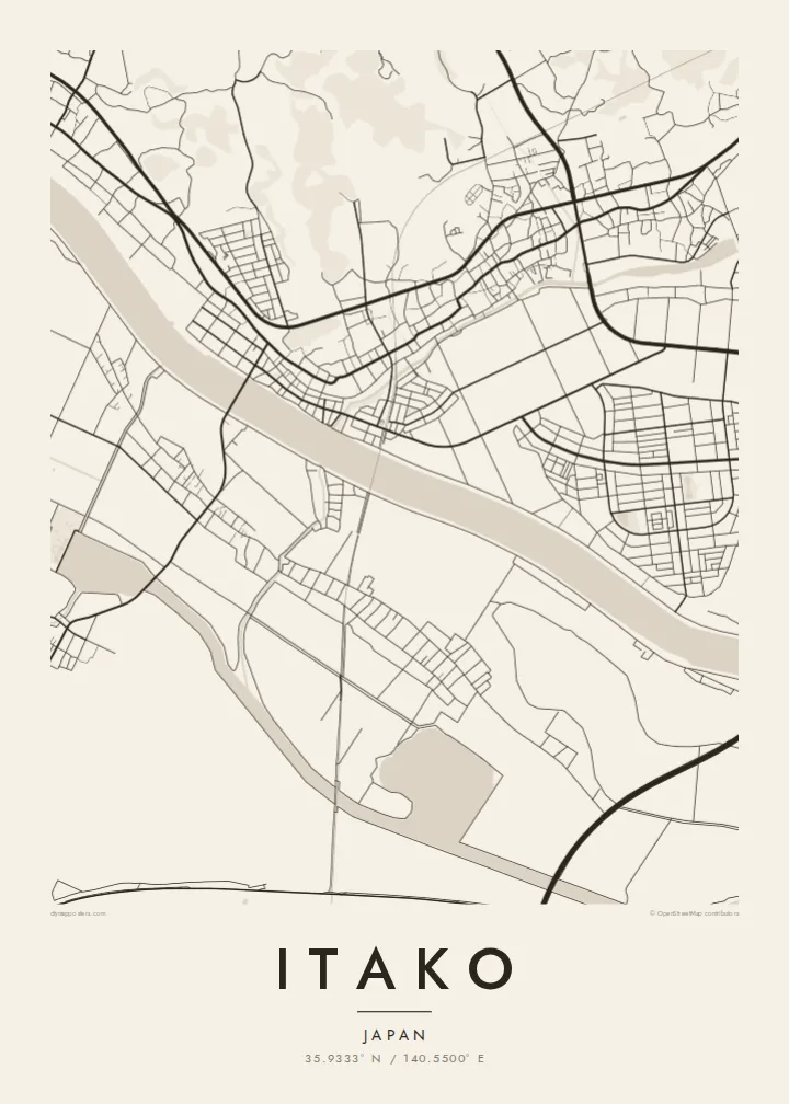

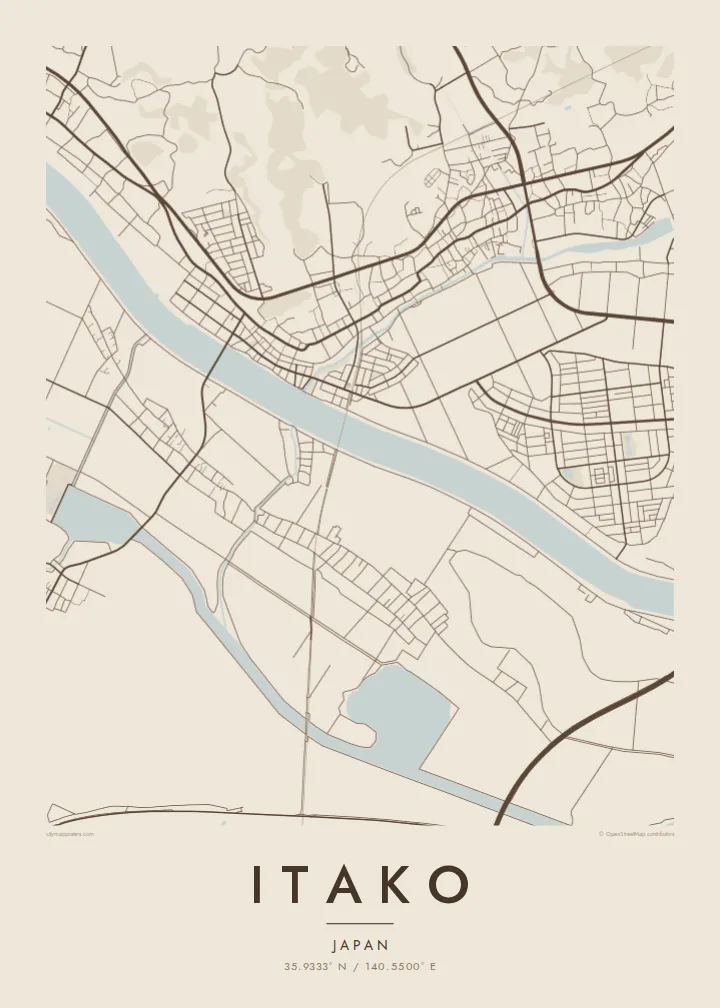
Una ciudad, cinco ambientes
Toca un estilo para verlo en la pared. Todos los estilos cuestan lo mismo: impreso, enmarcado o en archivos HD.
 Píxeles reales · archivo de impresión de 24 × 36″
Nitidez de impresión
Este es un recorte al 100% del archivo de impresión real. Cada póster —impreso, enmarcado o descargado— se renderiza en nuestros servidores a 300 DPI, hasta 7,200 × 10,800 píxeles, para que hasta las calles más pequeñas se vean nítidas en una impresión de 24 × 36″.
En la pared


El mapa
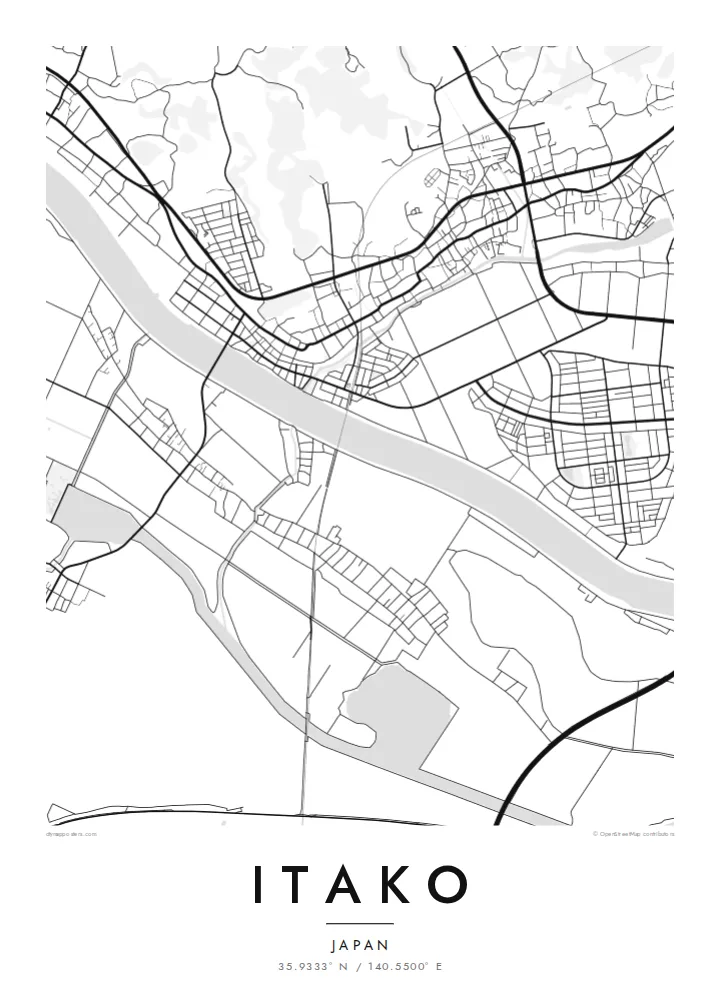
Itako lies in the south-east of Ibaraki Prefecture, in the low wetland country known as Suigo, the water district. The town sits between the Kitaura and Kasumigaura lake systems near the Tone River, and water is everywhere on its map. Canals run through the town and fields, and the landscape is flat, open and threaded with channels.
Itako is best known for its iris garden and the festival held each year in early summer, when thousands of irises bloom and traditional boats carry visitors along the waterways. Boat trips through the narrow canals have long been part of the town's identity, giving it a character quite different from most Japanese towns.
An Itako map poster captures that intricate mix of land and water. The canals, the lakeshore and the regular divisions of the rice fields create a finely layered composition. In black and white, the lines of water stand out with particular clarity, making it a calm and detailed map.
Narrow waterways wind through the town and farmland, drawing thin continuous lines across the map that reflect Itako's long reliance on boat travel.
Broad bodies of water border the town, with the shores of the Kasumigaura system and nearby rivers shaping a map where water takes up much of the space.
Around the built-up area, flat paddies are divided into neat rectangles, forming an orderly pattern that contrasts with the curves of the waterways.
Hazlo tuyo
Añade una fecha, un nombre o una frase propia, y cambia el estilo, el tamaño o la orientación.
La vista previa gratuita es de baja resolución y con marca de agua. Las impresiones y los archivos HD se renderizan a 300 DPI, hasta 7,200 × 10,800 px, sin marca de agua.
Por qué Itako
Itako appeals to anyone who loves quiet water landscapes and seasonal rituals like the iris festival. A map of the town makes a gentle, contemplative piece for a room, and a lasting memory of a visit.
You can personalise the title, subtitle and coordinates line, perhaps with the date of a trip, and choose one of five styles: Classic black & white, Noir, Paper, Blueprint or Sand.
Pedir el póster Itako| Tamaño de impresión | Resolución | Archivos |
|---|---|---|
| 30 × 40 cm (11.8 × 15.7″) | 3,543 × 4,724 px | PNG · PDF |
| 29.7 × 42 cm (A3, 11.7 × 16.5″) | 3,508 × 4,961 px | PNG · PDF |
| 42 × 59.4 cm (A2, 16.5 × 23.4″) | 4,961 × 7,016 px | PNG · PDF |
| 45.7 × 61 cm (18 × 24″) | 5,400 × 7,200 px | PNG · PDF |
| 50 × 70 cm (19.7 × 27.6″) | 5,906 × 8,268 px | PNG · PDF |
| 61 × 91.4 cm (24 × 36″) | 7,200 × 10,800 px | PNG · PDF |
Como referencia, la vista previa gratuita mide 900 px de ancho, lleva marca de agua y está pensada para pantallas. Los archivos HD tienen hasta 8 veces más resolución en cada dirección y se imprimen con total nitidez a tamaño póster.
Elige un estilo arriba de la página y luego selecciona Póster Impreso —un tamaño y, si quieres, un marco— o Archivos Digitales HD. El pago se hace en un solo paso, y tu página de pedido se actualiza en cuanto se confirma el pago.
Se imprime en papel mate premium de 200 g/m² en uno de seis tamaños, desde 30 × 40 cm hasta 24 × 36″. Los pósters impresos cuestan desde {printFrom}, envío incluido.
Sí. Elige un marco de madera maciza en negro, blanco, roble natural o madera oscura. Incluye vidrio irrompible y llega listo para colgar. Los pósters enmarcados cuestan desde {framedFrom}, envío incluido.
El envío es gratis en todo el mundo. Cada póster lo imprime el socio de impresión más cercano entre más de 30 países y suele llegar en 3 a 7 días hábiles. Puedes seguir el estado y el seguimiento en Mis Pedidos.
Envíanos una foto dentro de los 14 días posteriores a la entrega y te lo reimprimimos gratis o te devolvemos el dinero.
Sí. En el editor de esta página, cambia el título, el subtítulo y la línea de coordenadas por lo que quieras, y elige un estilo y un tamaño. Los pedidos impresos, enmarcados y digitales usan exactamente tu diseño.
Por $9 obtienes archivos PNG a 300 DPI y PDF listos para imprimir en los seis tamaños, sin marca de agua, para imprimir donde quieras. ¿Aún no estás seguro? Descarga primero una vista previa gratis con marca de agua.
Cerca
