Vistula bridges
The long road and rail crossings span the river east of the old town, drawn as strong straight lines across the widest open space on the map.
Póster de mapa minimalista · Polonia
54.0924° N / 18.7779° E
An old town on a bluff above the Vistula, beside the long iron bridges that once crossed Europe's great river.


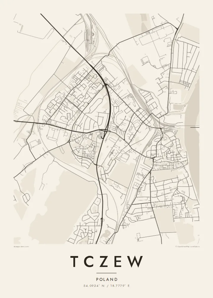

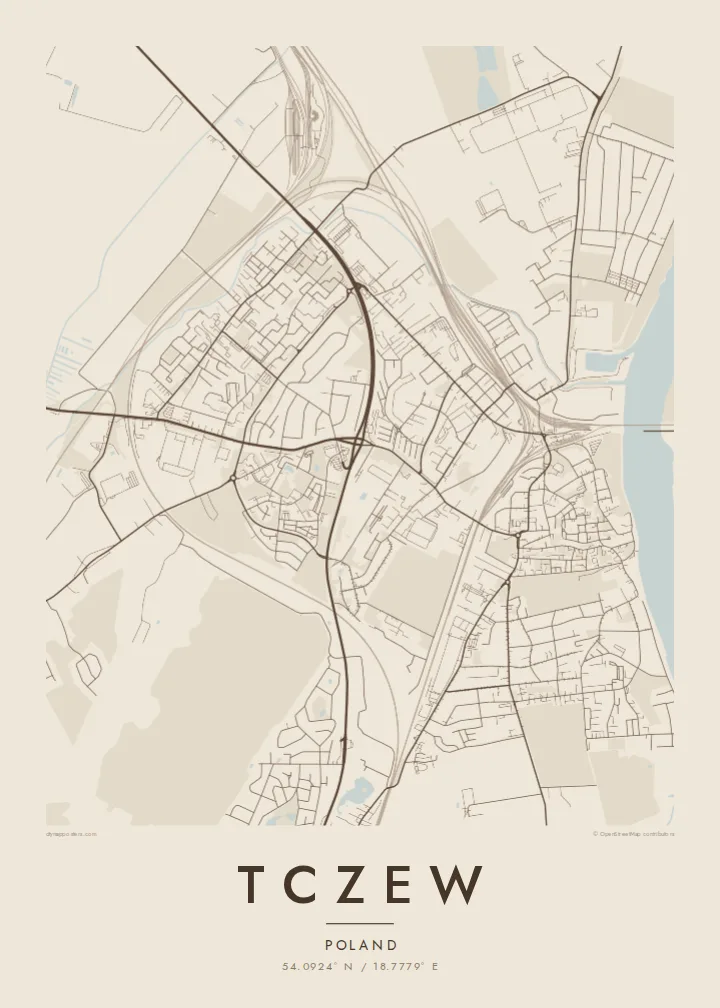
Una ciudad, cinco ambientes
Toca un estilo para verlo en la pared. Todos los estilos cuestan lo mismo: impreso, enmarcado o en archivos HD.
 Píxeles reales · archivo de impresión de 24 × 36″
Nitidez de impresión
Este es un recorte al 100% del archivo de impresión real. Cada póster —impreso, enmarcado o descargado— se renderiza en nuestros servidores a 300 DPI, hasta 7,200 × 10,800 píxeles, para que hasta las calles más pequeñas se vean nítidas en una impresión de 24 × 36″.
En la pared


El mapa
Tczew sits on the left bank of the Vistula in Pomerania, and the river defines its map. The historic centre occupies higher ground above the water, with a market square and a network of short streets, while the broad Vistula and its floodplain stretch along the eastern edge. Newer districts extend west and south, away from the river.
The town is best known for its bridges. The road and rail bridge completed in 1857 was among the longest in Europe at the time, and on 1 September 1939 the Tczew bridges were among the first targets of the German invasion of Poland. Today the town also houses a museum dedicated to the Vistula.
A Tczew map poster shows a clear composition: the dark mass of the old town, the wide open band of the river, and the long straight lines of the bridges reaching across to the far bank. Rail lines add sweeping curves, reflecting the town's role as an important junction.
The long road and rail crossings span the river east of the old town, drawn as strong straight lines across the widest open space on the map.
The historic centre sits above the river on raised ground, its compact grid of streets and market square forming the densest part of the town.
Tczew is a meeting point of major lines in Pomerania, and the tracks curve through the town in long arcs toward Gdańsk and the south.
Hazlo tuyo
Añade una fecha, un nombre o una frase propia, y cambia el estilo, el tamaño o la orientación.
La vista previa gratuita es de baja resolución y con marca de agua. Las impresiones y los archivos HD se renderizan a 300 DPI, hasta 7,200 × 10,800 px, sin marca de agua.
Por qué Tczew
Tczew holds meaning for families with roots in Kociewie and for anyone interested in the Vistula's history. Its river and bridges make a map that reads well even from across a room.
Personalise the title, subtitle and coordinates line to mark a birthplace or a family date. Choose one of five styles, from Paper to Noir, and download 300 DPI PNG and PDF files for $9, or order a printed poster.
Pedir el póster Tczew| Tamaño de impresión | Resolución | Archivos |
|---|---|---|
| 30 × 40 cm11.8 × 15.7″ | 3,543 × 4,724 px | PNG · PDF |
| 29.7 × 42 cm (A3)11.7 × 16.5″ | 3,508 × 4,961 px | PNG · PDF |
| 42 × 59.4 cm (A2)16.5 × 23.4″ | 4,961 × 7,016 px | PNG · PDF |
| 45.7 × 61 cm18 × 24″ | 5,400 × 7,200 px | PNG · PDF |
| 50 × 70 cm19.7 × 27.6″ | 5,906 × 8,268 px | PNG · PDF |
| 61 × 91.4 cm24 × 36″ | 7,200 × 10,800 px | PNG · PDF |
Como referencia, la vista previa gratuita mide 900 px de ancho, lleva marca de agua y está pensada para pantallas. Los archivos HD tienen hasta 8 veces más resolución en cada dirección y se imprimen con total nitidez a tamaño póster.
Elige un estilo arriba de la página y luego selecciona Póster Impreso —un tamaño y, si quieres, un marco— o Archivos Digitales HD. El pago se hace en un solo paso, y tu página de pedido se actualiza en cuanto se confirma el pago.
Se imprime en papel mate premium de 200 g/m² en uno de seis tamaños, desde 30 × 40 cm hasta 24 × 36″. Los pósters impresos cuestan desde $39, envío incluido.
Sí. Elige un marco de madera maciza en negro, blanco, roble natural o madera oscura. Incluye vidrio irrompible y llega listo para colgar. Los pósters enmarcados cuestan desde $99, envío incluido.
El envío es gratis a más de 60 países. Cada póster lo imprime el socio de impresión más cercano de nuestra red en más de 30 países y suele llegar en 3–7 días hábiles. Puedes seguir el estado y el seguimiento en Mis pedidos. Algunos países tardan de 2 a 5 semanas y, si aún no enviamos a tu país, la web te lo indica antes de pagar.
Envíanos una foto dentro de los 14 días posteriores a la entrega y te lo reimprimimos gratis o te devolvemos el dinero.
Sí. En el editor de esta página, cambia el título, el subtítulo y la línea de coordenadas por lo que quieras, y elige un estilo y un tamaño. Los pedidos impresos, enmarcados y digitales usan exactamente tu diseño.
Por $9 obtienes archivos PNG a 300 DPI y PDF listos para imprimir en los seis tamaños, sin marca de agua, para imprimir donde quieras. ¿Aún no estás seguro? Descarga primero una vista previa gratis con marca de agua.
