Bay salt ponds
The western edge of the city is lined with salt ponds and wetlands. On the map they form large, geometric shapes of water separated by thin levees along the shoreline.
Minimalist map poster · United States
37.5483° N / 121.9886° W
An East Bay city stretching from the salt ponds of San Francisco Bay up to the ridge below Mission Peak

One city, five moods
Tap a style to see it on the wall. Every style costs the same — printed, framed or as HD files.
 Actual pixels · 24 × 36″ print file
Print-sharp
This is a 100% crop of the real print file. Every poster — printed, framed or downloaded — is rendered on our servers at 300 DPI, up to 7,200 × 10,800 pixels, so even the smallest lanes stay crisp on a 24 × 36″ print.
On the wall
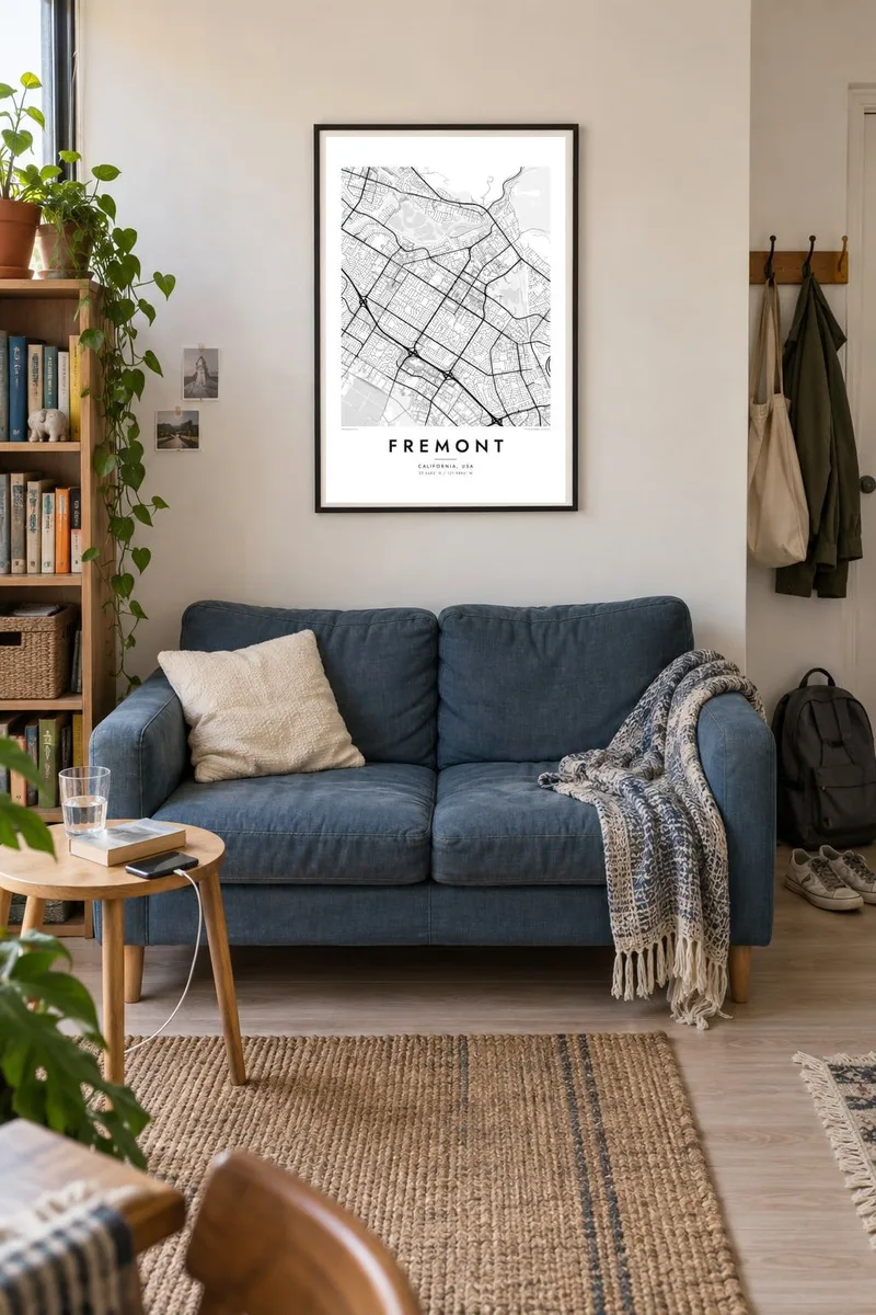


The map
Fremont stretches along the south-eastern shore of San Francisco Bay, between the salt ponds and marshes of the bay and the steep hills of the Diablo Range. From above, the flat land is filled with curving suburban streets, wide arterials and business parks. Freeways run lengthwise through the city, and Mission Peak rises sharply to the east.
Fremont was incorporated in 1956 when five older communities joined: Mission San Jose, Centerville, Niles, Irvington and Warm Springs. Mission San José was founded in 1797. In Niles, the Essanay studio made early silent films, including Charlie Chaplin's The Tramp. Today the former NUMMI car plant is Tesla's factory.
A Fremont map poster shows a long, layered composition. The fine curves of the salt ponds lie along the bay edge, the suburban street pattern fills the middle, and the network stops abruptly where the hills begin. A few old town centres show as small knots of denser streets.
The western edge of the city is lined with salt ponds and wetlands. On the map they form large, geometric shapes of water separated by thin levees along the shoreline.
To the east, the streets end at the foot of the steep hills that rise to Mission Peak. The sudden stop gives the map a sharp, clean eastern edge.
Central Park and its lake, Lake Elizabeth, sit near the city centre. The park is one of the largest open shapes among Fremont's suburban streets.
Make it yours
Add a date, a name or a line of your own, switch style, size or orientation.
The free preview is low-resolution with a watermark. Prints and HD files are rendered at 300 DPI, up to 7,200 × 10,800 px, without a watermark.
Why Fremont
Fremont is where many people have built careers, raised families or made their first home in the Bay Area. The layering of bay, suburbs and hills makes a map with a clear structure and plenty of detail.
Add your own title, subtitle and date, or keep the coordinates line. Choose from five styles: Classic black and white, Noir, Paper, Blueprint and Sand. HD files cost $9 for six sizes, or you can order a matte printed poster, framed or unframed, shipped from partners in over 30 countries.
Order the Fremont poster| Print size | Resolution | Files |
|---|---|---|
| 30 × 40 cm11.8 × 15.7″ | 3,543 × 4,724 px | PNG · PDF |
| 29.7 × 42 cm (A3)11.7 × 16.5″ | 3,508 × 4,961 px | PNG · PDF |
| 42 × 59.4 cm (A2)16.5 × 23.4″ | 4,961 × 7,016 px | PNG · PDF |
| 45.7 × 61 cm18 × 24″ | 5,400 × 7,200 px | PNG · PDF |
| 50 × 70 cm19.7 × 27.6″ | 5,906 × 8,268 px | PNG · PDF |
| 61 × 91.4 cm24 × 36″ | 7,200 × 10,800 px | PNG · PDF |
For comparison, the free preview is 900 px wide, watermarked and meant for screens. The HD files have up to 8× the resolution in each direction and print cleanly at full poster size.
Pick a style at the top of the page, then choose Printed Poster — a size and, if you like, a frame — or Digital HD Files. Checkout takes one step, and your order page updates as soon as the payment goes through.
It is printed on premium 200 gsm matte paper in one of six sizes, from 30 × 40 cm to 24 × 36″. Printed posters start at $39, shipping included.
Yes. Choose a solid wood frame in black, white, natural oak or dark wood. It comes with shatterproof glazing and is ready to hang. Framed posters start at $99, shipping included.
Shipping is free to 60+ countries. Each poster is printed by the nearest of our print partners in 30+ countries and usually arrives in 3–7 business days. You can follow the status and tracking under My Orders. A few countries take 2–5 weeks, and where we don't ship yet, the site tells you before you pay.
Send us a photo within 14 days of delivery and we will reprint it for free or refund you.
Yes. In the editor on this page, change the title, the subtitle and the coordinates line to anything you like, and pick a style and size. Printed, framed and digital orders all use exactly your design.
For $9 you get 300 DPI PNG and print-ready PDF files in all six sizes, without a watermark, to print anywhere. Not sure yet? Download a free watermarked preview first.
Nearby
