Port Curtis harbour
A broad, island-studded harbour with shipping channels, berths and mangrove creeks, which makes the eastern half of the map a complex pattern of water and land.
Minimalist map poster · Australia
23.8485° S / 151.2577° E
A working harbour city spread along Port Curtis, with wharves, headlands and scattered islands breaking up the southern Queensland coastline

One city, five moods
Tap a style to see it on the wall. Every style costs the same — printed, framed or as HD files.
 Actual pixels · 24 × 36″ print file
Print-sharp
This is a 100% crop of the real print file. Every poster — printed, framed or downloaded — is rendered on our servers at 300 DPI, up to 7,200 × 10,800 pixels, so even the smallest lanes stay crisp on a 24 × 36″ print.
On the wall
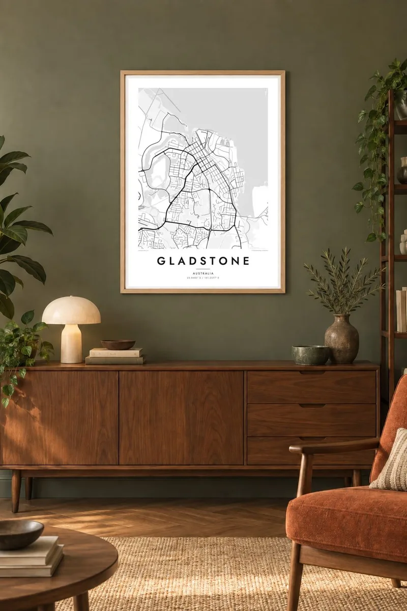


The map
Gladstone sits on the shore of Port Curtis, a deep natural harbour on the central Queensland coast. From above, the town centre gathers around Auckland Point and the low hills behind it. Suburbs spread west and south towards the Calliope River, and wharves, conveyor lines and industrial sites run along the water's edge. Islands and mangrove channels fill the harbour, so the shoreline has an uneven, fragmented outline.
The port is one of the busiest in Australia. Coal, alumina and liquefied natural gas pass through it, and the LNG plants on Curtis Island face the city across the narrows. Gladstone is also the departure point for Heron Island at the southern end of the Great Barrier Reef, which gives this industrial harbour a quieter second role as a gateway to the reef.
A Gladstone map poster shows both of those roles. Straight rail spurs and loading berths cut into the curves of the tidal creeks, and the residential grid on the hills keeps its distance from the heavy industry at the water. Further south, the road towards Boyne Island and Tannum Sands follows the coast, so the city's edges fade into estuary and bush rather than ending at a clear boundary.
A broad, island-studded harbour with shipping channels, berths and mangrove creeks, which makes the eastern half of the map a complex pattern of water and land.
The large island across the narrows, where gas processing plants sit on the western shore facing the city and the mainland wharves.
The headland near the town centre, where the older street grid, the harbour frontage and the port infrastructure all meet.
Make it yours
Add a date, a name or a line of your own, switch style, size or orientation.
The free preview is low-resolution with a watermark. Prints and HD files are rendered at 300 DPI, up to 7,200 × 10,800 px, without a watermark.
Why Gladstone
For people who have worked at the port, grown up on the harbour or passed through on the way to Heron Island, this map records a place defined by water and industry. It suits an office wall as easily as a living room, because the tangled coastline reads almost like an abstract drawing.
You can personalise the title, the subtitle and the coordinates line, for example to mark a move, a first job or a family address. The design comes in five styles: Classic black & white, Noir, Paper, Blueprint and Sand. The HD digital files cost $9, or you can order a framed print.
Order the Gladstone poster| Print size | Resolution | Files |
|---|---|---|
| 30 × 40 cm11.8 × 15.7″ | 3,543 × 4,724 px | PNG · PDF |
| 29.7 × 42 cm (A3)11.7 × 16.5″ | 3,508 × 4,961 px | PNG · PDF |
| 42 × 59.4 cm (A2)16.5 × 23.4″ | 4,961 × 7,016 px | PNG · PDF |
| 45.7 × 61 cm18 × 24″ | 5,400 × 7,200 px | PNG · PDF |
| 50 × 70 cm19.7 × 27.6″ | 5,906 × 8,268 px | PNG · PDF |
| 61 × 91.4 cm24 × 36″ | 7,200 × 10,800 px | PNG · PDF |
For comparison, the free preview is 900 px wide, watermarked and meant for screens. The HD files have up to 8× the resolution in each direction and print cleanly at full poster size.
Pick a style at the top of the page, then choose Printed Poster — a size and, if you like, a frame — or Digital HD Files. Checkout takes one step, and your order page updates as soon as the payment goes through.
It is printed on premium 200 gsm matte paper in one of six sizes, from 30 × 40 cm to 24 × 36″. Printed posters start at $39, shipping included.
Yes. Choose a solid wood frame in black, white, natural oak or dark wood. It comes with shatterproof glazing and is ready to hang. Framed posters start at $99, shipping included.
Shipping is free to 60+ countries. Each poster is printed by the nearest of our print partners in 30+ countries and usually arrives in 3–7 business days. You can follow the status and tracking under My Orders. A few countries take 2–5 weeks, and where we don't ship yet, the site tells you before you pay.
Send us a photo within 14 days of delivery and we will reprint it for free or refund you.
Yes. In the editor on this page, change the title, the subtitle and the coordinates line to anything you like, and pick a style and size. Printed, framed and digital orders all use exactly your design.
For $9 you get 300 DPI PNG and print-ready PDF files in all six sizes, without a watermark, to print anywhere. Not sure yet? Download a free watermarked preview first.
Nearby
