Two Rivers and Four Lakes
A connected ring of lakes and canals circles the old centre and joins the Li and Taohua rivers, giving the map a continuous loop of water.
Minimalist map poster · China
25.2802° N / 110.2964° E
A river city scattered among steep karst peaks, with lakes, the Li River and green hills woven through its streets.

One city, five moods
Tap a style to see it on the wall. Every style costs the same — printed, framed or as HD files.
 Actual pixels · 24 × 36″ print file
Print-sharp
This is a 100% crop of the real print file. Every poster — printed, framed or downloaded — is rendered on our servers at 300 DPI, up to 7,200 × 10,800 pixels, so even the smallest lanes stay crisp on a 24 × 36″ print.
On the wall

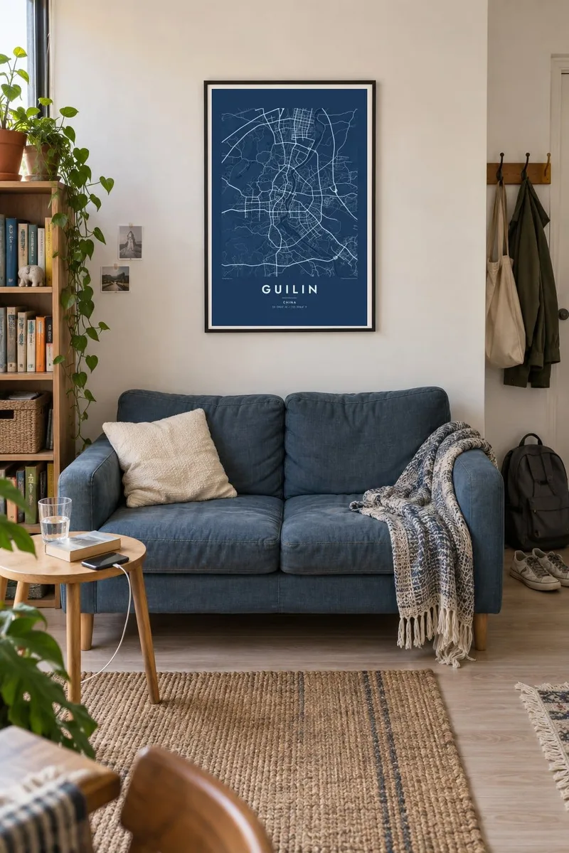

The map
Guilin sits in a landscape of limestone towers in northeastern Guangxi, and unlike most cities it does not flatten its terrain. Isolated karst hills rise directly from the urban area, so the street grid bends around them and leaves pockets of green in unexpected places. On a map these appear as small round islands of parkland scattered through the blocks.
The Li River runs along the eastern side of the centre from north to south, and a ring of lakes, Shan, Rong, Gui and Mulong, links with it and the Taohua River in a system often called Two Rivers and Four Lakes. Elephant Trunk Hill, a rock formation arching into the river at the junction with the Taohua, is the best-known view in the city.
The name means forest of sweet osmanthus, after the trees that line many streets and flower in autumn. Downstream, the Li River journey to Yangshuo passes the scenery printed on the Chinese 20 yuan note. A Guilin map poster shows the city itself, where water, hills and streets share the same compact space.
A connected ring of lakes and canals circles the old centre and joins the Li and Taohua rivers, giving the map a continuous loop of water.
Isolated limestone peaks such as Fubo Hill and Folded Brocade Hill stand within the city, showing up as small green masses that interrupt the street pattern.
Where the Taohua River meets the Li, this rock arch stands at the water's edge, a small but recognisable landmark at the southern end of the centre.
Make it yours
Add a date, a name or a line of your own, switch style, size or orientation.
The free preview is low-resolution with a watermark. Prints and HD files are rendered at 300 DPI, up to 7,200 × 10,800 px, without a watermark.
Why Guilin
Guilin is a place people often remember from a single journey, a honeymoon, a school trip or a river cruise. A map of its hills and lakes brings back that landscape without relying on the usual postcard view.
Personalise the title with the city's name in any form you like, add a date in the subtitle and edit the coordinates line. Choose Classic black & white, Noir, Paper, Blueprint or Sand; Paper suits the soft, painted quality of the scenery.
Order the Guilin poster| Print size | Resolution | Files |
|---|---|---|
| 30 × 40 cm11.8 × 15.7″ | 3,543 × 4,724 px | PNG · PDF |
| 29.7 × 42 cm (A3)11.7 × 16.5″ | 3,508 × 4,961 px | PNG · PDF |
| 42 × 59.4 cm (A2)16.5 × 23.4″ | 4,961 × 7,016 px | PNG · PDF |
| 45.7 × 61 cm18 × 24″ | 5,400 × 7,200 px | PNG · PDF |
| 50 × 70 cm19.7 × 27.6″ | 5,906 × 8,268 px | PNG · PDF |
| 61 × 91.4 cm24 × 36″ | 7,200 × 10,800 px | PNG · PDF |
For comparison, the free preview is 900 px wide, watermarked and meant for screens. The HD files have up to 8× the resolution in each direction and print cleanly at full poster size.
Pick a style at the top of the page, then choose Printed Poster — a size and, if you like, a frame — or Digital HD Files. Checkout takes one step, and your order page updates as soon as the payment goes through.
It is printed on premium 200 gsm matte paper in one of six sizes, from 30 × 40 cm to 24 × 36″. Printed posters start at $39, shipping included.
Yes. Choose a solid wood frame in black, white, natural oak or dark wood. It comes with shatterproof glazing and is ready to hang. Framed posters start at $99, shipping included.
Shipping is free to 60+ countries. Each poster is printed by the nearest of our print partners in 30+ countries and usually arrives in 3–7 business days. You can follow the status and tracking under My Orders. A few countries take 2–5 weeks, and where we don't ship yet, the site tells you before you pay.
Send us a photo within 14 days of delivery and we will reprint it for free or refund you.
Yes. In the editor on this page, change the title, the subtitle and the coordinates line to anything you like, and pick a style and size. Printed, framed and digital orders all use exactly your design.
For $9 you get 300 DPI PNG and print-ready PDF files in all six sizes, without a watermark, to print anywhere. Not sure yet? Download a free watermarked preview first.
Nearby
